


cervin

mikaelerouzic
User
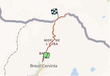

Length
9.4 km

Max alt
4437 m

Uphill gradient
2412 m
Km-Effort
36 km

Min alt
2017 m

Downhill gradient
621 m
Boucle
No
Creation date :
2015-01-05 00:00:00.0
Updated on :
2015-01-05 00:00:00.0
--
Difficulty : Very difficult

FREE GPS app for hiking
 SityTrail
IGN / Geographical institutes
SityTrail Plus
The world is yours!
About
Trail Walking of 9.4 km to be discovered at Aosta Valley, Unknown, Valtournenche. This trail is proposed by mikaelerouzic.
Positioning
Country:
Italy
Region :
Aosta Valley
Department/Province :
Unknown
Municipality :
Valtournenche
Location:
Unknown
Start:(Dec)
Start:(UTM)
393718 ; 5088132 (32T) N.
Comments