Trail Cycle Forcalquier - Parcours n°17 - Forcalquier - Photo

Randonnées de Vélo Loisir Provence GUIDE+

© OpenStreetMap contributors
Length
Length
21 km
Max alt
Max alt
575 m
Uphill gradient
Uphill gradient
346 m
Km-Effort
Km-Effort  
25 km
Min alt
Min alt
425 m
Downhill gradient
Downhill gradient
339 m
Boucle
Boucle
Yes
Creation date :
2015-01-07 00:00:00.0
Updated on :
2015-01-07 00:00:00.0

(1 Reviews)

Cycle
Cycle
1h28
Difficulty : Easy

Scan this QR Code to open this trail in the SityTrail application

FREE GPS app for hiking

Logo SityTrail SityTrail

IGN / Geographical institutes

Download SityTrail from the App Store Download SityTrail from Google Play

Logo SityTrail SityTrail World

The world is yours!

Download SityTrail from the App Store Download SityTrail from Google Play Download SityTrail on Huawei AppGallery

About

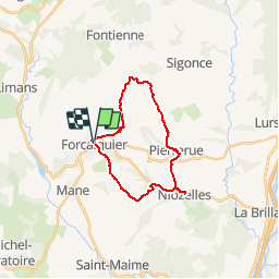
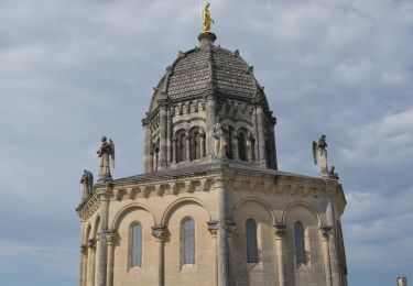
Trail Cycle of 21 km to be discovered at Provence-Alpes-Côte d'Azur, Alpes-de-Haute-Provence, Forcalquier. This trail is proposed by Vélo Loisir Provence.

Description

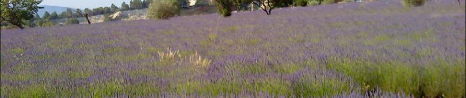
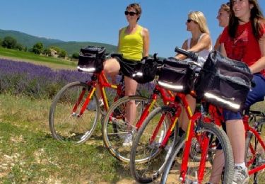
Discover the most typical villages and landscape of the «Pays de Haute-Provence» with its huge fields of lavender, plateaux, crests and hills. Direction of the itinerary : Forcalquier => Pierrerue => Niozelles => Forcalquier

Elevation profile

Photos

Positioning

Country:
France
Region :
Provence-Alpes-Côte d'Azur
Department/Province :
Alpes-de-Haute-Provence
Municipality :
Forcalquier
Location:
Unknown
Start:(UTM)
723096 ; 4871106 (31T) N.

Comments

Please log in to post a review or rate the element


Trails nearby

Trail Walking Forcalquier - GR6 - Mère des Fontaines - Roche Ruine - Les Mourres - Photo
Walking
toutankhcarton

Walking

Easy
(1)
Forcalquier, Provence-Alpes-Côte d'Azur, Alpes-de-Haute-Provence, France
18 km | 26 km-effort
4h 42min
Yes
Trail Walking Mane - 110ter-Mane.Les Ybourgues. sans passer par Chateauneuf. Mane  - Photo
Walking
dumotier

Walking

Medium
(1)
Mane, Provence-Alpes-Côte d'Azur, Alpes-de-Haute-Provence, France
13.2 km | 19.8 km-effort
3h 0min
Yes
Trail Mountain bike Forcalquier - La classique du Clot, circuit n°5 - Pays de Forcalquier - Photo
Mountain bike
tracegps

Mountain bike

Difficult
(1)
Forcalquier, Provence-Alpes-Côte d'Azur, Alpes-de-Haute-Provence, France
14.7 km | 20 km-effort
2h 0min
Yes
Trail Walking Mane - MANE Tours de la laye 3 - Photo
Walking
RobinMicheline

Walking

Medium
(1)
Mane, Provence-Alpes-Côte d'Azur, Alpes-de-Haute-Provence, France
15.1 km | 22 km-effort
5h 59min
Yes
Trail Cycle Forcalquier - Le Pays de Forcalquier - Montagne de Lure à vélo - Photo
Cycle
GUIDE+

Cycle

Medium
Forcalquier, Provence-Alpes-Côte d'Azur, Alpes-de-Haute-Provence, France
81 km | 99 km-effort
5h 36min
Yes
Trail Walking Mane - mane le barrage - Photo
Walking
Roger

Walking

Medium
Mane, Provence-Alpes-Côte d'Azur, Alpes-de-Haute-Provence, France
11.5 km | 16.5 km-effort
4h 42min
Yes
Trail Walking Forcalquier - Les Mourres autour de Forcalquier - Photo
Walking
PITOUSSAINT

Walking

Medium
Forcalquier, Provence-Alpes-Côte d'Azur, Alpes-de-Haute-Provence, France
9.3 km | 12.9 km-effort
4h 38min
Yes
Trail Walking Mane - salagon 04 .mane 04 leS - Photo
Walking
Roger

Walking

Medium
Mane, Provence-Alpes-Côte d'Azur, Alpes-de-Haute-Provence, France
13.4 km | 18 km-effort
4h 37min
Yes
Trail Walking Forcalquier - Wikiloc - 20220613 - Forcalquier - Visite & marché - Photo
Walking
GUIDE
pierreh01

Walking

Easy
Forcalquier, Provence-Alpes-Côte d'Azur, Alpes-de-Haute-Provence, France
2.8 km | 3.5 km-effort
48min
Yes


Close
My subscriptions