Trail Cycle Forcalquier - Le Pays de Forcalquier - Montagne de Lure à vélo - Photo

Le Pays de Forcalquier - Montagne de Lure à vélo

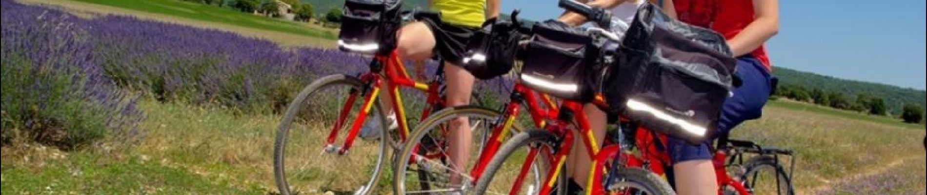
Randonnées de Vélo Loisir Provence GUIDE+

© OpenStreetMap contributors
Length
Length
81 km
Max alt
Max alt
717 m
Uphill gradient
Uphill gradient
1334 m
Km-Effort
Km-Effort  
99 km
Min alt
Min alt
385 m
Downhill gradient
Downhill gradient
1339 m
Boucle
Boucle
Yes
Signpost
Signpost
Creation date :
2015-01-07 00:00:00.0
Updated on :
2019-04-08 13:03:17.368

(0 Reviews)

Cycle
Cycle
5h36
Difficulty : Medium

Scan this QR Code to open this trail in the SityTrail application

FREE GPS app for hiking

Logo SityTrail SityTrail

IGN / Geographical institutes

Download SityTrail from the App Store Download SityTrail from Google Play

Logo SityTrail SityTrail World

The world is yours!

Download SityTrail from the App Store Download SityTrail from Google Play Download SityTrail on Huawei AppGallery

About

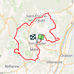
Trail Cycle of 81 km to be discovered at Provence-Alpes-Côte d'Azur, Alpes-de-Haute-Provence, Forcalquier. This trail is proposed by Vélo Loisir Provence.

Description

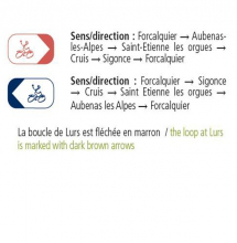
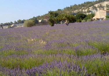
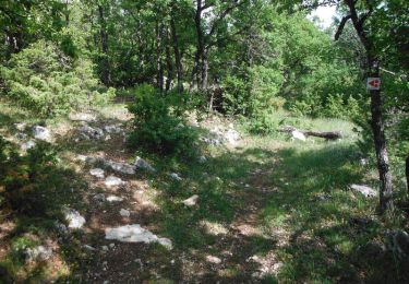
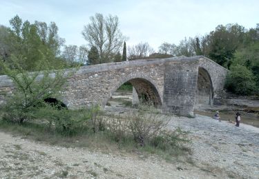
“Le Pays de Forcalquier – Montagne de Lure” by bike : An Authentic itinerary full of contrast ! On the high Provençal plains you will discover the wide variety of their landscapes in infinite colours, perfumes and atmosphere… Man exploited, adapted cultivated the natural products of the region: lavender, olives, honey, truffles… Here it is not unusually to encounter a herd of sheep along the way. Here you will appreciate the authentic charm of the villages you pass through. These itineraries take you into the wildest corner of the Luberon and to Saint-Michel-l’Observatoire reputed to have the purest skies in Europe.

Elevation profile

Photos

Positioning

Country:
France
Region :
Provence-Alpes-Côte d'Azur
Department/Province :
Alpes-de-Haute-Provence
Municipality :
Forcalquier
Location:
Unknown
Start:(UTM)
723017 ; 4871025 (31T) N.

Trails nearby

Trail Walking Forcalquier - GR6 - Mère des Fontaines - Roche Ruine - Les Mourres - Photo
Walking
toutankhcarton

Walking

Easy
(1)
Forcalquier, Provence-Alpes-Côte d'Azur, Alpes-de-Haute-Provence, France
18 km | 26 km-effort
4h 42min
Yes
Trail Cycle Forcalquier - Parcours n°17 - Forcalquier - Photo
Cycle
GUIDE+

Cycle

Easy
(1)
Forcalquier, Provence-Alpes-Côte d'Azur, Alpes-de-Haute-Provence, France
21 km | 25 km-effort
1h 28min
Yes
Trail Walking Mane - 110ter-Mane.Les Ybourgues. sans passer par Chateauneuf. Mane  - Photo
Walking
dumotier

Walking

Medium
(1)
Mane, Provence-Alpes-Côte d'Azur, Alpes-de-Haute-Provence, France
13.2 km | 19.8 km-effort
3h 0min
Yes
Trail Mountain bike Forcalquier - La classique du Clot, circuit n°5 - Pays de Forcalquier - Photo
Mountain bike
tracegps

Mountain bike

Difficult
(1)
Forcalquier, Provence-Alpes-Côte d'Azur, Alpes-de-Haute-Provence, France
14.7 km | 20 km-effort
2h 0min
Yes
Trail Walking Mane - MANE Tours de la laye 3 - Photo
Walking
RobinMicheline

Walking

Medium
(1)
Mane, Provence-Alpes-Côte d'Azur, Alpes-de-Haute-Provence, France
15.1 km | 22 km-effort
5h 59min
Yes
Trail Walking Mane - mane le barrage - Photo
Walking
Roger

Walking

Medium
Mane, Provence-Alpes-Côte d'Azur, Alpes-de-Haute-Provence, France
11.5 km | 16.5 km-effort
4h 42min
Yes
Trail Walking Forcalquier - Les Mourres autour de Forcalquier - Photo
Walking
PITOUSSAINT

Walking

Medium
Forcalquier, Provence-Alpes-Côte d'Azur, Alpes-de-Haute-Provence, France
9.3 km | 12.9 km-effort
4h 38min
Yes
Trail Walking Mane - salagon 04 .mane 04 leS - Photo
Walking
Roger

Walking

Medium
Mane, Provence-Alpes-Côte d'Azur, Alpes-de-Haute-Provence, France
13.4 km | 18 km-effort
4h 37min
Yes
Trail Walking Forcalquier - Wikiloc - 20220613 - Forcalquier - Visite & marché - Photo
Walking
GUIDE
pierreh01

Walking

Easy
Forcalquier, Provence-Alpes-Côte d'Azur, Alpes-de-Haute-Provence, France
2.8 km | 3.5 km-effort
48min
Yes


Close
My subscriptions