Trail Walking Souzy-la-Briche - Carrières de Madagascar à Souzy-la-Briche  - Photo

Carrières de Madagascar à Souzy-la-Briche

 guydu41
guydu41

User

© OpenStreetMap contributors
Length
Length
6.8 km
Max alt
Max alt
158 m
Uphill gradient
Uphill gradient
112 m
Km-Effort
Km-Effort  
8.3 km
Min alt
Min alt
80 m
Downhill gradient
Downhill gradient
112 m
Boucle
Boucle
Yes
Creation date :
2023-05-24 11:56:15.41
Updated on :
2023-05-25 05:03:06.991

(0 Reviews)

Walking
Walking
1h52
Difficulty : Medium

Scan this QR Code to open this trail in the SityTrail application

FREE GPS app for hiking

Logo SityTrail SityTrail

IGN / Geographical institutes

Download SityTrail from the App Store Download SityTrail from Google Play

Logo SityTrail SityTrail World

The world is yours!

Download SityTrail from the App Store Download SityTrail from Google Play Download SityTrail on Huawei AppGallery

About

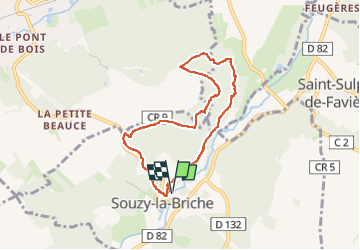
Trail Walking of 6.8 km to be discovered at Ile-de-France, Essonne, Souzy-la-Briche. This trail is proposed by guydu41.

Description

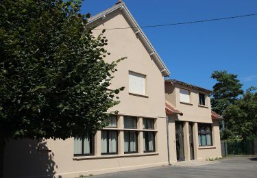
Petite randonnée au départ du parking à proximité de la Mairie de Souzy-la-Briche. Le bâtiment municipale est situé dans un beau parc traversé par "la Renarde" avec une aire de jeux, un lavoir, etc.
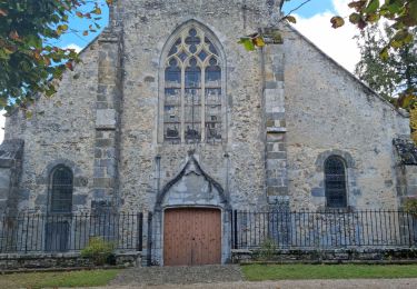
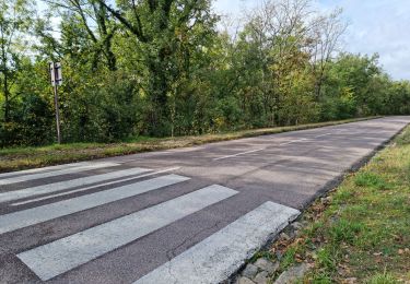
Ce petit circuit passe à côté de l'Église Saint Gilles et Saint Martin puis emprunte essentiellement des chemins et sentiers à travers bois, traverse les anciennes carrières de grès de Madagascar, etc.

Elevation profile

Photos

Positioning

Country:
France
Region :
Ile-de-France
Department/Province :
Essonne
Municipality :
Souzy-la-Briche
Location:
Unknown
Start:(UTM)
437183 ; 5375535 (31U) N.

Trails nearby

Trail Walking Saint-Sulpice-de-Favières - Les Pétales de Souzy - Photo
Walking
tracegps

Walking

Difficult
(1)
Saint-Sulpice-de-Favières, Ile-de-France, Essonne, France
23 km | 29 km-effort
4h 49min
Yes
Trail On foot Saint-Yon - Sur les traces de la Renarde - Photo
On foot
PRO

On foot

Very difficult
Saint-Yon, Ile-de-France, Essonne, France
38 km | 44 km-effort
10h 4min
No
Trail Walking Étréchy - Boucle de 2 jours au départ d'Etréchy via Etampes Chalo St Mars - Photo
Walking
philippebenne

Walking

Very difficult
(1)
Étréchy, Ile-de-France, Essonne, France
42 km | 51 km-effort
11h 28min
Yes
Trail Walking Saint-Sulpice-de-Favières - St Sulpice - Photo
Walking
Auger91

Walking

Medium
(1)
Saint-Sulpice-de-Favières, Ile-de-France, Essonne, France
8 km | 10.1 km-effort
2h 18min
Yes
Trail Walking Sermaise - 2018-09-26 Rando Sermaise - Photo
Walking
jchezlemas

Walking

Easy
(1)
Sermaise, Ile-de-France, Essonne, France
12.3 km | 15 km-effort
3h 15min
Yes
Trail Walking Boissy-sous-Saint-Yon - Carrière de Madagascar  - Photo
Walking
danbott

Walking

Very easy
(1)
Boissy-sous-Saint-Yon, Ile-de-France, Essonne, France
13.2 km | 16.5 km-effort
2h 59min
Yes
Trail Walking Villeconin - Villeconin - Photo
Walking
guydu41

Walking

Medium
Villeconin, Ile-de-France, Essonne, France
8.5 km | 10.9 km-effort
2h 11min
Yes
Trail Walking Saint-Sulpice-de-Favières - Saint-Sulpice-de-Favières - Photo
Walking
guydu41

Walking

Medium
Saint-Sulpice-de-Favières, Ile-de-France, Essonne, France
7.5 km | 9.4 km-effort
1h 55min
Yes
Trail Walking Chauffour-lès-Étréchy - Chauffour-lès-Etréchy Coteau des Verts Galants - Photo
Walking
guydu41

Walking

Easy
Chauffour-lès-Étréchy, Ile-de-France, Essonne, France
4.4 km | 5.7 km-effort
1h 25min
Yes


Close
My subscriptions