Trail Walking Toudon - Cime des Colettes par col de Vial - Photo

Cime des Colettes par col de Vial

 GrouGary
GrouGary

User

© OpenStreetMap contributors
Length
Length
9.5 km
Max alt
Max alt
1498 m
Uphill gradient
Uphill gradient
673 m
Km-Effort
Km-Effort  
18.4 km
Min alt
Min alt
980 m
Downhill gradient
Downhill gradient
675 m
Boucle
Boucle
Yes
Creation date :
2023-10-27 07:28:46.342
Updated on :
2023-10-28 07:02:58.444

(0 Reviews)

Walking
Walking
4h11
Difficulty : Medium

Scan this QR Code to open this trail in the SityTrail application

FREE GPS app for hiking

Logo SityTrail SityTrail

IGN / Geographical institutes

Download SityTrail from the App Store Download SityTrail from Google Play

Logo SityTrail SityTrail World

The world is yours!

Download SityTrail from the App Store Download SityTrail from Google Play Download SityTrail on Huawei AppGallery

About

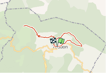
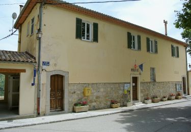
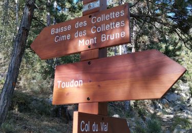
Trail Walking of 9.5 km to be discovered at Provence-Alpes-Côte d'Azur, Maritime Alps, Toudon. This trail is proposed by GrouGary.

Description

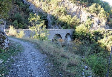
Petite boucle d'automne, sur sentier balisé et sans difficulté technique.
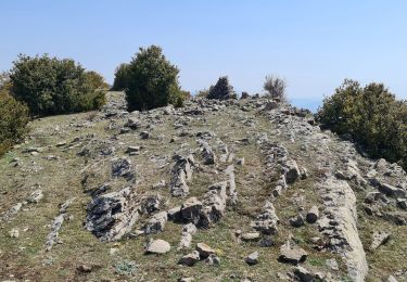
Vue à 360° sur l'Esteron sauvage et tourmenté, le Mercantour

Elevation profile

Photos

Positioning

Country:
France
Region :
Provence-Alpes-Côte d'Azur
Department/Province :
Maritime Alps
Municipality :
Toudon
Location:
Unknown
Start:(UTM)
348397 ; 4862632 (32T) N.

Trails nearby

Trail On foot Toudon - Cime des Collettes - Photo
On foot
PRO

On foot

Easy
Toudon, Provence-Alpes-Côte d'Azur, Maritime Alps, France
7 km | 13.4 km-effort
3h 3min
Yes
Trail Walking Toudon - cime des Colettes - Photo
Walking
franquen

Walking

Medium
(1)
Toudon, Provence-Alpes-Côte d'Azur, Maritime Alps, France
7.7 km | 14.6 km-effort
3h 40min
No
Trail Walking Revest-les-Roches - Balme de Vial - Photo
Walking
56jj

Walking

Medium
Revest-les-Roches, Provence-Alpes-Côte d'Azur, Maritime Alps, France
7.4 km | 14.6 km-effort
5h 1min
No
Trail Walking Pierrefeu - mont brune  - Photo
Walking
Mariephil

Walking

Difficult
Pierrefeu, Provence-Alpes-Côte d'Azur, Maritime Alps, France
8 km | 13.7 km-effort
3h 13min
Yes
Trail On foot Villars-sur-Var - Chapelle Saint-Jean - Photo
On foot
PRO

On foot

Easy
Villars-sur-Var, Provence-Alpes-Côte d'Azur, Maritime Alps, France
5 km | 9.7 km-effort
2h 12min
Yes
Trail Walking Toudon - Baisse des Colettes et Mt Brune de Toudon - Photo
Walking
GrouGary

Walking

Medium
(1)
Toudon, Provence-Alpes-Côte d'Azur, Maritime Alps, France
13.3 km | 24 km-effort
4h 39min
Yes
Trail Walking Malaussène - Malaussene : Le Canal de l'Adous - Photo
Walking
jlrayon

Walking

Medium
Malaussène, Provence-Alpes-Côte d'Azur, Maritime Alps, France
8.8 km | 11.8 km-effort
3h 59min
Yes
Trail Walking Toudon - FFR - la Cime des Colettes  - Photo
Walking
clarambre

Walking

Medium
(1)
Toudon, Provence-Alpes-Côte d'Azur, Maritime Alps, France
7.8 km | 14.9 km-effort
4h 50min
Yes
Trail Walking Massoins - Pointe des 4 cantons - Photo
Walking
ETMU5496

Walking

Very difficult
Massoins, Provence-Alpes-Côte d'Azur, Maritime Alps, France
23 km | 43 km-effort
6h 12min
Yes


Close
My subscriptions