


la Toussuire - la pierre du turc

laurentnecca
User
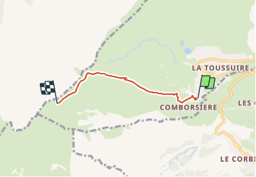

Length
3.6 km

Max alt
2280 m

Uphill gradient
520 m
Km-Effort
8.8 km

Min alt
1755 m

Downhill gradient
0 m
Boucle
No
Creation date :
2023-12-16 09:04:28.237
Updated on :
2023-12-16 10:55:34.854
1h50
Difficulty : Medium

FREE GPS app for hiking
 SityTrail
IGN / Geographical institutes
SityTrail Plus
The world is yours!
About
Trail Touring skiing of 3.6 km to be discovered at Auvergne-Rhône-Alpes, Savoy, Fontcouverte-la-Toussuire. This trail is proposed by laurentnecca.
Positioning
Country:
France
Region :
Auvergne-Rhône-Alpes
Department/Province :
Savoy
Municipality :
Fontcouverte-la-Toussuire
Location:
Unknown
Start:(Dec)
Start:(UTM)
284764 ; 5014447 (32T) N.
Comments