Trail Walking Burnhaupt-le-Haut - Rando du 09/02/2024 par Alain...Pont d'Aspach - Photo

Rando du 09/02/2024 par Alain...Pont d'Aspach

 boubou68
boubou68

User

© OpenStreetMap contributors
Length
Length
22 km
Max alt
Max alt
473 m
Uphill gradient
Uphill gradient
411 m
Km-Effort
Km-Effort  
27 km
Min alt
Min alt
294 m
Downhill gradient
Downhill gradient
411 m
Boucle
Boucle
Yes
Creation date :
2024-02-09 07:41:31.887
Updated on :
2024-02-09 14:37:18.17

(0 Reviews)

Walking
Walking
5h12
Difficulty : Very difficult

Scan this QR Code to open this trail in the SityTrail application

FREE GPS app for hiking

Logo SityTrail SityTrail

IGN / Geographical institutes

Download SityTrail from the App Store Download SityTrail from Google Play

Logo SityTrail SityTrail World

The world is yours!

Download SityTrail from the App Store Download SityTrail from Google Play Download SityTrail on Huawei AppGallery

About

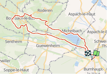
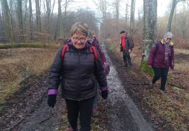
Trail Walking of 22 km to be discovered at Grand Est, Haut-Rhin, Burnhaupt-le-Haut. This trail is proposed by boubou68.

Description

Beaucoup de gadoue...un peu de pluie...

Elevation profile

Photos

Positioning

Country:
France
Region :
Grand Est
Department/Province :
Haut-Rhin
Municipality :
Burnhaupt-le-Haut
Location:
Unknown
Start:(UTM)
360906 ; 5289146 (32T) N.

Trails nearby

Trail Walking Guewenheim - Circuit de la Doller  - Photo
Walking
domi68440

Walking

Medium
Guewenheim, Grand Est, Haut-Rhin, France
10.7 km | 12.2 km-effort
2h 24min
Yes
Trail Walking Aspach-Michelbach - Aspach le Haut (6/12/2018) - Photo
Walking
Richard68500

Walking

Medium
Aspach-Michelbach, Grand Est, Haut-Rhin, France
15 km | 19.4 km-effort
3h 34min
Yes
Trail Walking Burnhaupt-le-Bas - GR531 Diefmaten Gildwiller - Photo
Walking
helmut68

Walking

Easy
Burnhaupt-le-Bas, Grand Est, Haut-Rhin, France
6.1 km | 7.9 km-effort
1h 14min
No
Trail Walking Guewenheim - Guewenheim. 68 - Photo
Walking
jeankrust

Walking

Very easy
Guewenheim, Grand Est, Haut-Rhin, France
13.1 km | 15 km-effort
3h 14min
No
Trail Walking Roderen - Roderen - Photo
Walking
ROPPJP

Walking

Difficult
Roderen, Grand Est, Haut-Rhin, France
9.5 km | 12.2 km-effort
2h 46min
Yes
Trail Walking Roderen - roderen2 - Photo
Walking
JCLUTT

Walking

Medium
Roderen, Grand Est, Haut-Rhin, France
10.5 km | 16.3 km-effort
3h 30min
Yes
Trail Walking Guewenheim - Randonnée CVG Guewenheim - Pont d'Aspach - retour - Photo
Walking
zheppi

Walking

Easy
Guewenheim, Grand Est, Haut-Rhin, France
17.8 km | 19.9 km-effort
5h 46min
No
Trail Walking Schweighouse-Thann - 18.12.06.Schweighouse  - Photo
Walking
ROPPJP

Walking

Very easy
Schweighouse-Thann, Grand Est, Haut-Rhin, France
10.7 km | 12.7 km-effort
2h 42min
Yes
Trail Walking Roderen - roderen-Hochburg - Photo
Walking
bernard688

Walking

Medium
Roderen, Grand Est, Haut-Rhin, France
9.7 km | 15.3 km-effort
3h 8min
Yes


Close
My subscriptions