Trail Walking Méry-sur-Oise - Méry sur OIse- Neuville université - Photo

Méry sur OIse- Neuville université

 chessyca
chessyca

User

© OpenStreetMap contributors
Length
Length
15.6 km
Max alt
Max alt
79 m
Uphill gradient
Uphill gradient
150 m
Km-Effort
Km-Effort  
17.7 km
Min alt
Min alt
18 m
Downhill gradient
Downhill gradient
176 m
Boucle
Boucle
No
Creation date :
2024-02-14 09:36:05.702
Updated on :
2024-02-14 20:15:18.088

(0 Reviews)

Walking
Walking
3h37
Difficulty : Very easy

Scan this QR Code to open this trail in the SityTrail application

FREE GPS app for hiking

Logo SityTrail SityTrail

IGN / Geographical institutes

Download SityTrail from the App Store Download SityTrail from Google Play

Logo SityTrail SityTrail World

The world is yours!

Download SityTrail from the App Store Download SityTrail from Google Play Download SityTrail on Huawei AppGallery

About

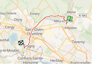
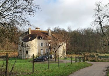
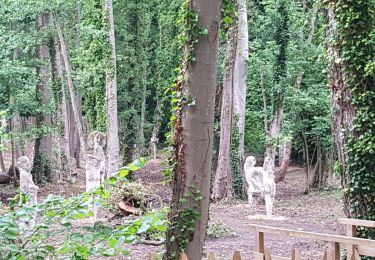
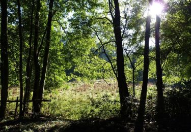
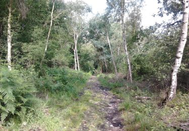
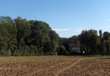
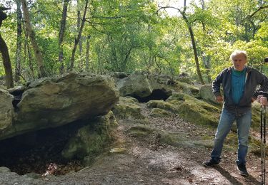
Trail Walking of 15.6 km to be discovered at Ile-de-France, Val-d'Oise, Méry-sur-Oise. This trail is proposed by chessyca.

Description

Suivi de la ceinture verte d'idf  en mode hors boue ( d'ou certains diverticules) par Katherine du Rif

Elevation profile

Photos

Positioning

Country:
France
Region :
Ile-de-France
Department/Province :
Val-d'Oise
Municipality :
Méry-sur-Oise
Location:
Unknown
Start:(UTM)
440887 ; 5434176 (31U) N.

Trails nearby

Trail Walking Frépillon - GRP CV-IDF 2023 - Photo
Walking
clalaur

Walking

Very difficult
(1)
Frépillon, Ile-de-France, Val-d'Oise, France
16 km | 20 km-effort
4h 32min
No
Trail Walking Parmain - L Parmain jean Sarment a Valmondoit - Photo
Walking
avdem

Walking

Very easy
(1)
Parmain, Ile-de-France, Val-d'Oise, France
7.9 km | 9.5 km-effort
2h 10min
Yes
Trail Mountain bike Taverny - La Tabernacienne 2013 - Taverny - Photo
Mountain bike
tracegps

Mountain bike

Medium
(1)
Taverny, Ile-de-France, Val-d'Oise, France
32 km | 39 km-effort
2h 30min
Yes
Trail Walking Taverny - Boucle en forêt à partir de Taverny - Photo
Walking
tracegps

Walking

Medium
(1)
Taverny, Ile-de-France, Val-d'Oise, France
12.3 km | 15.8 km-effort
3h 30min
Yes
Trail Walking Valmondois - Vallée de Nesles - Photo
Walking
tracegps

Walking

Difficult
(1)
Valmondois, Ile-de-France, Val-d'Oise, France
23 km | 28 km-effort
4h 45min
Yes
Trail Equestrian Taverny - Rando testé Montmorency l'isle adam 23km - Photo
Equestrian
unirega

Equestrian

Medium
(2)
Taverny, Ile-de-France, Val-d'Oise, France
25 km | 31 km-effort
3h 51min
Yes
Trail Mountain bike Saint-Leu-la-Forêt - Montmorency - Photo
Mountain bike
sylvain75

Mountain bike

Medium
(2)
Saint-Leu-la-Forêt, Ile-de-France, Val-d'Oise, France
23 km | 30 km-effort
Unknown
Yes
Trail Walking Valmondois - Valmondois Mesles - Photo
Walking
avdem

Walking

Easy
Valmondois, Ile-de-France, Val-d'Oise, France
11 km | 13.6 km-effort
2h 42min
Yes
Trail Walking L'Isle-Adam - les genêts depart Tampicot - Photo
Walking
avdem

Walking

Very easy
L'Isle-Adam, Ile-de-France, Val-d'Oise, France
13 km | 16.1 km-effort
2h 49min
Yes


Close
My subscriptions