Trail Walking Mirabel-et-Blacons - Le vieux Mirabel - Photo
© OpenStreetMap contributors
Length
Length
17.2 km
Max alt
Max alt
397 m
Uphill gradient
Uphill gradient
309 m
Km-Effort
Km-Effort  
22 km
Min alt
Min alt
183 m
Downhill gradient
Downhill gradient
377 m
Boucle
Boucle
No
Creation date :
2024-03-13 12:44:44.182
Updated on :
2024-03-13 17:06:45.567

(0 Reviews)

Walking
Walking
3h20
Difficulty : Easy

Scan this QR Code to open this trail in the SityTrail application

FREE GPS app for hiking

Logo SityTrail SityTrail

IGN / Geographical institutes

Download SityTrail from the App Store Download SityTrail from Google Play

Logo SityTrail SityTrail World

The world is yours!

Download SityTrail from the App Store Download SityTrail from Google Play Download SityTrail on Huawei AppGallery

About

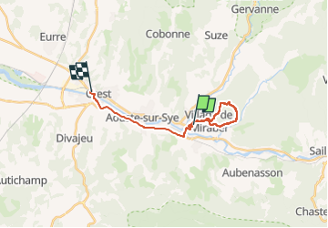
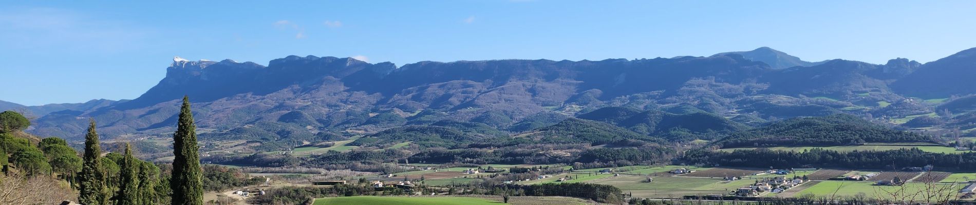
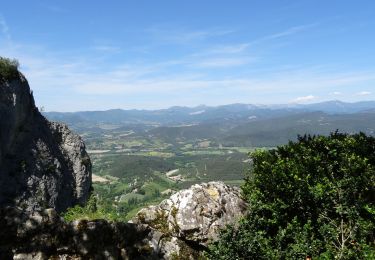
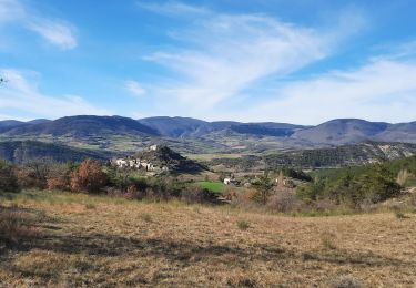
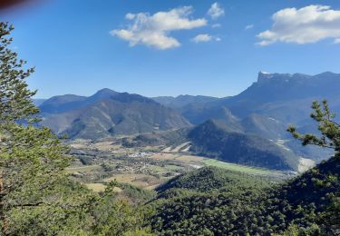
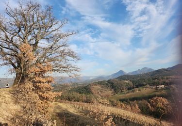
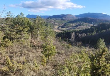
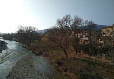
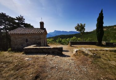
Trail Walking of 17.2 km to be discovered at Auvergne-Rhône-Alpes, Drôme, Mirabel-et-Blacons. This trail is proposed by Fanchon_24.

Description

une belle boucle qui part du vieux village. se garer au cimetière.

Elevation profile

Photos

Positioning

Country:
France
Region :
Auvergne-Rhône-Alpes
Department/Province :
Drôme
Municipality :
Mirabel-et-Blacons
Location:
Unknown
Start:(UTM)
666007 ; 4953081 (31T) N.

Trails nearby

Trail Walking Piégros-la-Clastre - La Chapelle Saint-Médard - Description et vidéo - Photo
Walking
bob2023

Walking

Medium
(1)
Piégros-la-Clastre, Auvergne-Rhône-Alpes, Drôme, France
14.9 km | 25 km-effort
5h 16min
Yes
Trail Walking Montclar-sur-Gervanne - Montclar sur Gervanne-Col Gerbe-Chple St Christophe 17km - Photo
Walking
GUIDE
thonyc

Walking

Medium
Montclar-sur-Gervanne, Auvergne-Rhône-Alpes, Drôme, France
16.6 km | 24 km-effort
5h 20min
Yes
Trail Walking Mirabel-et-Blacons - Mirabel et Balcons de La Drôme 16km - Photo
Walking
GUIDE
thonyc

Walking

Medium
Mirabel-et-Blacons, Auvergne-Rhône-Alpes, Drôme, France
16.1 km | 24 km-effort
3h 30min
Yes
Trail Mountain bike Aouste-sur-Sye - vtt vcs 120922 - Photo
Mountain bike
denis.benoit

Mountain bike

Medium
(1)
Aouste-sur-Sye, Auvergne-Rhône-Alpes, Drôme, France
37 km | 49 km-effort
3h 29min
No
Trail Walking Saint-Sauveur-en-Diois - saint sauveur en diois - Photo
Walking
Fanchon_24

Walking

Very easy
Saint-Sauveur-en-Diois, Auvergne-Rhône-Alpes, Drôme, France
5 km | 6.7 km-effort
1h 46min
Yes
Trail Walking Aubenasson - saint Michel Aubenasson - Photo
Walking
Fanchon_24

Walking

Medium
Aubenasson, Auvergne-Rhône-Alpes, Drôme, France
19.7 km | 24 km-effort
3h 45min
No
Trail Walking Aouste-sur-Sye - crête de Saint Alban. Aoust - Photo
Walking
Fanchon_24

Walking

Difficult
Aouste-sur-Sye, Auvergne-Rhône-Alpes, Drôme, France
9.7 km | 12.1 km-effort
2h 42min
No
Trail Walking Mirabel-et-Blacons - SANS SOUCIS SAILLANS - Photo
Walking
floup6138

Walking

Medium
Mirabel-et-Blacons, Auvergne-Rhône-Alpes, Drôme, France
16.3 km | 24 km-effort
5h 33min
No
Trail Walking Mirabel-et-Blacons - Chapelle Saint-Christophe - Charsac - Photo
Walking
Philindy26

Walking

Difficult
Mirabel-et-Blacons, Auvergne-Rhône-Alpes, Drôme, France
17.8 km | 27 km-effort
4h 50min
Yes


Close
My subscriptions