Trail Walking Conques-en-Rouergue - J6_Conques - Livinhac-le-Haut - Photo

J6_Conques - Livinhac-le-Haut

 MAD-CVW
MAD-CVW

User

© OpenStreetMap contributors
Length
Length
29 km
Max alt
Max alt
638 m
Uphill gradient
Uphill gradient
779 m
Km-Effort
Km-Effort  
40 km
Min alt
Min alt
177 m
Downhill gradient
Downhill gradient
1156 m
Boucle
Boucle
No
Creation date :
2024-04-08 08:01:00.597
Updated on :
2024-04-29 20:08:20.702

(0 Reviews)

Walking
Walking
9h08
Difficulty : Very difficult

Scan this QR Code to open this trail in the SityTrail application

FREE GPS app for hiking

Logo SityTrail SityTrail

IGN / Geographical institutes

Download SityTrail from the App Store Download SityTrail from Google Play

Logo SityTrail SityTrail World

The world is yours!

Download SityTrail from the App Store Download SityTrail from Google Play Download SityTrail on Huawei AppGallery

About

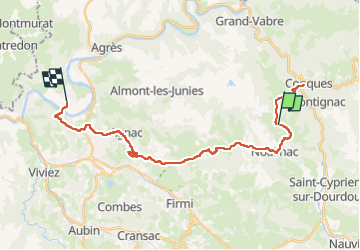
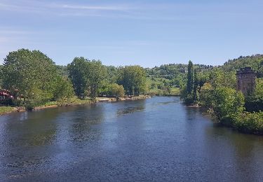
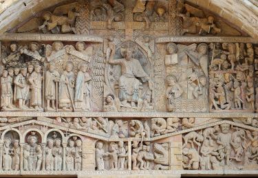
Trail Walking of 29 km to be discovered at Occitania, Aveyron, Conques-en-Rouergue. This trail is proposed by MAD-CVW.

Description

Au départ du bas du Village de Conques, traverser la route et le pont pour monter en face vers la chapelle Ste-Foy. Le chemin part par le GR65 (une option possible par GR6) a travers forêt.
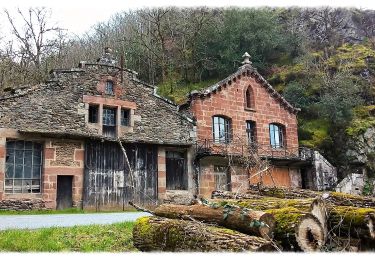
Avant Decazeville, au niveau de St-Michel, éviter de descendre en ville et continuer par chemin à droite non balisé, autour de la prairie, pour descendre au ruisseau, passage à gué et remonter le chemin forestier en face. Très beau parcours en forêt, passage devant belle statue de St-Vincent pour aboutir à Agnac. De là, prendre à gauche en direction de la route des crêtes qui mène à St-Roch pour rejoindre le GR65. Poursuivre jusqu'à Livinhac.

Elevation profile

Positioning

Country:
France
Region :
Occitania
Department/Province :
Aveyron
Municipality :
Conques-en-Rouergue
Location:
Noailhac
Start:(UTM)
450574 ; 4936408 (31T) N.

Trails nearby

Trail Walking Conques-en-Rouergue - Noailhac - Livinhac le Haut - Chemin de St-Jacques de Compostelle - Photo
Walking
tracegps

Walking

Difficult
(1)
Conques-en-Rouergue, Occitania, Aveyron, France
16.8 km | 23 km-effort
3h 0min
No
Trail On foot Conques-en-Rouergue - TerraTrail 7 - Photo
On foot
PRO

On foot

Easy
Conques-en-Rouergue, Occitania, Aveyron, France
9.4 km | 15.8 km-effort
3h 36min
Yes
Trail On foot Conques-en-Rouergue - Terra Trail 4 - Photo
On foot
PRO

On foot

Easy
Conques-en-Rouergue, Occitania, Aveyron, France
10.3 km | 16 km-effort
3h 38min
Yes
Trail On foot Conques-en-Rouergue - Terra Trail 13 - Photo
On foot
PRO

On foot

Medium
Conques-en-Rouergue, Occitania, Aveyron, France
18 km | 27 km-effort
6h 11min
Yes
Trail Walking Conques-en-Rouergue - Conques Levinhac le Haut Avril 2018 - Photo
Walking
GUIDE
Kargil

Walking

Difficult
Conques-en-Rouergue, Occitania, Aveyron, France
25 km | 36 km-effort
7h 4min
No
Trail Walking Conques-en-Rouergue - Conques  - Photo
Walking
GUIDE
antignacs

Walking

Very easy
Conques-en-Rouergue, Occitania, Aveyron, France
10.9 km | 16.3 km-effort
3h 2min
Yes
Trail On foot Conques-en-Rouergue - Le Chemin de l'Oiseau - Photo
On foot
PRO

On foot

Easy
Conques-en-Rouergue, Occitania, Aveyron, France
5 km | 7.9 km-effort
1h 47min
Yes
Trail On foot Conques-en-Rouergue - Sentier Conques - Grand-Vabre - Photo
On foot
PRO

On foot

Easy
Conques-en-Rouergue, Occitania, Aveyron, France
4.9 km | 6.4 km-effort
1h 27min
No
Trail On foot Conques-en-Rouergue - Le Sentier de Saint-Roch - Photo
On foot
PRO

On foot

Easy
Conques-en-Rouergue, Occitania, Aveyron, France
7.5 km | 11.3 km-effort
2h 33min
No


Close
My subscriptions