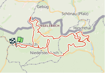
10.9 km | 14.8 km-effort
Balade en calèche Le Floch 2
FlorieAnne
User
Length
27 km
Max alt
419 m
Uphill gradient
619 m
Km-Effort
35 km
Min alt
210 m
Downhill gradient
620 m
Boucle
Yes
Creation date :
2024-04-11 14:27:26.414
Updated on :
2024-04-11 14:29:32.812
0m
Difficulty : Very easy
FREE GPS app for hiking
About
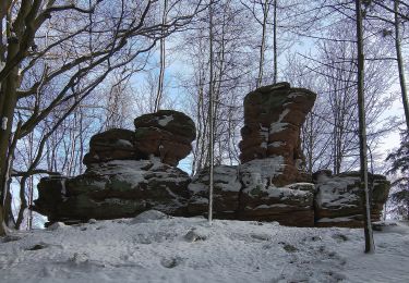
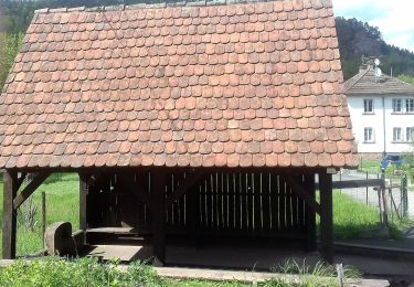
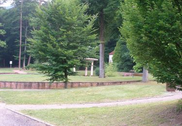
Trail Coupling of 27 km to be discovered at Grand Est, Bas-Rhin, Obersteinbach. This trail is proposed by FlorieAnne.
Description
Pour la dernière partie à compter du col, passer par le gros chemin en allemagne et non le chemin balisé rond rouge
Positioning
Country:
France
Region :
Grand Est
Department/Province :
Bas-Rhin
Municipality :
Obersteinbach
Location:
Unknown
Start:(Dec)
Start:(UTM)
403402 ; 5432185 (32U) N.
Comments
Trails nearby
Autour des moines de Sturzelbronn
On foot
Easy
Sturzelbronn,
Grand Est,
Moselle,
France
3h 22min
Yes
Losange jaune
On foot
Easy
Niedersteinbach,
Grand Est,
Bas-Rhin,
France
3.5 km | 5.1 km-effort
1h 9min
No
Anneau bleu
On foot
Easy
Niedersteinbach,
Grand Est,
Bas-Rhin,
France
3.9 km | 6.8 km-effort
1h 32min
Yes
Anneau jaune
On foot
Easy
Niedersteinbach,
Grand Est,
Bas-Rhin,
France
3.4 km | 4.9 km-effort
1h 6min
Yes
Anneau jaune
On foot
Easy
Obersteinbach,
Grand Est,
Bas-Rhin,
France
3.8 km | 6.2 km-effort
1h 25min
Yes
Triangle rouge
On foot
Medium
Obersteinbach,
Grand Est,
Bas-Rhin,
France
14.1 km | 21 km-effort
4h 45min
No
Scenic cross-border trail No. 3
On foot
Easy
Sturzelbronn,
Grand Est,
Moselle,
France
10 km | 13.8 km-effort
3h 8min
Yes
Triangle rouge
On foot
Easy
Schönau (Pfalz),
Rhineland-Palatinate,
Südwestpfalz,
Germany
5.5 km | 8.2 km-effort
1h 51min
No