


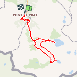

13 km | 22 km-effort


User


FREE GPS app for hiking
 SityTrail
IGN / Geographical institutes
SityTrail World
The world is yours!
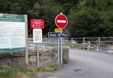
Trail Walking of 25 km to be discovered at Occitania, Hautespyrenees, Génos. This trail is proposed by ach31.

Walking

Walking

Walking
Walking
Walking
Walking

Walking

Walking

Walking
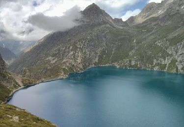
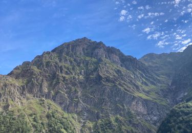
très beaux parcours.la vu et magnifique tout le long du parcour