![](/images/other/stat-length.png)
![Trail Walking Philippeville - Balade à Omezée - Photo](https://media.geolcdn.com/t/1900/400/ext.pjpeg?maxdim=2&url=https%3A%2F%2Fmedia.geolcdn.com%2Ff%2Fd0f447be-f54e-441d-b772-99cec4ce701f.jpeg)
Balade à Omezée
Desrumaux
User GUIDE
![Length](/images/other/stat-length.png)
Length
11.4 km
![Max alt](https://static1.geolcdn.com/siteimages/upload/files/1508320355ic_sort_altitude_max_24dp.png)
Max alt
300 m
![Uphill gradient](https://static1.geolcdn.com/siteimages/upload/files/1508320355ic_sort_den_pos_24dp.png)
Uphill gradient
209 m
![Km-Effort](/images/other/stat-length.png)
Km-Effort
14.2 km
![Min alt](https://static1.geolcdn.com/siteimages/upload/files/1508320355ic_sort_altitude_min_24dp.png)
Min alt
199 m
![Downhill gradient](https://static1.geolcdn.com/siteimages/upload/files/1508320355ic_sort_den_neg_24dp.png)
Downhill gradient
210 m
![Boucle](https://static1.geolcdn.com/siteimages/upload/files/16400158638029165_repeat_loop_refresh_sync_direction_icon.png)
Boucle
Yes
Creation date :
2024-04-30 17:59:02.317
Updated on :
2024-04-30 18:21:56.789
![Walking](https://static1.geolcdn.com/sitytour/trail-icons/101.png)
3h13
Difficulty : Difficult
![Scan this QR Code to open this trail in the SityTrail application](https://capi.geolives.com/qq0zvz2zws4bq2lad0pu/sitytour/trails/4035331/qr.png?size=200)
FREE GPS app for hiking
About
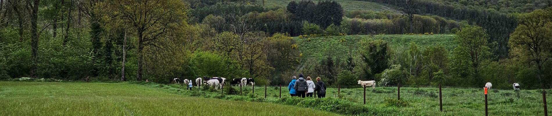
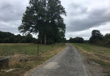
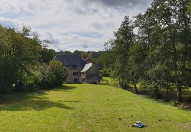
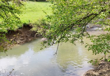
Trail Walking of 11.4 km to be discovered at Wallonia, Namur, Philippeville. This trail is proposed by Desrumaux.
Description
Magnifique balade organisée par le collectif de défense des sentiers de Philippeville au départ du village d'Omezée vers le village de Surice par le vallon d'Oméri.
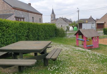
Positioning
Country:
Belgium
Region :
Wallonia
Department/Province :
Namur
Municipality :
Philippeville
Location:
Unknown
Start:(Dec)
Start:(UTM)
621313 ; 5561493 (31U) N.
Comments
Trails nearby
![Trail Walking Doische - RB-Na-11 La vallée de l’Hermeton - Photo](https://media.geolcdn.com/t/375/260/ext.jpg?maxdim=2&url=https%3A%2F%2Fservices.sitytrail.com%2FGeolivesWS%2FDownloadMedia.ashx%3FTrailID%3D179637%26Media%3D97aab1d2-a5d6-4980-8916-291d500d2803.jpg)
![Walking Walking](https://static1.geolcdn.com/sitytour/trail-icons/101.png)
RB-Na-11 La vallée de l’Hermeton
Walking
Medium
(4)
Doische,
Wallonia,
Namur,
Belgium
![](/images/other/stat-length.png)
25 km | 31 km-effort
6h 40min
![](https://static1.geolcdn.com/siteimages/upload/files/16400158638029165_repeat_loop_refresh_sync_direction_icon.png)
Yes
![Trail Walking Philippeville - Balade a Franchimont - Photo](https://media.geolcdn.com/t/375/260/ext.jpg?maxdim=2&url=https%3A%2F%2Fservices.sitytrail.com%2FGeolivesWS%2FDownloadMedia.ashx%3FTrailID%3D1022738%26Media%3D20180815124535.jpg)
![Walking Walking](https://static1.geolcdn.com/sitytour/trail-icons/101.png)
Balade a Franchimont
Walking
Easy
(2)
Philippeville,
Wallonia,
Namur,
Belgium
![](/images/other/stat-length.png)
11.2 km | 13.3 km-effort
2h 53min
![](https://static1.geolcdn.com/siteimages/upload/files/16400158638029165_repeat_loop_refresh_sync_direction_icon.png)
Yes
![Trail Walking Doische - RB-Na-11 Raccourci - La vallée de l’Hermeton - Photo](https://media.geolcdn.com/t/375/260/ext.jpg?maxdim=2&url=https%3A%2F%2Fstatic1.geolcdn.com%2Fsiteimages%2Fupload%2Ffiles%2F1553511878bg_sport_marche.png)
![Walking Walking](https://static1.geolcdn.com/sitytour/trail-icons/101.png)
RB-Na-11 Raccourci - La vallée de l’Hermeton
Walking
Medium
(5)
Doische,
Wallonia,
Namur,
Belgium
![](/images/other/stat-length.png)
19.7 km | 25 km-effort
5h 22min
![](https://static1.geolcdn.com/siteimages/upload/files/16400158638029165_repeat_loop_refresh_sync_direction_icon.png)
Yes
![Trail Walking Doische - De Gochenee vers Soulme par la vallee de l'Ermeton - Photo](https://media.geolcdn.com/t/375/260/ext.jpg?maxdim=2&url=https%3A%2F%2Fstatic1.geolcdn.com%2Fsiteimages%2Fupload%2Ffiles%2F1553511878bg_sport_marche.png)
![Walking Walking](https://static1.geolcdn.com/sitytour/trail-icons/101.png)
De Gochenee vers Soulme par la vallee de l'Ermeton
Walking
Medium
(1)
Doische,
Wallonia,
Namur,
Belgium
![](/images/other/stat-length.png)
18.5 km | 24 km-effort
4h 40min
![](https://static1.geolcdn.com/siteimages/upload/files/16400158638029165_repeat_loop_refresh_sync_direction_icon.png)
Yes
![Trail Walking Doische - Promenade à Vodelée - Photo](https://media.geolcdn.com/t/375/260/ext.jpg?maxdim=2&url=https%3A%2F%2Fstatic1.geolcdn.com%2Fsiteimages%2Fupload%2Ffiles%2F1553511878bg_sport_marche.png)
![Walking Walking](https://static1.geolcdn.com/sitytour/trail-icons/101.png)
Promenade à Vodelée
Walking
Easy
(1)
Doische,
Wallonia,
Namur,
Belgium
![](/images/other/stat-length.png)
9.3 km | 11.4 km-effort
2h 15min
![](https://static1.geolcdn.com/siteimages/upload/files/16400158638029165_repeat_loop_refresh_sync_direction_icon.png)
Yes
![Trail Walking Florennes - De Morville à Miavoye par le bois et le château de Fontaine - Photo](https://media.geolcdn.com/t/375/260/ext.jpg?maxdim=2&url=https%3A%2F%2Fstatic1.geolcdn.com%2Fsiteimages%2Fupload%2Ffiles%2F1553511878bg_sport_marche.png)
![Walking Walking](https://static1.geolcdn.com/sitytour/trail-icons/101.png)
De Morville à Miavoye par le bois et le château de Fontaine
Walking
Very easy
(3)
Florennes,
Wallonia,
Namur,
Belgium
![](/images/other/stat-length.png)
7.5 km | 9.2 km-effort
2h 0min
![](https://static1.geolcdn.com/siteimages/upload/files/16400158638029165_repeat_loop_refresh_sync_direction_icon.png)
Yes
![Trail Walking Doische - La Boucle de l'Hermeton - Photo](https://media.geolcdn.com/t/375/260/ext.jpg?maxdim=2&url=https%3A%2F%2Fmedia.geolcdn.com%2Ff%2Fc5cf3b26-e3a8-49a4-9696-0ff21384f9ea.jpg)
![Walking Walking](https://static1.geolcdn.com/sitytour/trail-icons/101.png)
La Boucle de l'Hermeton
Walking
Difficult
Doische,
Wallonia,
Namur,
Belgium
![](/images/other/stat-length.png)
19 km | 24 km-effort
2h 50min
![](https://static1.geolcdn.com/siteimages/upload/files/16400158638029165_repeat_loop_refresh_sync_direction_icon.png)
Yes
![Trail Walking Doische - Promenade de la Bonne-Fontaine - Photo](https://media.geolcdn.com/t/375/260/ext.jpg?maxdim=2&url=https%3A%2F%2Fmedia.geolcdn.com%2Ff%2Fb9d49c14-e249-4d19-a8a1-50d5262ebbb9.jpg)
![Walking Walking](https://static1.geolcdn.com/sitytour/trail-icons/101.png)
Promenade de la Bonne-Fontaine
Walking
Medium
(3)
Doische,
Wallonia,
Namur,
Belgium
![](/images/other/stat-length.png)
7.3 km | 9.4 km-effort
2h 7min
![](https://static1.geolcdn.com/siteimages/upload/files/16400158638029165_repeat_loop_refresh_sync_direction_icon.png)
Yes
![Trail Walking Doische - De Gochenée à Vodelée par la vallée de l'Hermeton - Photo](https://media.geolcdn.com/t/375/260/ext.jpg?maxdim=2&url=https%3A%2F%2Fmedia.geolcdn.com%2Ff%2F143bf095-b327-4de7-bd89-cf3882d0cbb7.jpg)
![Walking Walking](https://static1.geolcdn.com/sitytour/trail-icons/101.png)
De Gochenée à Vodelée par la vallée de l'Hermeton
Walking
Difficult
Doische,
Wallonia,
Namur,
Belgium
![](/images/other/stat-length.png)
10.7 km | 12.9 km-effort
3h 46min
![](https://static1.geolcdn.com/siteimages/upload/files/16400158638029165_repeat_loop_refresh_sync_direction_icon.png)
Yes