Trail Walking Ville-d'Avray - Etang Corot - Photo
 mallovon
mallovon

User

© OpenStreetMap contributors
Length
Length
3.8 km
Max alt
Max alt
168 m
Uphill gradient
Uphill gradient
89 m
Km-Effort
Km-Effort  
5 km
Min alt
Min alt
118 m
Downhill gradient
Downhill gradient
88 m
Boucle
Boucle
Yes
Creation date :
2024-05-09 14:04:18.701
Updated on :
2024-05-09 15:17:02.686

(0 Reviews)

Walking
Walking
1h12
Difficulty : Easy

Scan this QR Code to open this trail in the SityTrail application

FREE GPS app for hiking

Logo SityTrail SityTrail

IGN / Geographical institutes

Download SityTrail from the App Store Download SityTrail from Google Play

Logo SityTrail SityTrail World

The world is yours!

Download SityTrail from the App Store Download SityTrail from Google Play Download SityTrail on Huawei AppGallery

About

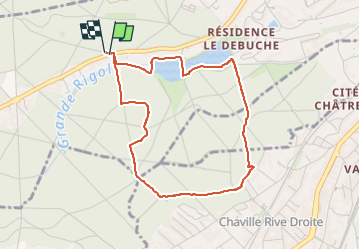
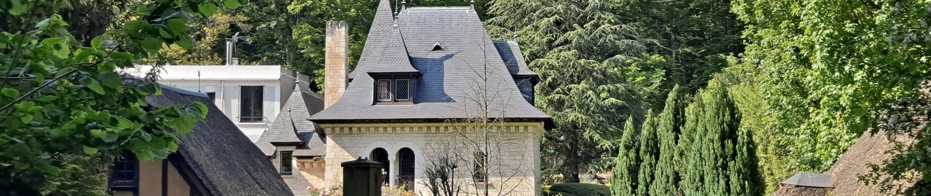
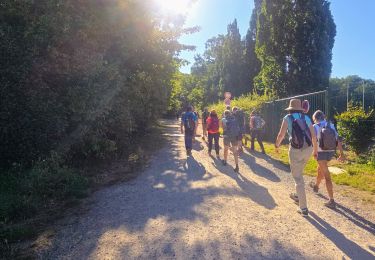
Trail Walking of 3.8 km to be discovered at Ile-de-France, Hauts-de-Seine, Ville-d'Avray. This trail is proposed by mallovon.

Description

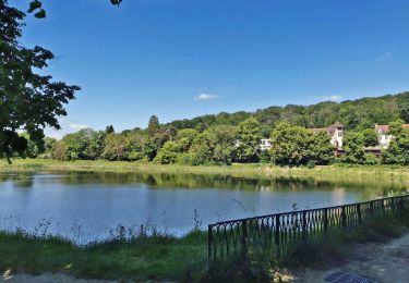
Boucle en forêt se terminant le long de l'étang.

Elevation profile

Photos

Positioning

Country:
France
Region :
Ile-de-France
Department/Province :
Hauts-de-Seine
Municipality :
Ville-d'Avray
Location:
Unknown
Start:(UTM)
439384 ; 5407886 (31U) N.

Trails nearby

Trail Walking Chaville - Le Sentier des 7 étangs - Photo
Walking
tracegps

Walking

Difficult
(5)
Chaville, Ile-de-France, Hauts-de-Seine, France
23 km | 31 km-effort
5h 0min
Yes
Trail Walking Chaville - GRP CV-IDF 20R Chaville à Vaucresson - Photo
Walking
clalaur

Walking

Medium
(1)
Chaville, Ile-de-France, Hauts-de-Seine, France
8.2 km | 11.1 km-effort
2h 30min
No
Trail Walking Bougival - Bougival-Saint-cucufa reel - Photo
Walking
perlimpinpin59

Walking

(1)
Bougival, Ile-de-France, Yvelines, France
7.7 km | 10.3 km-effort
2h 29min
Yes
Trail Walking Viroflay - Les 3 Forêts; Meudon, Fausses Reposes et Versailles - Photo
Walking
tracegps

Walking

Difficult
(2)
Viroflay, Ile-de-France, Yvelines, France
25 km | 32 km-effort
5h 19min
Yes
Trail Walking Chaville - Sentier des deux Forêts - Meudon et Verrières - Photo
Walking
tracegps

Walking

Difficult
(2)
Chaville, Ile-de-France, Hauts-de-Seine, France
23 km | 29 km-effort
5h 0min
Yes
Trail Walking Boulogne-Billancourt - Parc de St Cloud et forêt de Fausses Reposes - Photo
Walking
tracegps

Walking

Medium
(1)
Boulogne-Billancourt, Ile-de-France, Hauts-de-Seine, France
18.2 km | 23 km-effort
4h 30min
No
Trail On foot Boulogne-Billancourt - Boulogne -  Marne la Coquette - Ville d'Avray - Meudon - Photo
On foot
GUIDE
chessyca

On foot

Difficult
Boulogne-Billancourt, Ile-de-France, Hauts-de-Seine, France
29 km | 36 km-effort
8h 9min
No
Trail Walking Versailles - 20240828_100557 - Photo
Walking
GUIDE
chessyca

Walking

Very difficult
Versailles, Ile-de-France, Yvelines, France
19.7 km | 25 km-effort
5h 34min
Yes
Trail On foot Versailles - Boucle 28 km autour de Versailles - Photo
On foot
GUIDE
chessyca

On foot

Medium
Versailles, Ile-de-France, Yvelines, France
28 km | 33 km-effort
7h 25min
Yes


Close
My subscriptions