Trail Walking Haut Valromey - la ronde des plans - Photo
© OpenStreetMap contributors
Length
Length
10.3 km
Max alt
Max alt
1214 m
Uphill gradient
Uphill gradient
234 m
Km-Effort
Km-Effort  
13.5 km
Min alt
Min alt
1033 m
Downhill gradient
Downhill gradient
234 m
Boucle
Boucle
Yes
Creation date :
2015-05-14 00:00:00.0
Updated on :
2015-05-14 00:00:00.0

(0 Reviews)

Walking
Walking
3h09
Difficulty : Medium

Scan this QR Code to open this trail in the SityTrail application

FREE GPS app for hiking

Logo SityTrail SityTrail

IGN / Geographical institutes

Download SityTrail from the App Store Download SityTrail from Google Play

Logo SityTrail SityTrail World

The world is yours!

Download SityTrail from the App Store Download SityTrail from Google Play Download SityTrail on Huawei AppGallery

About

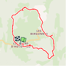
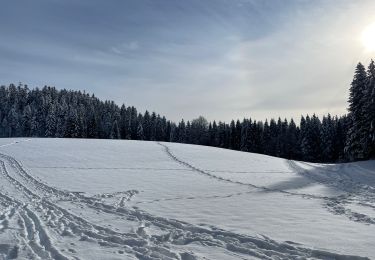
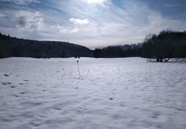
Trail Walking of 10.3 km to be discovered at Auvergne-Rhône-Alpes, Ain, Haut Valromey. This trail is proposed by romain-donner.

Description

ce circuit, particulièrement attractif pour des enfants, suit en partie le sentier de la découverte et permet de découvrir le vaste panorama de la chaîne des alpes
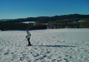
Elevation profile

Photos

Positioning

Country:
France
Region :
Auvergne-Rhône-Alpes
Department/Province :
Ain
Municipality :
Haut Valromey
Location:
Hotonnes
Start:(UTM)
708985 ; 5101896 (31T) N.

Trails nearby

Trail Snowshoes Haut Valromey - Raquette Lachat - Photo
Snowshoes
antoine01

Snowshoes

Easy
(1)
Haut Valromey, Auvergne-Rhône-Alpes, Ain, France
5.3 km | 7.1 km-effort
1h 35min
Yes
Trail Mountain bike Haut Valromey - Espace VTT FFC du Bugey - Circuit n° 16 - Les Plans d'Hotonnes - Photo
Mountain bike
tracegps

Mountain bike

Difficult
(1)
Haut Valromey, Auvergne-Rhône-Alpes, Ain, France
24 km | 32 km-effort
2h 0min
Yes
Trail Mountain bike Haut Valromey - Espace VTT FFC du Bugey - Circuit n° 15 - Les Plans d'Hotonnes - Photo
Mountain bike
tracegps

Mountain bike

Very difficult
(2)
Haut Valromey, Auvergne-Rhône-Alpes, Ain, France
14.1 km | 22 km-effort
1h 15min
Yes
Trail Walking Haut Valromey - ruffieu rando des bacs quinzaine - Photo
Walking
loca.yves

Walking

Medium
Haut Valromey, Auvergne-Rhône-Alpes, Ain, France
12.4 km | 17.7 km-effort
3h 55min
Yes
Trail Walking Haut Valromey - les bergonnes  - Photo
Walking
Jackoyo

Walking

Medium
Haut Valromey, Auvergne-Rhône-Alpes, Ain, France
8.4 km | 12.4 km-effort
2h 46min
Yes
Trail Walking Haut Valromey - Lachat  - Photo
Walking
tiki01

Walking

Very easy
Haut Valromey, Auvergne-Rhône-Alpes, Ain, France
6.2 km | 8.1 km-effort
2h 1min
Yes
Trail Walking Haut Valromey - les plans d automne - Photo
Walking
colomb24

Walking

Easy
Haut Valromey, Auvergne-Rhône-Alpes, Ain, France
37 km | 58 km-effort
5h 1min
No
Trail Snowshoes Haut Valromey - Plan d'Hotonnes - GTJ - Photo
Snowshoes
tracegps

Snowshoes

Medium
Haut Valromey, Auvergne-Rhône-Alpes, Ain, France
10.7 km | 15.6 km-effort
4h 0min
Yes
Trail Walking Chanay - Le Colombier  - Photo
Walking
Arvierie56@Gmail.com

Walking

Medium
Chanay, Auvergne-Rhône-Alpes, Ain, France
27 km | 40 km-effort
6h 53min
Yes


Close
My subscriptions