


refuge shallern - le markstein

OxygenLT
User
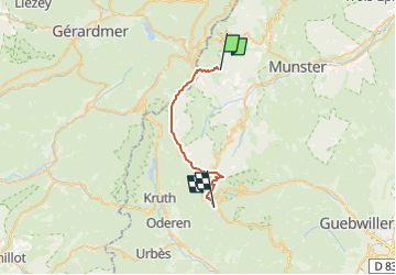

Length
21 km

Max alt
1355 m

Uphill gradient
791 m
Km-Effort
31 km

Min alt
1086 m

Downhill gradient
703 m
Boucle
No
Creation date :
2025-04-29 14:02:01.576
Updated on :
2025-04-29 14:02:39.966
7h07
Difficulty : Medium

FREE GPS app for hiking
 SityTrail
IGN / Geographical institutes
SityTrail Plus
The world is yours!
About
Trail Walking of 21 km to be discovered at Grand Est, Haut-Rhin, Stosswihr. This trail is proposed by OxygenLT.
Positioning
Country:
France
Region :
Grand Est
Department/Province :
Haut-Rhin
Municipality :
Stosswihr
Location:
Unknown
Start:(Dec)
Start:(UTM)
353928 ; 5322335 (32U) N.
Comments