


Camp 2025 - Le Honeck depuis le refuge

norbertmarteau
User
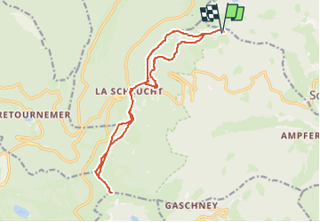

Length
16.4 km

Max alt
1355 m

Uphill gradient
656 m
Km-Effort
25 km

Min alt
1094 m

Downhill gradient
655 m
Boucle
Yes
Creation date :
2025-08-03 15:28:05.89
Updated on :
2025-08-03 15:28:38.218
5h42
Difficulty : Very difficult

FREE GPS app for hiking
 SityTrail
IGN / Geographical institutes
SityTrail Plus
The world is yours!
About
Trail Walking of 16.4 km to be discovered at Grand Est, Haut-Rhin, Stosswihr. This trail is proposed by norbertmarteau.
Positioning
Country:
France
Region :
Grand Est
Department/Province :
Haut-Rhin
Municipality :
Stosswihr
Location:
Unknown
Start:(Dec)
Start:(UTM)
355394 ; 5326910 (32U) N.
Comments