Trail Walking Sainte-Foy-Tarentaise - le lac du Clou par le Monal - Photo
 amiral13
amiral13

User GUIDE

© OpenStreetMap contributors
Length
Length
12.2 km
Max alt
Max alt
2382 m
Uphill gradient
Uphill gradient
726 m
Km-Effort
Km-Effort  
22 km
Min alt
Min alt
1696 m
Downhill gradient
Downhill gradient
728 m
Boucle
Boucle
Yes
Creation date :
2015-08-31 00:00:00.0
Updated on :
2015-08-31 00:00:00.0

(1 Reviews)

Walking
Walking
6h20
Difficulty : Easy

Scan this QR Code to open this trail in the SityTrail application

FREE GPS app for hiking

Logo SityTrail SityTrail

IGN / Geographical institutes

Download SityTrail from the App Store Download SityTrail from Google Play

Logo SityTrail SityTrail World

The world is yours!

Download SityTrail from the App Store Download SityTrail from Google Play Download SityTrail on Huawei AppGallery

About

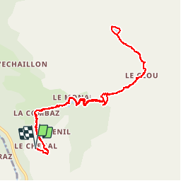
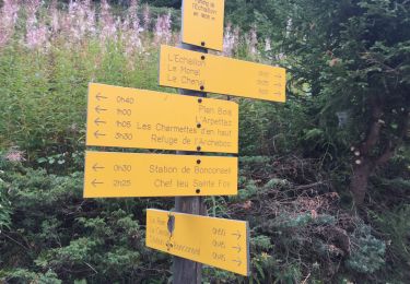
Trail Walking of 12.2 km to be discovered at Auvergne-Rhône-Alpes, Savoy, Sainte-Foy-Tarentaise. This trail is proposed by amiral13.

Description

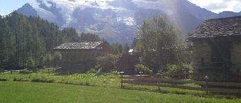
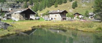
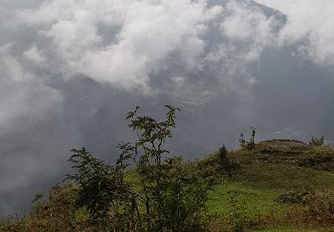
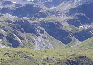
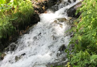
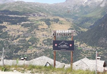
jolie randonnée qui vous amenera au superbe hameau du Monal en passant par celui de la combaz.
on se dirigera ensuite vers le village ruiné du clou, puis par une raide sente jusqu'au lac éponyme.
Par un temps sans nuages les mont Pourri et Turia ainsi que le dôme de la sache vous accompagneront jusqu'au hameau du Clou.

Elevation profile

Photos

Points of interest

Point of interest Sainte-Foy-Tarentaise - lac du Clou - Photo
amiral13
SAINTE-FOY-TARENTAISE 
Point of interest Sainte-Foy-Tarentaise - le Monal - Photo
amiral13
SAINTE-FOY-TARENTAISE 
Point of interest Sainte-Foy-Tarentaise - le Monal - Photo
amiral13
SAINTE-FOY-TARENTAISE 

Positioning

Country:
France
Region :
Auvergne-Rhône-Alpes
Department/Province :
Savoy
Municipality :
Sainte-Foy-Tarentaise
Location:
Unknown
Start:(UTM)
337113 ; 5045759 (32T) N.

Comments

Please log in to post a review or rate the element


Excellent !


Trails nearby

Trail Walking Villaroger - le refuge de Turia et l'approche du glacier de la Gurraz - Photo
Walking
GUIDE
amiral13

Walking

Medium
Villaroger, Auvergne-Rhône-Alpes, Savoy, France
11.7 km | 26 km-effort
5h 2min
Yes
Trail Walking Tignes - Le refuge de la martin - Photo
Walking
GUIDE
amiral13

Walking

Easy
Tignes, Auvergne-Rhône-Alpes, Savoy, France
13.4 km | 27 km-effort
6h 26min
Yes
Trail Walking Villaroger - Tarentaise-Villaroger-Planey - Photo
Walking
Maryma

Walking

Medium
(1)
Villaroger, Auvergne-Rhône-Alpes, Savoy, France
7.7 km | 16.9 km-effort
3h 50min
Yes
Trail Walking Sainte-Foy-Tarentaise - Col de l'aiguille par le lac du clou - Photo
Walking
reneperrin

Walking

Medium
(1)
Sainte-Foy-Tarentaise, Auvergne-Rhône-Alpes, Savoy, France
11.9 km | 23 km-effort
4h 49min
Yes
Trail Walking Sainte-Foy-Tarentaise - Chenal Monal Clou Fenil (boucle) - Photo
Walking
GUIDE
lhomme.ph

Walking

Medium
Sainte-Foy-Tarentaise, Auvergne-Rhône-Alpes, Savoy, France
10.4 km | 17.8 km-effort
3h 3min
Yes
Trail Walking Sainte-Foy-Tarentaise - Bon conseil lac du Clou - Photo
Walking
michel.pegaz

Walking

Very difficult
(1)
Sainte-Foy-Tarentaise, Auvergne-Rhône-Alpes, Savoy, France
16.1 km | 29 km-effort
6h 6min
Yes
Trail Walking Sainte-Foy-Tarentaise - Le Monial lac du clos en boucle randonnée très facile - Photo
Walking
PATGUSS

Walking

Easy
Sainte-Foy-Tarentaise, Auvergne-Rhône-Alpes, Savoy, France
10.6 km | 19.2 km-effort
5h 16min
No
Trail Walking Sainte-Foy-Tarentaise - Des bataillettes à plan dessous - Photo
Walking
Klhn

Walking

Easy
Sainte-Foy-Tarentaise, Auvergne-Rhône-Alpes, Savoy, France
5.8 km | 9.1 km-effort
2h 16min
Yes
Trail Walking Villaroger - les souliers, plan de l'aiguille refuge de Turia - Photo
Walking
BernardThiry

Walking

Medium
Villaroger, Auvergne-Rhône-Alpes, Savoy, France
13.4 km | 26 km-effort
5h 15min
Yes


Close
My subscriptions