


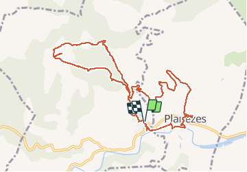


12.6 km | 17 km-effort


User


FREE GPS app for hiking
 SityTrail
IGN / Geographical institutes
SityTrail World
The world is yours!
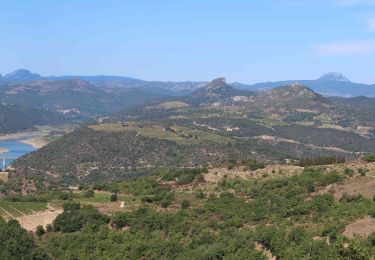
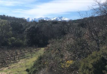
Trail Walking of 12.8 km to be discovered at Occitania, Pyrénées-Orientales, Rasiguères. This trail is proposed by jeff66.
66 RASIGUERES - parking de la mairie - rue grande - piste DFCI F11bis - l'aspicata - vue sur le village, ruisseau le Tremoine, autour et tour de Tremoine- les cortalets - Musals - la serre - bac del Taillou - Sentier découverte du vignoble, PLANÈZES - Roque Courbe - Bac del Four - piste DFCI F116 - PLANÈZES - chapelle et pierre - rue de la mairie, chemin de la rivière - RASUGUÈRES - avenue de caramany - mairie


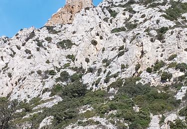
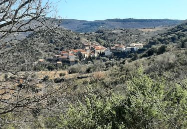
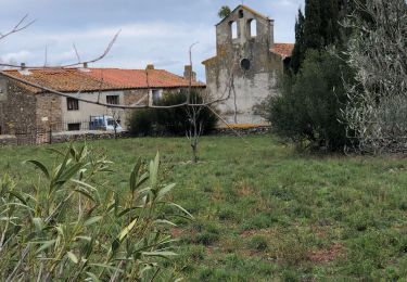
23 photos in total. Please click on a photo to see them all in the gallery.
Walking

Walking
Walking
Walking
Walking
Walking
Walking

Walking

Walking