


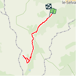

9.8 km | 17 km-effort


User


FREE GPS app for hiking
 SityTrail
IGN / Geographical institutes
SityTrail World
The world is yours!
Trail Walking of 14.9 km to be discovered at Provence-Alpes-Côte d'Azur, Maritime Alps, Saint-Dalmas-le-Selvage. This trail is proposed by lecynophile.
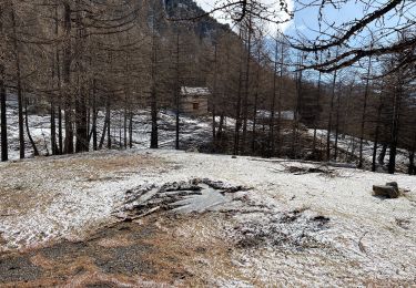
Ici départ de la balise 72, on peut monter en voiture jusque la balise 73 mais c'est un chemin de pierre.
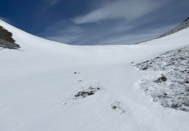
On peut partir de Saint Dalmas Selvage, mais jusqu'à la balise 73 la balade ne présente que peu d'intérêt.
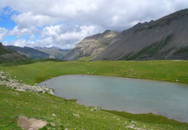
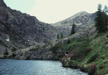
La balade se fait facilement jusqu'aux lacs
On foot
On foot
On foot
On foot
Snowshoes
Snowshoes
Walking
Snowshoes
Walking