Trail Walking Contest - Tour de Contest - Photo
© OpenStreetMap contributors
Length
Length
4.8 km
Max alt
Max alt
129 m
Uphill gradient
Uphill gradient
72 m
Km-Effort
Km-Effort  
5.7 km
Min alt
Min alt
87 m
Downhill gradient
Downhill gradient
72 m
Boucle
Boucle
Yes
Creation date :
2015-12-03 00:00:00.0
Updated on :
2015-12-03 00:00:00.0

(0 Reviews)

Walking
Walking
1h15
Difficulty : Easy

Scan this QR Code to open this trail in the SityTrail application

FREE GPS app for hiking

Logo SityTrail SityTrail

IGN / Geographical institutes

Download SityTrail from the App Store Download SityTrail from Google Play

Logo SityTrail SityTrail World

The world is yours!

Download SityTrail from the App Store Download SityTrail from Google Play Download SityTrail on Huawei AppGallery

About

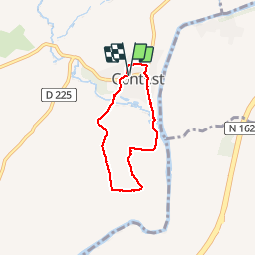
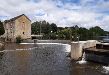
Trail Walking of 4.8 km to be discovered at Pays de la Loire, Mayenne, Contest. This trail is proposed by Axelloceane.

Description

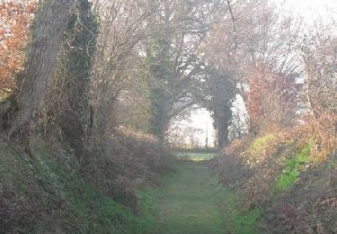
Départ de la mairie,prendre la première rue à gauche et continuer vers La louvellière.Continuer le chemin et avant d'aller jusqu'à l'Islentière prendre
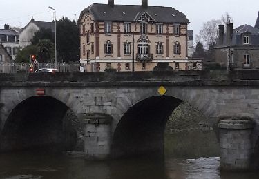
à gauche le chemin en terre.Passer derrière les bâtiments d'une ancienne ferme et reprendre le chemin goudronné.Passer sur le pont et rejoindre le village.  

Elevation profile

Photos

Points of interest

Point of interest Contest - Point 2 - Photo
Axelloceane
CONTEST 
Point of interest Contest - Point 6 - Photo
Axelloceane
CONTEST 
Point of interest Contest - Point 7 - Photo
Axelloceane
CONTEST 
Point of interest Contest - Point 10 - Photo
Axelloceane
CONTEST 

Positioning

Country:
France
Region :
Pays de la Loire
Department/Province :
Mayenne
Municipality :
Contest
Location:
Unknown
Start:(UTM)
673794 ; 5348068 (30U) N.

Trails nearby

Trail Walking Mayenne - Circuit dans les rues de Mayenne  - Photo
Walking
Axelloceane

Walking

Easy
Mayenne, Pays de la Loire, Mayenne, France
4.7 km | 5.9 km-effort
1h 16min
Yes
Trail Walking Contest - Circuit de Contest (4 km)  - Photo
Walking
tracegps

Walking

Easy
Contest, Pays de la Loire, Mayenne, France
4.5 km | 5.5 km-effort
1h 10min
Yes
Trail Walking Martigné-sur-Mayenne - Écluses Corçu - La Roche  - Photo
Walking
norbertdenise

Walking

Easy
Martigné-sur-Mayenne, Pays de la Loire, Mayenne, France
12.2 km | 14.2 km-effort
2h 12min
Yes
Trail Cycle Saint-Baudelle - rando vers St Loup - Photo
Cycle
gillesb53

Cycle

Easy
Saint-Baudelle, Pays de la Loire, Mayenne, France
20 km | 23 km-effort
Unknown
No
Trail Walking Contest - Circuit de Contest (8 km) - Photo
Walking
tracegps

Walking

Easy
Contest, Pays de la Loire, Mayenne, France
7.1 km | 8.5 km-effort
1h 49min
Yes
Trail Bicycle tourism Mayenne - francette j1 depart mayenne - Photo
Bicycle tourism
werth

Bicycle tourism

Medium
Mayenne, Pays de la Loire, Mayenne, France
55 km | 63 km-effort
5h 44min
No
Trail Electric bike Saint-Baudelle - 6 aout 2020 - Photo
Electric bike
mimi53

Electric bike

Medium
Saint-Baudelle, Pays de la Loire, Mayenne, France
34 km | 40 km-effort
Unknown
Yes
Trail Hybrid bike Saint-Baudelle - 13 juillet 2020 - Photo
Hybrid bike
mimi53

Hybrid bike

Saint-Baudelle, Pays de la Loire, Mayenne, France
32 km | 35 km-effort
2h 10min
Yes
Trail Walking Mayenne - Mayenne  - Photo
Walking
COGLAIS3

Walking

Very easy
Mayenne, Pays de la Loire, Mayenne, France
4 km | 4.9 km-effort
1h 23min
Yes


Close
My subscriptions