Trail Walking Argentat-sur-Dordogne - Argentat - les crêtes - Photo
 houbart
houbart

User

© OpenStreetMap contributors
Length
Length
9.7 km
Max alt
Max alt
375 m
Uphill gradient
Uphill gradient
267 m
Km-Effort
Km-Effort  
13.2 km
Min alt
Min alt
178 m
Downhill gradient
Downhill gradient
265 m
Boucle
Boucle
Yes
Creation date :
2019-03-28 15:47:27.461
Updated on :
2019-03-28 15:47:27.507

(0 Reviews)

Walking
Walking
2h54
Difficulty : Medium

Scan this QR Code to open this trail in the SityTrail application

FREE GPS app for hiking

Logo SityTrail SityTrail

IGN / Geographical institutes

Download SityTrail from the App Store Download SityTrail from Google Play

Logo SityTrail SityTrail World

The world is yours!

Download SityTrail from the App Store Download SityTrail from Google Play Download SityTrail on Huawei AppGallery

About

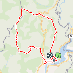
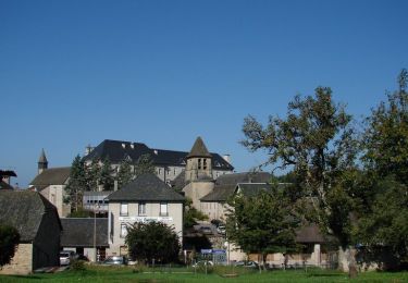
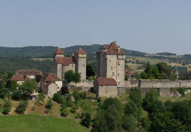
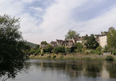
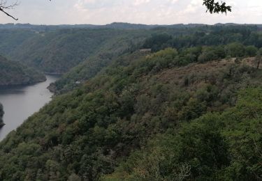
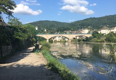
Trail Walking of 9.7 km to be discovered at New Aquitaine, Corrèze, Argentat-sur-Dordogne. This trail is proposed by houbart.

Description

Rando qui surplombe les vallées des rivières et ruisseaux qui irriguent Argentat.

Elevation profile

Positioning

Country:
France
Region :
New Aquitaine
Department/Province :
Corrèze
Municipality :
Argentat-sur-Dordogne
Location:
Argentat
Start:(UTM)
417423 ; 4995089 (31T) N.

Trails nearby

Trail Walking Servières-le-Château - Les chapelles - Servières le Château - Photo
Walking
tracegps

Walking

Difficult
(2)
Servières-le-Château, New Aquitaine, Corrèze, France
7.3 km | 12.2 km-effort
3h 0min
Yes
Trail Motorbike Argentat-sur-Dordogne - Les tours de Merle - Beaulieu - Collonges - Photo
Motorbike
bernard_ostermann

Motorbike

Easy
Argentat-sur-Dordogne, New Aquitaine, Corrèze, France
162 km | 204 km-effort
4h 0min
No
Trail Walking Hautefage - Hautefage - Photo
Walking
martinjacque

Walking

Very easy
(1)
Hautefage, New Aquitaine, Corrèze, France
6.4 km | 7.8 km-effort
1h 55min
Yes
Trail sport Monceaux-sur-Dordogne - Monceaux sur Dordogne - Photo
sport
hl44lv

sport

Very easy
Monceaux-sur-Dordogne, New Aquitaine, Corrèze, France
5.2 km | 8.2 km-effort
Unknown
Yes
Trail Walking Argentat-sur-Dordogne - argentât  - Photo
Walking
Django44380

Walking

Very easy
Argentat-sur-Dordogne, New Aquitaine, Corrèze, France
8.5 km | 10.3 km-effort
3h 57min
No
Trail Car Servières-le-Château - gorges de la Dordogne  - Photo
Car
Django44380

Car

Medium
Servières-le-Château, New Aquitaine, Corrèze, France
130 km | 173 km-effort
6h 51min
No
Trail Other activity Monceaux-sur-Dordogne - De Bros à Argentat  - Photo
Other activity
olk

Other activity

Medium
Monceaux-sur-Dordogne, New Aquitaine, Corrèze, France
8.7 km | 12.5 km-effort
2h 15min
No
Trail Walking Saint-Chamant - t42164281_l'ecole buissonniere - Photo
Walking
Gpoujade

Walking

Difficult
Saint-Chamant, New Aquitaine, Corrèze, France
10.3 km | 15.5 km-effort
3h 31min
Yes
Trail Mountain bike Argentat-sur-Dordogne - Wikiloc - Tour de la Xaintrie Noire (Corrèze) (2021) - Photo
Mountain bike
Gpoujade

Mountain bike

Very difficult
Argentat-sur-Dordogne, New Aquitaine, Corrèze, France
61 km | 83 km-effort
5h 44min
Yes


Close
My subscriptions