Trail Walking Larchant - 151213-RECO - DameJouanne - Photo

151213-RECO - DameJouanne

 randodan
randodan

User

© OpenStreetMap contributors
Length
Length
11.7 km
Max alt
Max alt
120 m
Uphill gradient
Uphill gradient
211 m
Km-Effort
Km-Effort  
14.5 km
Min alt
Min alt
68 m
Downhill gradient
Downhill gradient
211 m
Boucle
Boucle
Yes
Creation date :
2015-12-15 00:00:00.0
Updated on :
2015-12-15 00:00:00.0

(0 Reviews)

Walking
Walking
4h18
Difficulty : Medium

Scan this QR Code to open this trail in the SityTrail application

FREE GPS app for hiking

Logo SityTrail SityTrail

IGN / Geographical institutes

Download SityTrail from the App Store Download SityTrail from Google Play

Logo SityTrail SityTrail World

The world is yours!

Download SityTrail from the App Store Download SityTrail from Google Play Download SityTrail on Huawei AppGallery

About

Trail Walking of 11.7 km to be discovered at Ile-de-France, Seine-et-Marne, Larchant. This trail is proposed by randodan.

Description

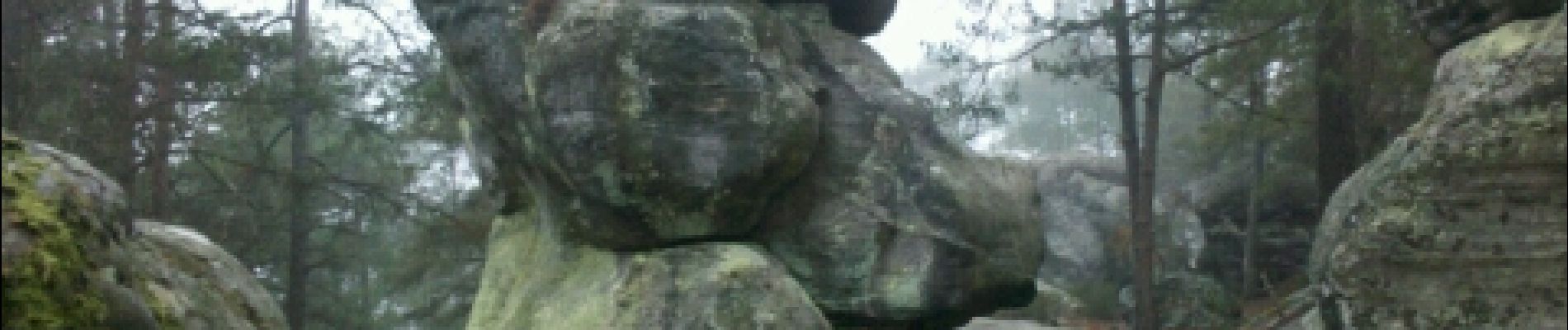
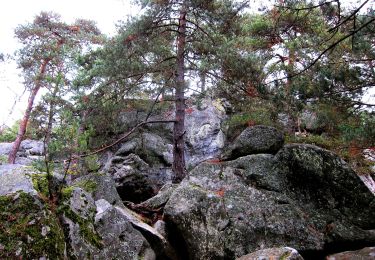
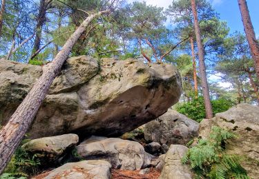
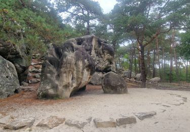
Reconnaissance Dame Jouanne avec JP<br>
- 13 décembre 2015 -<br>
Départ parking Dame Jouanne 9h30 pour le Denecourt n°19 . Pas trouvé la Croix du Petit Homme (peut-être à cause de la déviation du tracé ?) . Evitons la Fontaine St Mathurin à cause du retard, de même pour la carrière de Blomont . Attention à la sortie de la carrière, c'est grillagé (alors qu'on y est rentré sans problème) . Pas trouvé non plus la Fontaine Perdue de Saint Bernard (la déviation du tracé est peut-être pour "protéger" la Fontaine ?).<br>
12h30 au Chalet Jaubert (Auberge de la Dame Jouanne) où on retrouve Mireille.<br>
14h50, on attaque la petite boucle digestive au-dessus de la Dame Jeanne jusqu'au Maunoury . Au retour, j'essaie bien d'approcher le pied de la grande Dame, mais les rochers humides m'en dissuadent.<br>
16h10 à la voiture.

Elevation profile

Photos

Points of interest

Point of interest Larchant - La Molaire - Photo
randodan
LARCHANT 

Positioning

Country:
France
Region :
Ile-de-France
Department/Province :
Seine-et-Marne
Municipality :
Larchant
Location:
Unknown
Start:(UTM)
470301 ; 5350065 (31U) N.

Trails nearby

Trail On foot Larchant - Sentier Denecourt-Colinet 19 - Photo
On foot
PRO

On foot

Easy
Larchant, Ile-de-France, Seine-et-Marne, France
9.7 km | 12.3 km-effort
2h 47min
Yes
Trail Walking Villiers-sous-Grez - Villiers sous grez / Larchant - Photo
Walking
becor94

Walking

Very difficult
Villiers-sous-Grez, Ile-de-France, Seine-et-Marne, France
24 km | 29 km-effort
5h 31min
Yes
Trail Walking Recloses - Recloses Ve120124 pm - Photo
Walking
fmg

Walking

Medium
(1)
Recloses, Ile-de-France, Seine-et-Marne, France
8.9 km | 10.5 km-effort
2h 23min
Yes
Trail Walking Recloses - Recloses ve 120124 am - Photo
Walking
fmg

Walking

Medium
(1)
Recloses, Ile-de-France, Seine-et-Marne, France
10.8 km | 12.6 km-effort
2h 52min
Yes
Trail Walking Recloses - Boucle recloses Nemours Grez/loing - Photo
Walking
chessyca

Walking

Medium
(1)
Recloses, Ile-de-France, Seine-et-Marne, France
30 km | 34 km-effort
6h 20min
Yes
Trail Walking Larchant - Larchant la Féérique  - Photo
Walking
chessyca

Walking

Medium
Larchant, Ile-de-France, Seine-et-Marne, France
19.6 km | 24 km-effort
5h 14min
Yes
Trail Walking Recloses - Recloses Ve 280423 SR30042323 PM10km - Photo
Walking
fmg

Walking

Medium
(1)
Recloses, Ile-de-France, Seine-et-Marne, France
9.9 km | 11.9 km-effort
2h 42min
Yes
Trail Nordic walking Larchant - Dame Juane - Photo
Nordic walking
pierre_mack

Nordic walking

Larchant, Ile-de-France, Seine-et-Marne, France
22 km | 26 km-effort
3h 6min
No
Trail Walking Recloses - Recloses Sentier Denecourt 20 - Photo
Walking
guydu41

Walking

Medium
Recloses, Ile-de-France, Seine-et-Marne, France
6.4 km | 8 km-effort
2h 17min
Yes


Close
My subscriptions