Trail Walking Irun - Aiako 2 Harria depuis Irun - Photo
 DECHAMPD
DECHAMPD

User

© OpenStreetMap contributors
Length
Length
9.4 km
Max alt
Max alt
456 m
Uphill gradient
Uphill gradient
345 m
Km-Effort
Km-Effort  
13.7 km
Min alt
Min alt
279 m
Downhill gradient
Downhill gradient
264 m
Boucle
Boucle
No
Creation date :
2019-01-14 17:31:49.86
Updated on :
2019-01-14 17:31:50.0

(0 Reviews)

Walking
Walking
3h03
Difficulty : Medium

Scan this QR Code to open this trail in the SityTrail application

FREE GPS app for hiking

Logo SityTrail SityTrail

IGN / Geographical institutes

Download SityTrail from the App Store Download SityTrail from Google Play

Logo SityTrail SityTrail World

The world is yours!

Download SityTrail from the App Store Download SityTrail from Google Play Download SityTrail on Huawei AppGallery

About

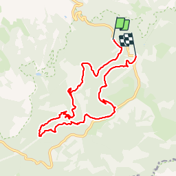
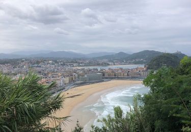
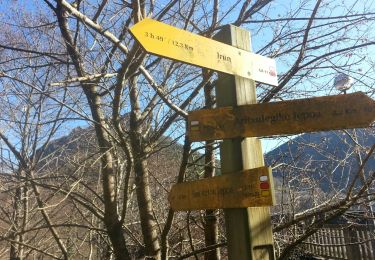
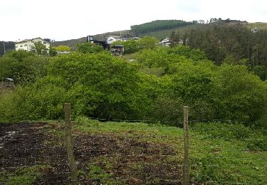
Trail Walking of 9.4 km to be discovered at Autonomous Community of the Basque Country, Gipuzkoa, Irun. This trail is proposed by DECHAMPD.

Description

Le parc naturel d'Aiako Harria (Peñas de Aya, en castillan ou les "Trois Couronnes" pour les Basques d'Iparralde, Sa forme caractéristique peut être discerné près de Bayonne, dans la mesure où le massif étant surnommé le « visage de Napoléon » en raison de ses lignes similaires)  se situe sur les contreforts des Pyrénées, à l'extrémité orientale de la province de Guipúzcoa.
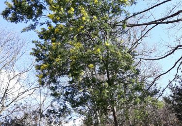
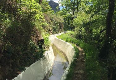
Le relief d'Aiako Harria est particulièrement tourmenté. Il est formé d'une mosaïque de montagnes et de gorges irriguées par de nombreux torrents. La végétation du parc est typiquement atlantique. Cependant, on trouve quelques éléments méditerranéens dans les parties basses et ensoleillées. Quant à la faune du parc, impossible de ne pas évoquer la présence de 170 espèces de vertébrés, et de celle des oiseaux.
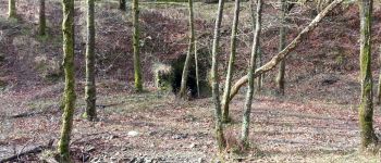
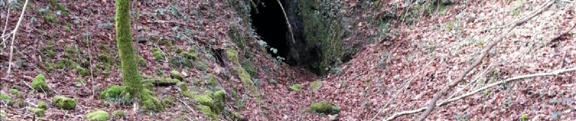
À ses pieds à l'Ouest, la montagne détient le site Arditurri associés à Oiasso antique avec un réseau de couloirs de mines taillés dans la roche et imputée à des Romains. On a calculé que les tunnels ont une longueur totale de 15 à 18 km nous en traverserons plusieurs.

Elevation profile

Photos

Points of interest

Point of interest Irun - tunnel   - Photo
DECHAMPD
IRUN 
Point of interest Irun - Point 2 - Photo
DECHAMPD
IRUN 
Point of interest Irun - Cascada de Aitzondo - Photo
DECHAMPD
Point of interest Irun - Point 4 - Photo
DECHAMPD
IRUN 
Point of interest Irun - pour suivre torent - Photo
DECHAMPD
Point of interest Irun - entrée de mines - Photo
DECHAMPD
Point of interest Irun - Point 5 - Photo
DECHAMPD
IRUN 
Point of interest Irun - Point 6 - Photo
DECHAMPD
IRUN 
Point of interest Irun - aire de pique nique - Photo
DECHAMPD
Point of interest Irun - tables pic-nique - Photo
DECHAMPD
Point of interest Irun - point de vue - Photo
DECHAMPD
Point of interest Irun - Unnamed POI - Photo
DECHAMPD
Point of interest Irun - infos - Photo
DECHAMPD
IRUN 
Point of interest Irun - ???? - Photo
DECHAMPD
IRUN 

Positioning

Country:
Spain
Region :
Autonomous Community of the Basque Country
Department/Province :
Gipuzkoa
Municipality :
Irun
Location:
Unknown
Start:(UTM)
600405 ; 4796593 (30T) N.

Trails nearby

Trail Walking Biriatou - Biriatou et lac Poiriers - Photo
Walking
RVMASSON

Walking

Medium
(1)
Biriatou, New Aquitaine, Pyrénées-Atlantiques, France
10.1 km | 17.1 km-effort
3h 45min
Yes
Trail Walking Irun - Ibarla - Cascade d'Aitzondo - Ermitage san Martzial 2024 01 21 - Photo
Walking
DECHAMPD

Walking

Very difficult
Irun, Autonomous Community of the Basque Country, Gipuzkoa, Spain
12.1 km | 19.7 km-effort
4h 28min
Yes
Trail On foot Irun - SL-GI 1006 Cascada de Aitzondo - Photo
On foot
PRO

On foot

Easy
Irun, Autonomous Community of the Basque Country, Gipuzkoa, Spain
6 km | 8.4 km-effort
1h 54min
Yes
Trail Walking Biriatou - biriatou chemin de la foret - Photo
Walking
brindacier

Walking

Easy
Biriatou, New Aquitaine, Pyrénées-Atlantiques, France
4 km | 6.4 km-effort
1h 21min
No
Trail Walking Irun - Ibarla - Cascade d'Aitzondo - Ermitage san Martzial 2020 01 21 - Photo
Walking
DECHAMPD

Walking

Irun, Autonomous Community of the Basque Country, Gipuzkoa, Spain
13 km | 21 km-effort
5h 4min
Yes
Trail Walking Hendaye - Hendaye Saint Sébastien GR121 Sentier du littoral - Photo
Walking
jaja64

Walking

Easy
Hendaye, New Aquitaine, Pyrénées-Atlantiques, France
54 km | 71 km-effort
5h 54min
Yes
Trail Walking Irun - Boucle 3 couronnes  - Photo
Walking
jaja64

Walking

Medium
Irun, Autonomous Community of the Basque Country, Gipuzkoa, Spain
11.3 km | 0 m-effort
4h 7min
Yes
Trail Walking Lesaka - Embalse de Endara 2017 05 09x_backup - Photo
Walking
DECHAMPD

Walking

Very easy
Lesaka, Navarre, Unknown, Spain
11.4 km | 16.3 km-effort
3h 57min
Yes
Trail Other activity Hendaye - TDP N°1 HENDAYE OLHETTE  - Photo
Other activity
jeff2

Other activity

Very easy
Hendaye, New Aquitaine, Pyrénées-Atlantiques, France
24 km | 38 km-effort
7h 15min
No


Close
My subscriptions