


66 MAURY - mas Amiel - Promenade dans le vignoble - mas de las Fredes

jeff66
User

Length
7.4 km

Max alt
224 m

Uphill gradient
144 m
Km-Effort
9.3 km

Min alt
115 m

Downhill gradient
141 m
Boucle
Yes
Creation date :
2016-04-18 00:00:00.0
Updated on :
2016-04-18 00:00:00.0
1h32
Difficulty : Medium

FREE GPS app for hiking
 SityTrail
IGN / Geographical institutes
SityTrail Plus
The world is yours!
About
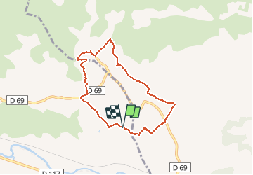
Trail Walking of 7.4 km to be discovered at Occitania, Pyrénées-Orientales, Maury. This trail is proposed by jeff66.
Description
66 MAURY. Promenade vignobles du Mas Amiel, Le Peyssounie, traverser la RD69, Cabirou, RD69a, Mas de l'as Fredes, piste DFCI F93, Traou, camp del Baquié, L ouille


Positioning
Country:
France
Region :
Occitania
Department/Province :
Pyrénées-Orientales
Municipality :
Maury
Location:
Unknown
Start:(Dec)
Start:(UTM)
472205 ; 4739508 (31T) N.
Comments