


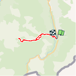

10.6 km | 19.3 km-effort


User


FREE GPS app for hiking
 SityTrail
IGN / Geographical institutes
SityTrail World
The world is yours!
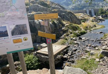
Trail Walking of 11.4 km to be discovered at New Aquitaine, Pyrénées-Atlantiques, Laruns. This trail is proposed by DuMarsan.
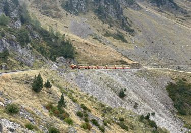
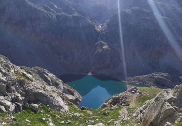
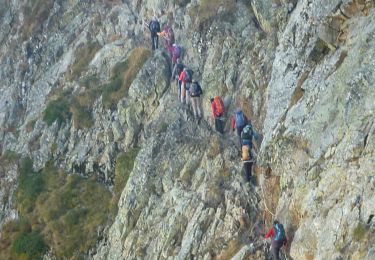
12/06/2016 Geo, André et Suzanne. Ossau dans la brume...
Un dimanche cool, les izards gambadent dans les prairies fleuries...


Walking
Walking

Walking
Walking
On foot

Walking

Walking

Walking
Walking