Trail Walking Bonneval-sur-Arc - pointe et aiguille Pers - Photo
 amiral13
amiral13

User GUIDE

© OpenStreetMap contributors
Length
Length
8.7 km
Max alt
Max alt
3366 m
Uphill gradient
Uphill gradient
631 m
Km-Effort
Km-Effort  
17.1 km
Min alt
Min alt
2750 m
Downhill gradient
Downhill gradient
633 m
Boucle
Boucle
Yes
Creation date :
2017-08-27 00:00:00.0
Updated on :
2017-08-27 00:00:00.0

(0 Reviews)

Walking
Walking
5h49
Difficulty : Medium

Scan this QR Code to open this trail in the SityTrail application

FREE GPS app for hiking

Logo SityTrail SityTrail

IGN / Geographical institutes

Download SityTrail from the App Store Download SityTrail from Google Play

Logo SityTrail SityTrail World

The world is yours!

Download SityTrail from the App Store Download SityTrail from Google Play Download SityTrail on Huawei AppGallery

About

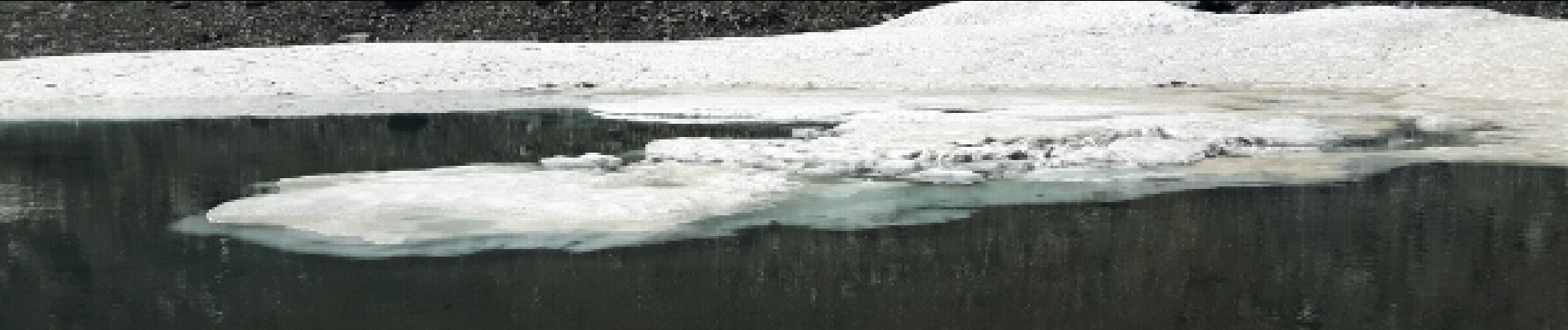
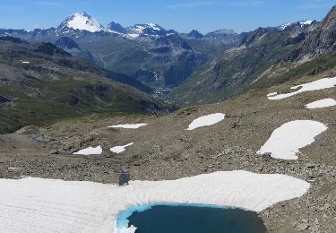
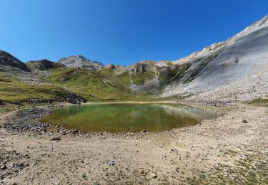
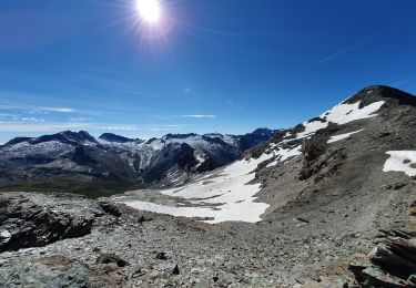
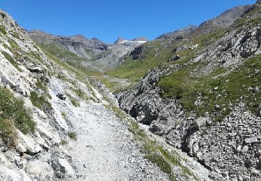
Trail Walking of 8.7 km to be discovered at Auvergne-Rhône-Alpes, Savoy, Bonneval-sur-Arc. This trail is proposed by amiral13.

Description

cette randonnée a été réalisée avec un enfant de 9 ans, le temps de parcours peut être donc être réduit.

Elevation profile

Photos

Positioning

Country:
France
Region :
Auvergne-Rhône-Alpes
Department/Province :
Savoy
Municipality :
Bonneval-sur-Arc
Location:
Unknown
Start:(UTM)
346561 ; 5031786 (32T) N.

Trails nearby

Trail Walking Bonneval-sur-Arc - Lac du Grand Mean - Photo
Walking
Michel_Martin

Walking

Medium
(2)
Bonneval-sur-Arc, Auvergne-Rhône-Alpes, Savoy, France
14 km | 27 km-effort
5h 1min
Yes
Trail Walking Bonneval-sur-Arc - Refuge des Evettes - Photo
Walking
freche

Walking

Easy
(1)
Bonneval-sur-Arc, Auvergne-Rhône-Alpes, Savoy, France
8.9 km | 16.4 km-effort
2h 48min
Yes
Trail Walking Val-d'Isère - cols de la loze et de la galise et grand Cocor - Photo
Walking
GUIDE
amiral13

Walking

Medium
(1)
Val-d'Isère, Auvergne-Rhône-Alpes, Savoy, France
13.9 km | 27 km-effort
6h 25min
Yes
Trail Walking Val-d'Isère - Lac, col et pointe de la Bailletaz - Photo
Walking
GUIDE
amiral13

Walking

Difficult
Val-d'Isère, Auvergne-Rhône-Alpes, Savoy, France
9.6 km | 23 km-effort
4h 35min
Yes
Trail Walking Val-d'Isère - le glacier des sources de l'Isère - Photo
Walking
GUIDE
amiral13

Walking

Very difficult
Val-d'Isère, Auvergne-Rhône-Alpes, Savoy, France
17 km | 32 km-effort
10h 49min
Yes
Trail Walking Val-d'Isère - pointe de la Galise (alpinisme) - Photo
Walking
GUIDE
amiral13

Walking

Very difficult
Val-d'Isère, Auvergne-Rhône-Alpes, Savoy, France
15.6 km | 33 km-effort
8h 0min
Yes
Trail Walking Bonneval-sur-Arc - signal de l'Iseran - Photo
Walking
GUIDE
amiral13

Walking

Very difficult
Bonneval-sur-Arc, Auvergne-Rhône-Alpes, Savoy, France
5.2 km | 11.7 km-effort
3h 9min
Yes
Trail Walking Bonneval-sur-Arc - l'Ouille noire - Photo
Walking
GUIDE
amiral13

Walking

Difficult
Bonneval-sur-Arc, Auvergne-Rhône-Alpes, Savoy, France
8.1 km | 16.7 km-effort
4h 14min
Yes
Trail Walking Val-d'Isère - le roc de Bassagne - Photo
Walking
GUIDE
amiral13

Walking

Difficult
Val-d'Isère, Auvergne-Rhône-Alpes, Savoy, France
13.4 km | 29 km-effort
6h 16min
Yes


Close
My subscriptions