Trail Cycle Gargas - L Echappee Belge en Luberon - Jour 5 - Gargas/Apt - Photo

L Echappee Belge en Luberon - Jour 5 - Gargas/Apt

Randonnées de Vélo Loisir Provence GUIDE+

© OpenStreetMap contributors
Length
Length
28 km
Max alt
Max alt
322 m
Uphill gradient
Uphill gradient
373 m
Km-Effort
Km-Effort  
33 km
Min alt
Min alt
227 m
Downhill gradient
Downhill gradient
403 m
Boucle
Boucle
No
Creation date :
2016-09-16 00:00:00.0
Updated on :
2016-09-16 00:00:00.0

(0 Reviews)

Cycle
Cycle
1h52
Difficulty : Easy

Scan this QR Code to open this trail in the SityTrail application

FREE GPS app for hiking

Logo SityTrail SityTrail

IGN / Geographical institutes

Download SityTrail from the App Store Download SityTrail from Google Play

Logo SityTrail SityTrail World

The world is yours!

Download SityTrail from the App Store Download SityTrail from Google Play Download SityTrail on Huawei AppGallery

About

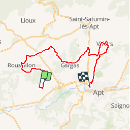
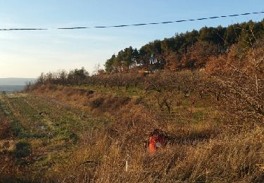
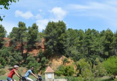
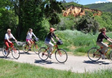
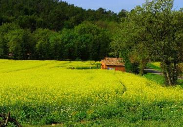
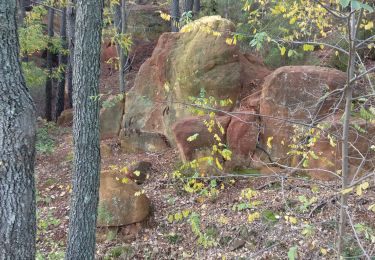
Trail Cycle of 28 km to be discovered at Provence-Alpes-Côte d'Azur, Vaucluse, Gargas. This trail is proposed by Vélo Loisir Provence.

Description

Parcours vélo du jour 5 de L'échappée Belge en Luberon !

Elevation profile

Positioning

Country:
France
Region :
Provence-Alpes-Côte d'Azur
Department/Province :
Vaucluse
Municipality :
Gargas
Location:
Unknown
Start:(Dec)
Start:(UTM)
686100 ; 4861246 (31T) N.

Trails nearby

Trail Mountain bike Roussillon - activity_9127223319 - Photo
Mountain bike
GUIDE
pascalou73

Mountain bike

Easy
Roussillon, Provence-Alpes-Côte d'Azur, Vaucluse, France
11.5 km | 15.4 km-effort
1h 4min
No
Trail Walking Joucas - Gorges de Véroncle au départ de Joucas - Photo
Walking
PapouBertrand

Walking

Difficult
Joucas, Provence-Alpes-Côte d'Azur, Vaucluse, France
11.6 km | 16.4 km-effort
3h 43min
Yes
Trail Walking Joucas - Joucas - Les gorges de Véroncle - Photo
Walking
Roulland

Walking

Difficult
Joucas, Provence-Alpes-Côte d'Azur, Vaucluse, France
13.7 km | 19 km-effort
3h 54min
Yes
Trail Walking Bonnieux - Roquemaure  - Photo
Walking
POMMEN

Walking

Easy
Bonnieux, Provence-Alpes-Côte d'Azur, Vaucluse, France
5.3 km | 7.5 km-effort
1h 31min
Yes
Trail Walking Saint-Saturnin-lès-Apt - Sainte Radegonde  - Photo
Walking
POMMEN

Walking

Very easy
(1)
Saint-Saturnin-lès-Apt, Provence-Alpes-Côte d'Azur, Vaucluse, France
4.2 km | 5.9 km-effort
1h 16min
Yes
Trail Cycle Roussillon - Parcours n°27 - Roussillon - Photo
Cycle
GUIDE+

Cycle

Easy
Roussillon, Provence-Alpes-Côte d'Azur, Vaucluse, France
22 km | 26 km-effort
1h 31min
Yes
Trail Cycle Roussillon - Parcours n°28 - Roussillon - Photo
Cycle
GUIDE+

Cycle

Easy
Roussillon, Provence-Alpes-Côte d'Azur, Vaucluse, France
24 km | 28 km-effort
1h 38min
Yes
Trail Cycle Roussillon - Circuit Vélo - Les ocres (Itinéraire n°2)  - Roussillon - Photo
Cycle
tracegps

Cycle

Medium
Roussillon, Provence-Alpes-Côte d'Azur, Vaucluse, France
22 km | 26 km-effort
1h 30min
Yes
Trail Walking Roussillon - Roussillon  - Photo
Walking
elcanario

Walking

Very easy
Roussillon, Provence-Alpes-Côte d'Azur, Vaucluse, France
11 km | 13.1 km-effort
3h 57min
No


Close
My subscriptions