


66 SOREDE - ND du château d'Ultréra le 24.09.2016

jeff66
User
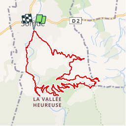

Length
13.9 km

Max alt
550 m

Uphill gradient
528 m
Km-Effort
21 km

Min alt
81 m

Downhill gradient
529 m
Boucle
Yes
Creation date :
2016-09-24 00:00:00.0
Updated on :
2016-09-24 00:00:00.0
2h57
Difficulty : Medium

FREE GPS app for hiking
 SityTrail
IGN / Geographical institutes
SityTrail Plus
The world is yours!
About
Trail Walking of 13.9 km to be discovered at Occitania, Pyrénées-Orientales, Sorède. This trail is proposed by jeff66.
Description
66 SOREDE - ND du château d'Ultréra - château d'Ultréra - PUIG de Nalt - MAS de Ca - LA RIVIERE de SOREDE - Le Tassio - rue du Veinat - le 24.09.2016
Positioning
Country:
France
Region :
Occitania
Department/Province :
Pyrénées-Orientales
Municipality :
Sorède
Location:
Unknown
Start:(Dec)
Start:(UTM)
496478 ; 4708457 (31T) N.
Comments
magnifique