Trail Walking Cogny - Cogny (69) 21,9 km D. 590 m  - Photo

Cogny (69) 21,9 km D. 590 m

© OpenStreetMap contributors
Length
Length
22 km
Max alt
Max alt
537 m
Uphill gradient
Uphill gradient
627 m
Km-Effort
Km-Effort  
30 km
Min alt
Min alt
259 m
Downhill gradient
Downhill gradient
625 m
Boucle
Boucle
Yes
Creation date :
2017-01-10 00:00:00.0
Updated on :
2017-01-10 00:00:00.0

(0 Reviews)

Walking
Walking
6h31
Difficulty : Medium

Scan this QR Code to open this trail in the SityTrail application

FREE GPS app for hiking

Logo SityTrail SityTrail

IGN / Geographical institutes

Download SityTrail from the App Store Download SityTrail from Google Play

Logo SityTrail SityTrail World

The world is yours!

Download SityTrail from the App Store Download SityTrail from Google Play Download SityTrail on Huawei AppGallery

About

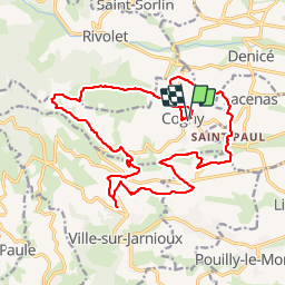
Trail Walking of 22 km to be discovered at Auvergne-Rhône-Alpes, Rhône, Cogny. This trail is proposed by Thomasdanielle.

Description

le 02/12/2016
Distance 21,9 km - Dénivelé 590 m
Départ et retour Salle des fêtes
Partir sur la droite en quittant le parking
Monter dans le champ sur la gauche, ensuite suivre les panneaux de direction :
- Le Manoir d'Epeisse - Régny - Collongé le haut - Chardonnet
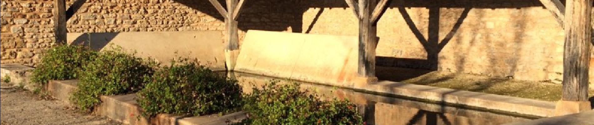
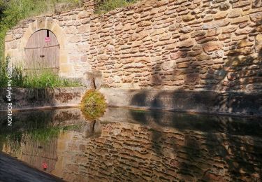
Après Chardonnet prendre le petit sentier qui descend sur la gauche, suivre le Vernet, on passe à côté du lavoir, Le Maillet, Le Montessuis - Le Bret - Le Soly - après le panneau le Soly dans le virage, ne pas continuer sur la route à droite direction du pont mais prendre le petit sentier à gauche, et longer la rivière (le Morgon) qui se trouve sur notre droite, nous la traversons un peu plus loin - le Ricotier
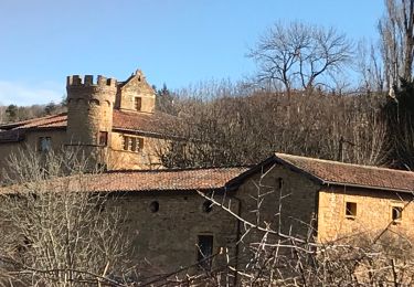
lorsqu'on arrive dans le quartier La Maladière, on arrive sur la route de Cogny, prendre à gauche et traverser la route du Saule d'Oing (D31) et prendre en face la route de la Maladière (D19), ensuite la 1ère à gauche chemin du petit corset et se diriger jusqu'au poteau Cosset, Alt. 400 m. - Cosset - suivre tous vents, la Croix du Pilon, - Le bois du jour - Lachanal - Le Corbet - Bois Franc (ce poteau à disparu il est scié !!!) - Le sou (on peut admirer le Château du Sou) - Pollui - Le cimetière - Chazier - La trêve Fontion - Régny - Le manoir d'Epaissie - Le bourg et direction parking salle des Fêtes.

Elevation profile

Photos

Positioning

Country:
France
Region :
Auvergne-Rhône-Alpes
Department/Province :
Rhône
Municipality :
Cogny
Location:
Unknown
Start:(UTM)
625993 ; 5093940 (31T) N.

Trails nearby

Trail Walking Val d'Oingt - Oingt (69) Beaujolais  - Photo
Walking
Thomasdanielle

Walking

Very easy
(1)
Val d'Oingt, Auvergne-Rhône-Alpes, Rhône, France
9.3 km | 13.3 km-effort
2h 30min
Yes
Trail Walking Montmelas-Saint-Sorlin - Col de Saint Bonnet (13-09-18)  - Photo
Walking
Thomasdanielle

Walking

Easy
(1)
Montmelas-Saint-Sorlin, Auvergne-Rhône-Alpes, Rhône, France
8.1 km | 11.9 km-effort
2h 29min
Yes
Trail Walking Sainte-Paule - Sainte-Paule (13,4 km D. 485 m) - Photo
Walking
Thomasdanielle

Walking

Medium
(1)
Sainte-Paule, Auvergne-Rhône-Alpes, Rhône, France
13.4 km | 19.4 km-effort
4h 9min
Yes
Trail Walking Rivolet - Rivolet - Photo
Walking
jpcoco

Walking

Medium
(2)
Rivolet, Auvergne-Rhône-Alpes, Rhône, France
11.1 km | 17.2 km-effort
3h 42min
No
Trail Walking Val d'Oingt - 69620-Saint-Laurent d'Oingt-Bois d'Oingt : lavoirs, château et coteaux - Photo
Walking
adye

Walking

Medium
Val d'Oingt, Auvergne-Rhône-Alpes, Rhône, France
8 km | 11 km-effort
1h 57min
Yes
Trail Walking Lacenas - Lacenas (11 km - D 310 m) RG - Photo
Walking
Thomasdanielle

Walking

Easy
Lacenas, Auvergne-Rhône-Alpes, Rhône, France
10.6 km | 14.7 km-effort
2h 38min
Yes
Trail Walking Val d'Oingt - Oingt en Beaujolais (13 km - D. 405 m) - Photo
Walking
Thomasdanielle

Walking

Medium
Val d'Oingt, Auvergne-Rhône-Alpes, Rhône, France
13.4 km | 18.8 km-effort
4h 58min
Yes
Trail Walking Val d'Oingt - Trail & Rando de
Walking
adye

Walking

Very difficult
Val d'Oingt, Auvergne-Rhône-Alpes, Rhône, France
22 km | 31 km-effort
5h 0min
Yes
Trail Walking Val d'Oingt - Trail & Randonnée de
Walking
adye

Walking

Difficult
Val d'Oingt, Auvergne-Rhône-Alpes, Rhône, France
10.8 km | 14.5 km-effort
2h 55min
Yes


Close
My subscriptions