Trail Mountain bike Argiésans - Salbert Chagey - Photo
 qlqin
qlqin

User

© OpenStreetMap contributors
Length
Length
25 km
Max alt
Max alt
603 m
Uphill gradient
Uphill gradient
464 m
Km-Effort
Km-Effort  
31 km
Min alt
Min alt
342 m
Downhill gradient
Downhill gradient
466 m
Boucle
Boucle
No
Creation date :
2016-12-22 00:00:00.0
Updated on :
2023-09-02 13:07:43.519

(0 Reviews)

Mountain bike
Mountain bike
2h08
Difficulty : Medium

Scan this QR Code to open this trail in the SityTrail application

FREE GPS app for hiking

Logo SityTrail SityTrail

IGN / Geographical institutes

Download SityTrail from the App Store Download SityTrail from Google Play

Logo SityTrail SityTrail World

The world is yours!

Download SityTrail from the App Store Download SityTrail from Google Play Download SityTrail on Huawei AppGallery

About

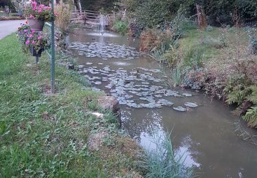
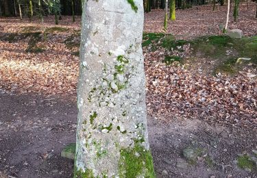
Trail Mountain bike of 25 km to be discovered at Bourgogne-Franche-Comté, Territoire-de-Belfort, Argiésans. This trail is proposed by qlqin.

Description

Tour sympa, bien sportif avec 2 ou 3 "coups de cul" à la limite du décrochage (sur sol sec !) et 2 efforts bien découplés : Le Salbert, puis le Bois de la Goutte en Chagey. A partir de Chagey retour en nocturne, sans frein => petite vitesse et route simplifiée.

Elevation profile

Positioning

Country:
France
Region :
Bourgogne-Franche-Comté
Department/Province :
Territoire-de-Belfort
Municipality :
Argiésans
Location:
Unknown
Start:(UTM)
336322 ; 5274567 (32T) N.

Trails nearby

Trail Walking Héricourt - La Pierre Plate - Héricourt - Photo
Walking
tracegps

Walking

Difficult
(3)
Héricourt, Bourgogne-Franche-Comté, Haute-Saône, France
12 km | 16.4 km-effort
3h 10min
Yes
Trail Mountain bike Andelnans - Tour d'Essert - Photo
Mountain bike
qlqin

Mountain bike

Easy
(2)
Andelnans, Bourgogne-Franche-Comté, Territoire-de-Belfort, France
29 km | 36 km-effort
2h 12min
Yes
Trail Walking Banvillars - Banvillars - forts du Hauts Bois et du Bois d'Oye - Photo
Walking
Bart2015

Walking

Very difficult
Banvillars, Bourgogne-Franche-Comté, Territoire-de-Belfort, France
16.3 km | 21 km-effort
4h 40min
Yes
Trail Walking Mandrevillars - Echenans et son fort - Photo
Walking
Bart2015

Walking

Very difficult
Mandrevillars, Bourgogne-Franche-Comté, Haute-Saône, France
14.8 km | 19.6 km-effort
4h 27min
Yes
Trail Walking Sevenans - Randonnée des forts depuis Sévenans - Photo
Walking
Bart2015

Walking

Very difficult
Sevenans, Bourgogne-Franche-Comté, Territoire-de-Belfort, France
19.9 km | 24 km-effort
5h 26min
Yes
Trail Walking Châlonvillars - Châlonvillars - Fort du Salbert - Evette-Salbert - Photo
Walking
Bart2015

Walking

Difficult
(1)
Châlonvillars, Bourgogne-Franche-Comté, Haute-Saône, France
11 km | 15.8 km-effort
3h 36min
Yes
Trail Mountain bike Châlonvillars - Châlonvillars - Fort Giromagny en passant au milieu des étangs - Photo
Mountain bike
Bart2015

Mountain bike

Very difficult
Châlonvillars, Bourgogne-Franche-Comté, Haute-Saône, France
40 km | 51 km-effort
3h 31min
Yes
Trail Mountain bike Châlonvillars - Châlonvillars - Menhir - Mandrevillars - Fort Essert et du Salbert - Photo
Mountain bike
Bart2015

Mountain bike

Very difficult
Châlonvillars, Bourgogne-Franche-Comté, Haute-Saône, France
31 km | 42 km-effort
2h 53min
Yes
Trail Walking Châlonvillars - Châlonvillars - le mehnir - Mandrevillars - Photo
Walking
Bart2015

Walking

Medium
Châlonvillars, Bourgogne-Franche-Comté, Haute-Saône, France
13.4 km | 17.1 km-effort
2h 39min
Yes


Close
My subscriptions