Trail Walking Sainte-Souline - Sainte Souline - Photo
 dorcier
dorcier

User

© OpenStreetMap contributors
Length
Length
10.1 km
Max alt
Max alt
186 m
Uphill gradient
Uphill gradient
215 m
Km-Effort
Km-Effort  
13 km
Min alt
Min alt
101 m
Downhill gradient
Downhill gradient
217 m
Boucle
Boucle
Yes
Creation date :
2017-03-28 00:00:00.0
Updated on :
2017-03-28 00:00:00.0

(0 Reviews)

Walking
Walking
2h31
Difficulty : Easy

Scan this QR Code to open this trail in the SityTrail application

FREE GPS app for hiking

Logo SityTrail SityTrail

IGN / Geographical institutes

Download SityTrail from the App Store Download SityTrail from Google Play

Logo SityTrail SityTrail World

The world is yours!

Download SityTrail from the App Store Download SityTrail from Google Play Download SityTrail on Huawei AppGallery

About

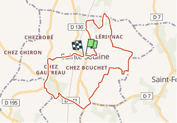
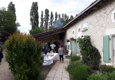
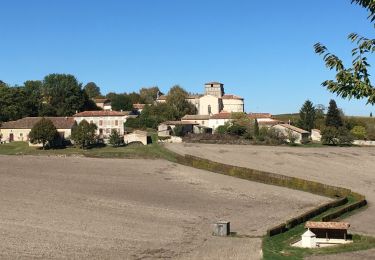
Trail Walking of 10.1 km to be discovered at New Aquitaine, Charente, Sainte-Souline. This trail is proposed by dorcier.

Description

départ du parking de l'école
Circuit agréable. Beau point de vue sur les vallons du Sud Charente et la nouvelle LGV.

Elevation profile

Photos

Positioning

Country:
France
Region :
New Aquitaine
Department/Province :
Charente
Municipality :
Sainte-Souline
Location:
Unknown
Start:(UTM)
733373 ; 5029461 (30T) N.

Trails nearby

Trail Walking Châtignac - La randonnée des fours à pain de Chalignac - Photo
Walking
alainjoseph6

Walking

Very easy
(1)
Châtignac, New Aquitaine, Charente, France
9.8 km | 12.5 km-effort
2h 40min
Yes
Trail Walking Châtignac - chatignac 18 juin 2019 - Photo
Walking
bert16

Walking

Medium
Châtignac, New Aquitaine, Charente, France
7.6 km | 10.2 km-effort
2h 2min
Yes
Trail Walking Châtignac - chatignac ronde fours à pain - Photo
Walking
bert16

Walking

Very easy
Châtignac, New Aquitaine, Charente, France
10.4 km | 12.7 km-effort
2h 53min
Yes
Trail Walking Berneuil - berneuil 16 - Photo
Walking
dorcier

Walking

Medium
Berneuil, New Aquitaine, Charente, France
8.2 km | 10.5 km-effort
2h 16min
Yes
Trail Walking Châtignac - Chatignac 05/05/2022 - Photo
Walking
dorcier

Walking

Medium
Châtignac, New Aquitaine, Charente, France
8 km | 10.3 km-effort
2h 35min
Yes
Trail Walking Saint-Laurent-des-Combes - St Laurent des combes - Photo
Walking
dorcier

Walking

Medium
Saint-Laurent-des-Combes, New Aquitaine, Charente, France
9.1 km | 11.3 km-effort
2h 30min
Yes
Trail On foot Deviat - Deviat Etang Jeannot - Photo
On foot
dorcier

On foot

Very easy
Deviat, New Aquitaine, Charente, France
5.7 km | 6.9 km-effort
Unknown
Yes
Trail On foot Deviat - Deviat Etang Jeannot - Photo
On foot
dorcier

On foot

Very easy
Deviat, New Aquitaine, Charente, France
5.6 km | 6.9 km-effort
1h 30min
Yes
Trail Walking Saint-Laurent-des-Combes - st Laurent des combes 17 avril 2018 - Photo
Walking
bert16

Walking

Easy
Saint-Laurent-des-Combes, New Aquitaine, Charente, France
8.7 km | 11.1 km-effort
2h 23min
Yes


Close
My subscriptions