


2017 04 Hohneck Munster Hard

staubalex
User
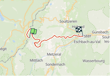

Length
20 km

Max alt
1351 m

Uphill gradient
487 m
Km-Effort
30 km

Min alt
378 m

Downhill gradient
1456 m
Boucle
No
Creation date :
2017-04-01 00:00:00.0
Updated on :
2017-04-01 00:00:00.0
1h46
Difficulty : Difficult

FREE GPS app for hiking
 SityTrail
IGN / Geographical institutes
SityTrail Plus
The world is yours!
About
Trail Other activity of 20 km to be discovered at Grand Est, Haut-Rhin, Stosswihr. This trail is proposed by staubalex.
Positioning
Country:
France
Region :
Grand Est
Department/Province :
Haut-Rhin
Municipality :
Stosswihr
Location:
Unknown
Start:(Dec)
Start:(UTM)
352143 ; 5322375 (32U) N.
Comments