Trail Walking La Chapelle-sur-Aveyron - Pr des hauts de la Chapelle - Photo
© OpenStreetMap contributors
Length
Length
14.7 km
Max alt
Max alt
164 m
Uphill gradient
Uphill gradient
147 m
Km-Effort
Km-Effort  
16.7 km
Min alt
Min alt
118 m
Downhill gradient
Downhill gradient
147 m
Boucle
Boucle
Yes
Creation date :
2019-05-03 09:14:49.562
Updated on :
2019-05-03 09:14:49.627

(0 Reviews)

Walking
Walking
3h40
Difficulty : Easy

Scan this QR Code to open this trail in the SityTrail application

FREE GPS app for hiking

Logo SityTrail SityTrail

IGN / Geographical institutes

Download SityTrail from the App Store Download SityTrail from Google Play

Logo SityTrail SityTrail World

The world is yours!

Download SityTrail from the App Store Download SityTrail from Google Play Download SityTrail on Huawei AppGallery

About

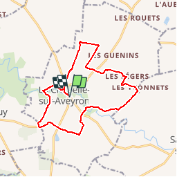
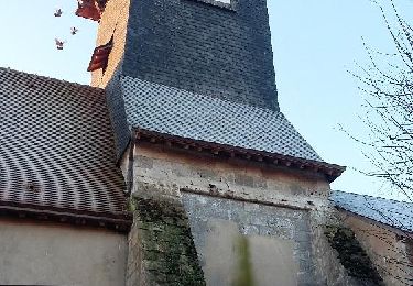
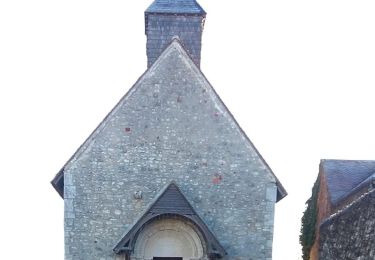
Trail Walking of 14.7 km to be discovered at Centre-Loire Valley, Loiret, La Chapelle-sur-Aveyron. This trail is proposed by Ordijamo45.

Description

Départ place de la l'église de la Chapelle-sur-Aveyron (45)

Elevation profile

Positioning

Country:
France
Region :
Centre-Loire Valley
Department/Province :
Loiret
Municipality :
La Chapelle-sur-Aveyron
Location:
Unknown
Start:(UTM)
489731 ; 5301482 (31T) N.

Trails nearby

Trail Walking Montbouy - Montbouy 45 rando  - Photo
Walking
picouleau220345

Walking

Difficult
Montbouy, Centre-Loire Valley, Loiret, France
14.8 km | 16.3 km-effort
2h 54min
Yes
Trail Walking Montcresson - L'orme au Muet - Photo
Walking
Ordijamo45

Walking

Easy
Montcresson, Centre-Loire Valley, Loiret, France
11.2 km | 12.3 km-effort
1h 52min
Yes
Trail Walking Montcresson - montcresson 45 - Photo
Walking
picouleau220345

Walking

Difficult
Montcresson, Centre-Loire Valley, Loiret, France
11.9 km | 13.5 km-effort
3h 2min
No
Trail Walking Châtillon-Coligny - Chatillon-Coligny 45 P.G - Photo
Walking
picouleau220345

Walking

Medium
Châtillon-Coligny, Centre-Loire Valley, Loiret, France
11.5 km | 12.7 km-effort
3h 4min
Yes
Trail Walking Montbouy - Montbouy 45 G - Photo
Walking
picouleau220345

Walking

Difficult
Montbouy, Centre-Loire Valley, Loiret, France
13.3 km | 14.8 km-effort
3h 3min
Yes
Trail Walking Saint-Maurice-sur-Aveyron - Pr de Bellefontaine - Photo
Walking
Ordijamo45

Walking

Easy
Saint-Maurice-sur-Aveyron, Centre-Loire Valley, Loiret, France
9.9 km | 11.2 km-effort
2h 28min
Yes
Trail Walking Montcresson - Pr de la vallée du Loing - Photo
Walking
Ordijamo45

Walking

Easy
Montcresson, Centre-Loire Valley, Loiret, France
13.2 km | 14.3 km-effort
3h 10min
Yes
Trail Walking Saint-Maurice-sur-Aveyron - Saint Maurice sur Aveyron - Photo
Walking
PatRando

Walking

Medium
Saint-Maurice-sur-Aveyron, Centre-Loire Valley, Loiret, France
12.7 km | 14.8 km-effort
3h 16min
Yes
Trail Walking Châtillon-Coligny - Rando réalisée le 03-07-2022 - Photo
Walking
Ordijamo45

Walking

Very easy
Châtillon-Coligny, Centre-Loire Valley, Loiret, France
18.7 km | 21 km-effort
3h 40min
Yes


Close
My subscriptions