Trail Walking Saintes - saintes (essais 01) - Photo
© OpenStreetMap contributors
Length
Length
9 km
Max alt
Max alt
53 m
Uphill gradient
Uphill gradient
111 m
Km-Effort
Km-Effort  
10.4 km
Min alt
Min alt
5 m
Downhill gradient
Downhill gradient
111 m
Boucle
Boucle
Yes
Creation date :
2017-07-02 00:00:00.0
Updated on :
2017-07-02 00:00:00.0

(1 Reviews)

Walking
Walking
2h01
Difficulty : Very easy

Scan this QR Code to open this trail in the SityTrail application

FREE GPS app for hiking

Logo SityTrail SityTrail

IGN / Geographical institutes

Download SityTrail from the App Store Download SityTrail from Google Play

Logo SityTrail SityTrail World

The world is yours!

Download SityTrail from the App Store Download SityTrail from Google Play Download SityTrail on Huawei AppGallery

About

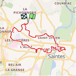
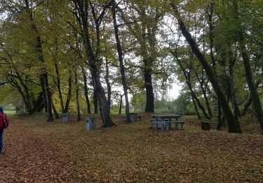
Trail Walking of 9 km to be discovered at New Aquitaine, Charente-Maritime, Saintes. This trail is proposed by Marcel-le-cycliste.

Elevation profile

Positioning

Country:
France
Region :
New Aquitaine
Department/Province :
Charente-Maritime
Municipality :
Saintes
Location:
Unknown
Start:(UTM)
683044 ; 5069585 (30T) N.

Comments

Please log in to post a review or rate the element


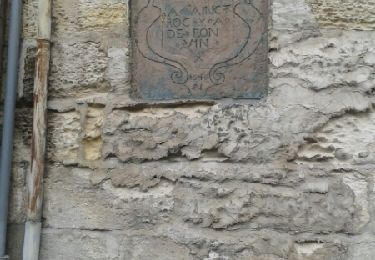
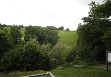
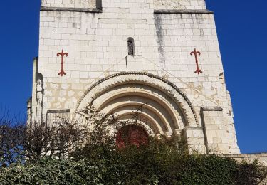
Circuit bien sympa qui fait découvrir la ville. Merci pour cette publication.


Trails nearby

Trail Walking Saintes - Voiville - Pessines 01 022023 - Photo
Walking
Claudinette17

Walking

Medium
(1)
Saintes, New Aquitaine, Charente-Maritime, France
7.8 km | 8.8 km-effort
2h 22min
Yes
Trail Walking Chaniers - port huble - Photo
Walking
ninie51

Walking

Medium
Chaniers, New Aquitaine, Charente-Maritime, France
5.6 km | 6.5 km-effort
1h 39min
Yes
Trail Other activity Bussac-sur-Charente - Bussac sur Charente - Photo
Other activity
Lessire

Other activity

Very easy
(1)
Bussac-sur-Charente, New Aquitaine, Charente-Maritime, France
11.7 km | 13.6 km-effort
3h 0min
Yes
Trail Walking Saintes - JFT YB Etape11 8-5 -2014  - Photo
Walking
jeff2

Walking

Medium
Saintes, New Aquitaine, Charente-Maritime, France
30 km | 33 km-effort
6h 10min
No
Trail Mountain bike Le Douhet - Circuit des Arches de Fontcouverte - Photo
Mountain bike
tracegps

Mountain bike

Difficult
Le Douhet, New Aquitaine, Charente-Maritime, France
16.5 km | 19.8 km-effort
1h 15min
Yes
Trail Walking Fontcouverte - fontcouverte et Aqueduc terrain de golfe - Photo
Walking
niniroro51

Walking

Medium
Fontcouverte, New Aquitaine, Charente-Maritime, France
5.1 km | 6.5 km-effort
1h 49min
Yes
Trail Walking Bussac-sur-Charente - Bussac su Charente  - Photo
Walking
mimosa55

Walking

Medium
Bussac-sur-Charente, New Aquitaine, Charente-Maritime, France
10.4 km | 12 km-effort
2h 37min
Yes
Trail Walking Écurat - ecurat - Photo
Walking
niniroro51

Walking

Easy
Écurat, New Aquitaine, Charente-Maritime, France
6.6 km | 7.4 km-effort
2h 12min
Yes
Trail Mountain bike Fontcouverte - Circuit des Arches de Fontcouverte - Photo
Mountain bike
tracegps

Mountain bike

Very difficult
Fontcouverte, New Aquitaine, Charente-Maritime, France
15.5 km | 18.4 km-effort
1h 15min
Yes


Close
My subscriptions