Trail Walking Courchevel - lac des creux au départ de l'altiport  - Photo

lac des creux au départ de l'altiport

 Klhn
Klhn

User

© OpenStreetMap contributors
Length
Length
6.8 km
Max alt
Max alt
2299 m
Uphill gradient
Uphill gradient
323 m
Km-Effort
Km-Effort  
11.1 km
Min alt
Min alt
1987 m
Downhill gradient
Downhill gradient
326 m
Boucle
Boucle
Yes
Creation date :
2017-07-20 00:00:00.0
Updated on :
2017-07-20 00:00:00.0

(1 Reviews)

Walking
Walking
2h40
Difficulty : Easy

Scan this QR Code to open this trail in the SityTrail application

FREE GPS app for hiking

Logo SityTrail SityTrail

IGN / Geographical institutes

Download SityTrail from the App Store Download SityTrail from Google Play

Logo SityTrail SityTrail World

The world is yours!

Download SityTrail from the App Store Download SityTrail from Google Play Download SityTrail on Huawei AppGallery

About

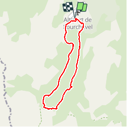
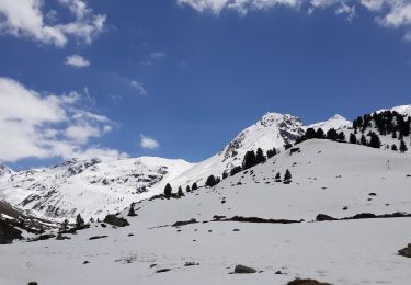
Trail Walking of 6.8 km to be discovered at Auvergne-Rhône-Alpes, Savoy, Courchevel. This trail is proposed by Klhn.

Description

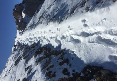
Piste mal délimitée sur la fin

Elevation profile

Photos

Positioning

Country:
France
Region :
Auvergne-Rhône-Alpes
Department/Province :
Savoy
Municipality :
Courchevel
Location:
Saint-Bon-Tarentaise
Start:(UTM)
314838 ; 5029630 (32T) N.

Comments

Please log in to post a review or rate the element


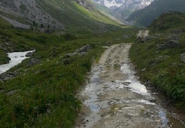
Magnifique parcours avec de temps en temps des petits visiteurs


Trails nearby

Trail Walking Courchevel - Petit Mont Blanc par Courchevel - Photo
Walking
Brusa

Walking

Easy
(1)
Courchevel, Auvergne-Rhône-Alpes, Savoy, France
19.8 km | 34 km-effort
6h 59min
Yes
Trail Other activity Les Allues - meribel ski 2 - Photo
Other activity
Cricounet84

Other activity

Medium
(1)
Les Allues, Auvergne-Rhône-Alpes, Savoy, France
67 km | 163 km-effort
5h 12min
Yes
Trail Walking Courchevel - Brêche de la Portetta - Photo
Walking
tracegps

Walking

Very difficult
(1)
Courchevel, Auvergne-Rhône-Alpes, Savoy, France
12.7 km | 27 km-effort
5h 0min
Yes
Trail Walking Les Allues - Col du Souffre et Lacs Mont-Coua - Photo
Walking
tracegps

Walking

Difficult
(1)
Les Allues, Auvergne-Rhône-Alpes, Savoy, France
25 km | 41 km-effort
7h 0min
Yes
Trail Walking Courchevel - Courchevel-Moriond,  Lac de  la Rosière, col de la Chal, crête du Mont Charvet, col de Grosse Pierre, Cascades des Poux - Photo
Walking
ranchoup

Walking

Difficult
Courchevel, Auvergne-Rhône-Alpes, Savoy, France
12.8 km | 25 km-effort
5h 36min
Yes
Trail Walking Courchevel - lacs Merlet depuis vallon des Avals - Photo
Walking
bymarc26

Walking

Medium
Courchevel, Auvergne-Rhône-Alpes, Savoy, France
18.4 km | 31 km-effort
5h 5min
Yes
Trail Walking Les Allues - Lac Tueda et Vallon du Fruit depuis Méribel - Photo
Walking
jpduc

Walking

Easy
Les Allues, Auvergne-Rhône-Alpes, Savoy, France
7 km | 11.2 km-effort
2h 44min
Yes
Trail Walking Courchevel - Le petit Mont-Blanc depuis Courchevel Moriond - Photo
Walking
redfire73

Walking

Medium
Courchevel, Auvergne-Rhône-Alpes, Savoy, France
20 km | 34 km-effort
7h 6min
Yes
Trail Walking Les Allues - Refuge du Saut - Photo
Walking
Hubert78

Walking

Medium
Les Allues, Auvergne-Rhône-Alpes, Savoy, France
16.1 km | 23 km-effort
4h 59min
No


Close
My subscriptions