Trail Mountain bike Habère-Poche - rando VTT Habere Poche 2017 - Photo
© OpenStreetMap contributors
Length
Length
71 km
Max alt
Max alt
1572 m
Uphill gradient
Uphill gradient
2543 m
Km-Effort
Km-Effort  
105 km
Min alt
Min alt
663 m
Downhill gradient
Downhill gradient
2549 m
Boucle
Boucle
Yes
Creation date :
2017-08-30 00:00:00.0
Updated on :
2020-01-09 20:28:49.355

(0 Reviews)

Mountain bike
Mountain bike
6h20
Difficulty : Very difficult

Scan this QR Code to open this trail in the SityTrail application

FREE GPS app for hiking

Logo SityTrail SityTrail

IGN / Geographical institutes

Download SityTrail from the App Store Download SityTrail from Google Play

Logo SityTrail SityTrail World

The world is yours!

Download SityTrail from the App Store Download SityTrail from Google Play Download SityTrail on Huawei AppGallery

About

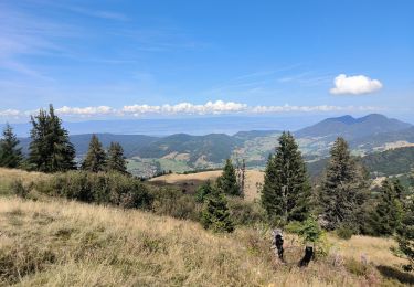
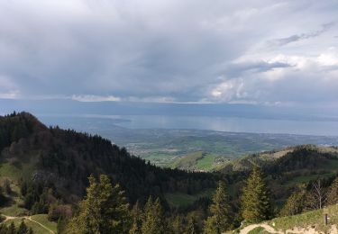
Trail Mountain bike of 71 km to be discovered at Auvergne-Rhône-Alpes, Upper Savoy, Habère-Poche. This trail is proposed by leclaude74.

Description

Superbe rando vtt a Habere Poche .
avec  au col de l'Encrenaz un portage de velo sur 100 m une vingtaine de minute mais cela en vaut la peine !!!
Sinon avant le col pour ne pas faire le portage prendre à droite car ce sera le même chemin du retour après la boucle du Forchat !
ce parcours permet beaucoup de zone de replis jusqu au col de creux , sinon après on change de vallee !.

Elevation profile

Photos

Points of interest

Point of interest Lullin - MONT FORCHAT - Photo
leclaude74
LULLIN 
Point of interest Lullin - COL ENCRENAZ - Photo
leclaude74
LULLIN 

Positioning

Country:
France
Region :
Auvergne-Rhône-Alpes
Department/Province :
Upper Savoy
Municipality :
Habère-Poche
Location:
Unknown
Start:(UTM)
305168 ; 5124811 (32T) N.

Trails nearby

Trail Walking Habère-Poche - Mont Forchat - Habère Poche - Ramble - Photo
Walking
tracegps

Walking

Medium
(2)
Habère-Poche, Auvergne-Rhône-Alpes, Upper Savoy, France
10.7 km | 18.6 km-effort
4h 0min
Yes
Trail Walking Onnion - Tour de la vallée de Miribel - Photo
Walking
michel.blin

Walking

Easy
(1)
Onnion, Auvergne-Rhône-Alpes, Upper Savoy, France
9.2 km | 14.6 km-effort
3h 51min
Yes
Trail Walking Habère-Poche - Le mont forchat  - Photo
Walking
colomb24

Walking

Very difficult
Habère-Poche, Auvergne-Rhône-Alpes, Upper Savoy, France
12.4 km | 19.9 km-effort
6h 49min
Yes
Trail Running Bellevaux - Allobroges2016_BZH74 - Photo
Running
BZH74

Running

Very difficult
(1)
Bellevaux, Auvergne-Rhône-Alpes, Upper Savoy, France
59 km | 119 km-effort
12h 0min
Yes
Trail Walking Habère-Lullin - Crêts des Brottets et d'Hirmentaz - Photo
Walking
tonymeyer

Walking

Easy
Habère-Lullin, Auvergne-Rhône-Alpes, Upper Savoy, France
10.1 km | 16.2 km-effort
3h 35min
Yes
Trail Running Bellevaux - Allobroges 63 - Photo
Running
BZH74

Running

Difficult
(1)
Bellevaux, Auvergne-Rhône-Alpes, Upper Savoy, France
63 km | 127 km-effort
14h 0min
Yes
Trail Walking Onnion - la pointe de meribel - Photo
Walking
bopapa

Walking

Easy
Onnion, Auvergne-Rhône-Alpes, Upper Savoy, France
3.4 km | 5.8 km-effort
1h 23min
No
Trail Walking Lullin - Le Mont Forchat au départ du col des Arses - Photo
Walking
reneperrin

Walking

Medium
Lullin, Auvergne-Rhône-Alpes, Upper Savoy, France
4.2 km | 8.9 km-effort
1h 20min
Yes
Trail Walking Habère-Poche - Rando VV - Photo
Walking
thierry.berthouze

Walking

Medium
Habère-Poche, Auvergne-Rhône-Alpes, Upper Savoy, France
13.4 km | 19.1 km-effort
3h 39min
No


Close
My subscriptions