Trail Walking Stosswihr -  68 Sentier des roches - Photo

68 Sentier des roches

 LUTZMarc
LUTZMarc

User

© OpenStreetMap contributors
Length
Length
17.3 km
Max alt
Max alt
1294 m
Uphill gradient
Uphill gradient
771 m
Km-Effort
Km-Effort  
28 km
Min alt
Min alt
923 m
Downhill gradient
Downhill gradient
771 m
Boucle
Boucle
Yes
Creation date :
2017-09-07 00:00:00.0
Updated on :
2017-09-07 00:00:00.0

(0 Reviews)

Walking
Walking
5h45
Difficulty : Difficult

Scan this QR Code to open this trail in the SityTrail application

FREE GPS app for hiking

Logo SityTrail SityTrail

IGN / Geographical institutes

Download SityTrail from the App Store Download SityTrail from Google Play

Logo SityTrail SityTrail Plus

The world is yours!

Download SityTrail from the App Store Download SityTrail from Google Play Download SityTrail on Huawei AppGallery

About

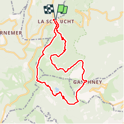
Trail Walking of 17.3 km to be discovered at Grand Est, Haut-Rhin, Stosswihr. This trail is proposed by LUTZMarc.

Description

Début de rando au col de la Schlucht. Sentier le long de parois rocheuses type alpestre .
Passage dangereux sécurisés.
A mi parcours
Possibilité de repas à la  Ferme Auberge du Gaschney.
33 3 89 77 63 73.

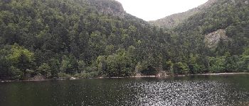
Montée sévère à partir du lac Du Schiessrothried jusqu'au sentier de la crête.
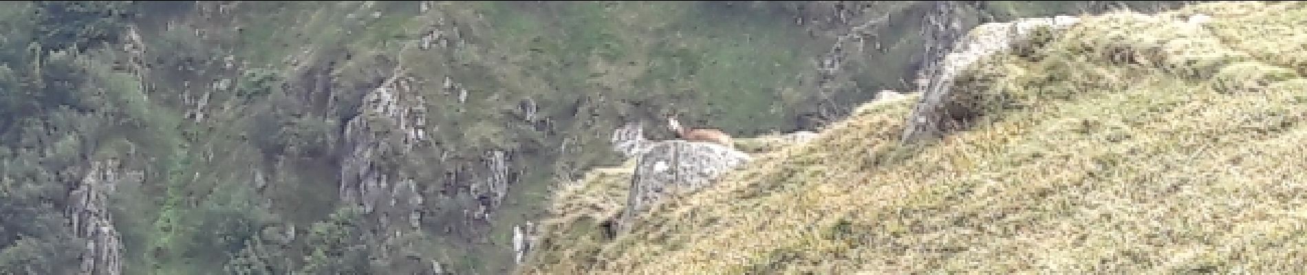
Nombreux chamois à observer dans la partie dégagée vers le sommet.


Elevation profile

Photos

Points of interest

Point of interest Metzeral - Point 1 - Photo
LUTZMarc
METZERAL 

Positioning

Country:
France
Region :
Grand Est
Department/Province :
Haut-Rhin
Municipality :
Stosswihr
Location:
Unknown
Start:(UTM)
352782 ; 5325267 (32U) N.


Close
My subscriptions