


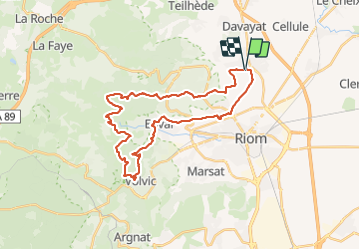

9.1 km | 13.2 km-effort


User


FREE GPS app for hiking
 SityTrail
IGN / Geographical institutes
SityTrail World
The world is yours!
Trail Equestrian of 32 km to be discovered at Auvergne-Rhône-Alpes, Puy-de-Dôme, Saint-Bonnet-près-Riom. This trail is proposed by Maestria.
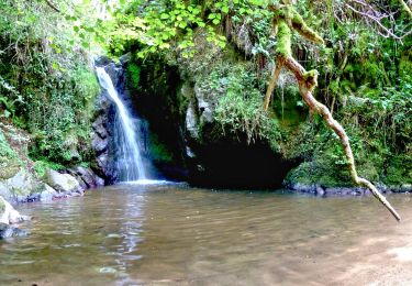
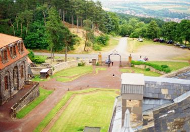
La montée à Notre Dame de la Garde est raide et vaut vraiment le coup ! L'arrivée sur Tournoël est magnifique. Possibilité de boire un verre en terrasse !
Walking

Walking

Walking

Walking

Walking

Walking

Walking
On foot
On foot