


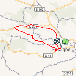

10.7 km | 13.5 km-effort


User


FREE GPS app for hiking
 SityTrail
IGN / Geographical institutes
SityTrail World
The world is yours!
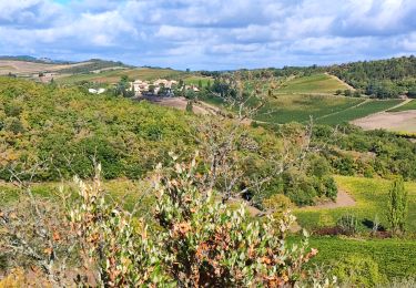
Trail Walking of 5.9 km to be discovered at Occitania, Aude, Pauligne. This trail is proposed by christinetondeur.
En partant de notre maison d'hôtes, une petite promenade à travers les vignes 5,9km sur 1h30 a son aise.
Walking
Mountain bike
Walking

Walking

Cycle
Cycle

Walking