Trail Walking Névache - 02 Ref Vallée Etroite-Plampinet - Photo

02 Ref Vallée Etroite-Plampinet

© OpenStreetMap contributors
Length
Length
16.3 km
Max alt
Max alt
2271 m
Uphill gradient
Uphill gradient
860 m
Km-Effort
Km-Effort  
29 km
Min alt
Min alt
1482 m
Downhill gradient
Downhill gradient
1149 m
Boucle
Boucle
No
Creation date :
2018-04-17 15:57:23.036
Updated on :
2018-04-17 15:57:23.036

(0 Reviews)

Walking
Walking
5h51
Difficulty : Unknown

Scan this QR Code to open this trail in the SityTrail application

FREE GPS app for hiking

Logo SityTrail SityTrail

IGN / Geographical institutes

Download SityTrail from the App Store Download SityTrail from Google Play

Logo SityTrail SityTrail World

The world is yours!

Download SityTrail from the App Store Download SityTrail from Google Play Download SityTrail on Huawei AppGallery

About

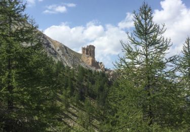
Trail Walking of 16.3 km to be discovered at Provence-Alpes-Côte d'Azur, Hautes-Alpes, Névache. This trail is proposed by edouard_bieber.

Description

2ème étape, par Tour des Rois Mages et Gr5b, GR5-GTA

Elevation profile

Positioning

Country:
France
Region :
Provence-Alpes-Côte d'Azur
Department/Province :
Hautes-Alpes
Municipality :
Névache
Location:
Unknown
Start:(UTM)
312870 ; 4993475 (32T) N.

Trails nearby

Trail Walking Névache - Lac Vert.Vallée Etroite.(27-09-17) - Photo
Walking
Dervalmarc

Walking

Very easy
(1)
Névache, Provence-Alpes-Côte d'Azur, Hautes-Alpes, France
4.2 km | 5.9 km-effort
1h 19min
Yes
Trail Walking Névache - les granges de la vallée étroite au refuge du Mont Thabor - Photo
Walking
reneperrin

Walking

Easy
(1)
Névache, Provence-Alpes-Côte d'Azur, Hautes-Alpes, France
8.6 km | 16.2 km-effort
3h 44min
No
Trail Mountain bike Névache - Tour des Rois Mages en VTT - Névache - Photo
Mountain bike
tracegps

Mountain bike

Difficult
(2)
Névache, Provence-Alpes-Côte d'Azur, Hautes-Alpes, France
35 km | 55 km-effort
5h 0min
Yes
Trail Walking Névache - le Mont Thabor - Photo
Walking
GUIDE
amiral13

Walking

Difficult
Névache, Provence-Alpes-Côte d'Azur, Hautes-Alpes, France
19.9 km | 40 km-effort
8h 44min
Yes
Trail Walking Névache - Vallée  étroite    refuge du Thabor - Photo
Walking
Sorriaux

Walking

Difficult
Névache, Provence-Alpes-Côte d'Azur, Hautes-Alpes, France
10.2 km | 18.4 km-effort
3h 6min
No
Trail Walking Névache - J4 2023 - Le Thabor épisode 2 - Photo
Walking
ETMU5496

Walking

Very difficult
Névache, Provence-Alpes-Côte d'Azur, Hautes-Alpes, France
24 km | 44 km-effort
7h 13min
Yes
Trail Walking Névache - Mont Thabor à partir des Granges  - Photo
Walking
Hugues Michel

Walking

Very difficult
Névache, Provence-Alpes-Côte d'Azur, Hautes-Alpes, France
18.1 km | 37 km-effort
6h 39min
No
Trail Touring skiing Névache - mont thabor - Photo
Touring skiing
FREERIDE13006

Touring skiing

Difficult
Névache, Provence-Alpes-Côte d'Azur, Hautes-Alpes, France
799 km | 2069 km-effort
6h 18min
No
Trail Walking Névache - les ascles 05 - Photo
Walking
silvestreclaudine

Walking

Easy
Névache, Provence-Alpes-Côte d'Azur, Hautes-Alpes, France
12.8 km | 23 km-effort
6h 1min
No


Close
My subscriptions