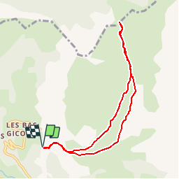
Trail Walking Le Dévoluy - R22   Le Col de Laup - Photo

Les Hautes Alpes à découvrir ! GUIDE+

© OpenStreetMap contributors
Length
Length
8 km
Max alt
Max alt
1684 m
Uphill gradient
Uphill gradient
473 m
Km-Effort
Km-Effort  
14.3 km
Min alt
Min alt
1310 m
Downhill gradient
Downhill gradient
473 m
Boucle
Boucle
Yes
Creation date :
2018-03-23 05:41:11.362
Updated on :
2019-05-14 04:56:55.912

(0 Reviews)

Walking
Walking
2h56
Difficulty : Very easy

Scan this QR Code to open this trail in the SityTrail application

FREE GPS app for hiking

Logo SityTrail SityTrail

IGN / Geographical institutes

Download SityTrail from the App Store Download SityTrail from Google Play

Logo SityTrail SityTrail World

The world is yours!

Download SityTrail from the App Store Download SityTrail from Google Play Download SityTrail on Huawei AppGallery

About

Trail Walking of 8 km to be discovered at Provence-Alpes-Côte d'Azur, Hautes-Alpes, Le Dévoluy. This trail is proposed by Camping Les Rives du Lac.

Description

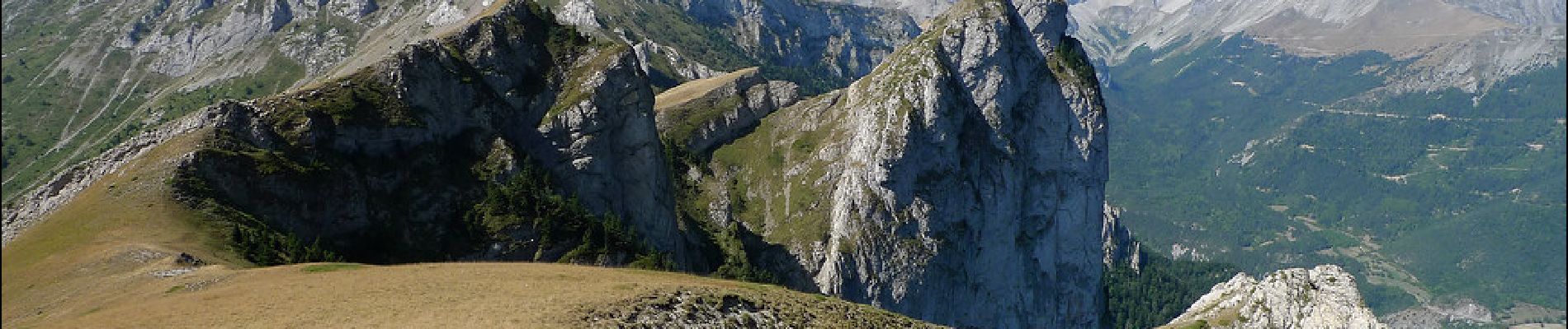
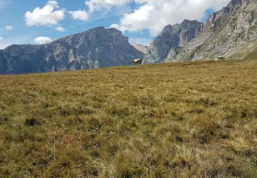
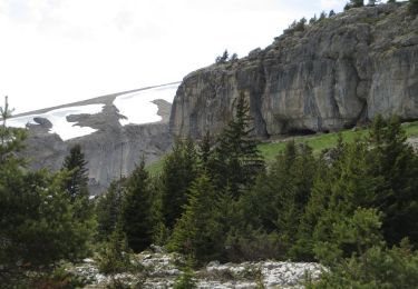
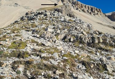
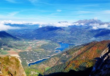
Easy hiking, very wild (incomparable flora), which offers a magnificent panorama of the Dévoluy massif. The view from the pass is also remarkable. Possibility of continuing this hike up to 1887 (200m more altitude difference, starting on the left (towards the west) at the pass) for an even clearer view. Take the opportunity to stop at Mother Church, famous chapel of the eleventh century.

Elevation profile

Photos

Positioning

Country:
France
Region :
Provence-Alpes-Côte d'Azur
Department/Province :
Hautes-Alpes
Municipality :
Le Dévoluy
Location:
Saint-Disdier
Start:(Dec)
Start:(UTM)
730337 ; 4957753 (31T) N.

Trails nearby

Trail Walking Le Dévoluy - R29   La crete des Beaumes - Photo
Walking
GUIDE+

Walking

Medium
(2)
Le Dévoluy, Provence-Alpes-Côte d'Azur, Hautes-Alpes, France
9 km | 16 km-effort
3h 17min
Yes
Trail Walking Pellafol - R44 Le Bénitier - Photo
Walking
GUIDE+

Walking

Medium
(1)
Pellafol, Auvergne-Rhône-Alpes, Isère, France
14 km | 25 km-effort
3h 0min
Yes
Trail Walking Pellafol - R43   Les Gillardes - Photo
Walking
GUIDE+

Walking

Very easy
(2)
Pellafol, Auvergne-Rhône-Alpes, Isère, France
6.1 km | 8.5 km-effort
1h 48min
Yes
Trail Walking Le Dévoluy - R30   Le Puits des Bans - Photo
Walking
GUIDE+

Walking

Easy
(2)
Le Dévoluy, Provence-Alpes-Côte d'Azur, Hautes-Alpes, France
5.2 km | 6.4 km-effort
3h 8min
Yes
Trail Walking Le Dévoluy - R25   Pierre Baudinard - Photo
Walking
GUIDE+

Walking

Medium
(1)
Le Dévoluy, Provence-Alpes-Côte d'Azur, Hautes-Alpes, France
8.6 km | 16.6 km-effort
3h 18min
Yes
Trail Walking Le Dévoluy - R19   Decouverte de Mere Eglise - Photo
Walking
GUIDE+

Walking

Very easy
Le Dévoluy, Provence-Alpes-Côte d'Azur, Hautes-Alpes, France
4.1 km | 7.1 km-effort
1h 30min
Yes
Trail Walking Le Dévoluy - le grand Ferrand  Devoluy - Photo
Walking
tchoua

Walking

Very difficult
Le Dévoluy, Provence-Alpes-Côte d'Azur, Hautes-Alpes, France
16.5 km | 35 km-effort
4h 50min
Yes
Trail Walking Le Dévoluy - Pic Perrioux - Photo
Walking
PapouBertrand

Walking

Very difficult
Le Dévoluy, Provence-Alpes-Côte d'Azur, Hautes-Alpes, France
11.1 km | 25 km-effort
6h 39min
Yes
Trail Touring skiing Le Dévoluy - L'Aiglière et serre de cheval - Photo
Touring skiing
nadd73

Touring skiing

Medium
Le Dévoluy, Provence-Alpes-Côte d'Azur, Hautes-Alpes, France
10.9 km | 26 km-effort
6h 10min
Yes


Close
My subscriptions