Trail Walking Meyrueis - la croix de fer  - Photo

la croix de fer

© OpenStreetMap contributors
Length
Length
18.8 km
Max alt
Max alt
1259 m
Uphill gradient
Uphill gradient
574 m
Km-Effort
Km-Effort  
26 km
Min alt
Min alt
908 m
Downhill gradient
Downhill gradient
568 m
Boucle
Boucle
Yes
Creation date :
2018-04-17 22:10:01.413
Updated on :
2018-04-17 22:10:01.413

(0 Reviews)

Walking
Walking
3h49
Difficulty : Medium

Scan this QR Code to open this trail in the SityTrail application

FREE GPS app for hiking

Logo SityTrail SityTrail

IGN / Geographical institutes

Download SityTrail from the App Store Download SityTrail from Google Play

Logo SityTrail SityTrail World

The world is yours!

Download SityTrail from the App Store Download SityTrail from Google Play Download SityTrail on Huawei AppGallery

About

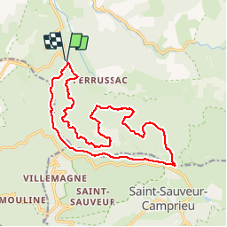
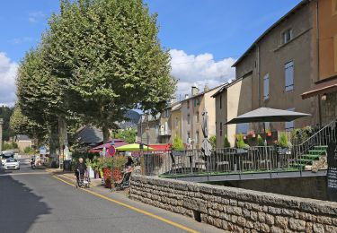
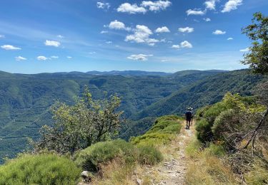
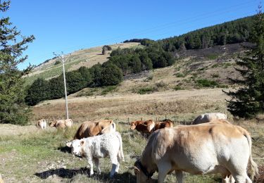
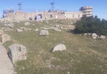
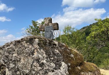
Trail Walking of 18.8 km to be discovered at Occitania, Lozère, Meyrueis. This trail is proposed by Erickcausse.

Description

boucle au départ du Tournayas jusqu'au col de La Croix de Fer

Elevation profile

Photos

Positioning

Country:
France
Region :
Occitania
Department/Province :
Lozère
Municipality :
Meyrueis
Location:
Unknown
Start:(UTM)
535039 ; 4888982 (31T) N.

Trails nearby

Trail Road bike Meyrueis - tour aigoual - Photo
Road bike
rafde210

Road bike

Medium
(1)
Meyrueis, Occitania, Lozère, France
58 km | 74 km-effort
3h 5min
No
Trail Walking Meyrueis - Meyrues à observatoire Mont Aigoual  - Photo
Walking
GUIDE
nadinebondoux

Walking

Difficult
Meyrueis, Occitania, Lozère, France
21 km | 0 m-effort
5h 58min
No
Trail On foot Meyrueis - Sentier du Château de Roquedols - Photo
On foot
PRO

On foot

Easy
Meyrueis, Occitania, Lozère, France
5 km | 6.9 km-effort
1h 33min
Yes
Trail Walking Meyrueis - Meyruis L’Esperou 26 km - Tour du mont Aigual  étape 3 - Photo
Walking
GUIDE
rvapeldo

Walking

Difficult
Meyrueis, Occitania, Lozère, France
28 km | 41 km-effort
9h 0min
No
Trail Mountain bike Meyrueis - cause noir mai 2020 - Photo
Mountain bike
richard.roure

Mountain bike

Easy
(1)
Meyrueis, Occitania, Lozère, France
36 km | 44 km-effort
4h 37min
Yes
Trail Walking Saint-Sauveur-Camprieu - rando du bonheur - Photo
Walking
GUIDE
nadinebondoux

Walking

Medium
Saint-Sauveur-Camprieu, Occitania, Gard, France
19.4 km | 27 km-effort
6h 28min
Yes
Trail Walking Meyrueis - Cabrillac - Photo
Walking
ilur56

Walking

Medium
(1)
Meyrueis, Occitania, Lozère, France
24 km | 33 km-effort
7h 9min
Yes
Trail Walking Meyrueis - meyrues l'esperouvia le mont aigoual - Photo
Walking
RoMo

Walking

Difficult
Meyrueis, Occitania, Lozère, France
31 km | 46 km-effort
8h 54min
No
Trail Walking Saint-Sauveur-Camprieu - Camprieu col des Ubertes , col du suquet les mon - Photo
Walking
boudpn

Walking

Very difficult
Saint-Sauveur-Camprieu, Occitania, Gard, France
15.1 km | 22 km-effort
6h 34min
Yes


Close
My subscriptions