stef789

Offline

Trails

Trail Walking Banyuls-sur-Mer - oli40 j1 banyuls - source massane - Photo
Walking
stef789

Walking

Very difficult
Banyuls-sur-Mer, Occitania, Pyrénées-Orientales, France
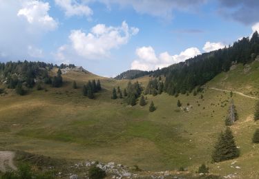
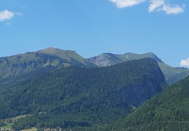
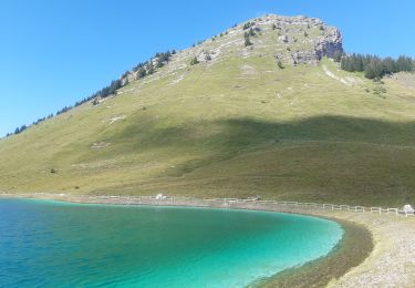
13.6 km | 25 km-effort
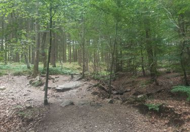
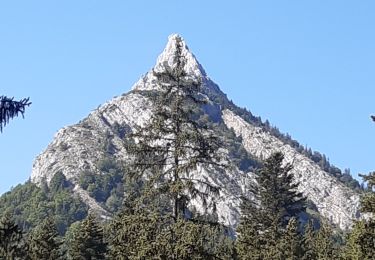
5h 46min
No
Trail Walking Montesquieu-des-Albères - dans les environs de Montesquieu  - Photo
Walking
stef789

Walking

Easy
Montesquieu-des-Albères, Occitania, Pyrénées-Orientales, France
6.2 km | 8.9 km-effort
3h 5min
Yes
Trail Walking L'Albère - trek albères j3 ullat laroque tracé carte - Photo
Walking
stef789

Walking

Very difficult
L'Albère, Occitania, Pyrénées-Orientales, France
14.3 km | 21 km-effort
4h 49min
No
Trail Walking Montesquieu-des-Albères - montesquieu-des-alberes entre canaux, rivières et tech  - Photo
Walking
stef789

Walking

Easy
Montesquieu-des-Albères, Occitania, Pyrénées-Orientales, France
11.7 km | 12.8 km-effort
4h 53min
Yes
Trail Walking Flémalle - entre Sous les Roches et Aigremont  - Photo
Walking
stef789

Walking

Easy
Flémalle, Wallonia, Liège, Belgium
9.9 km | 12.7 km-effort
3h 22min
Yes
Trail Walking Maureillas-las-Illas - traversée des alberes j1 trace desk - Photo
Walking
stef789

Walking

Very difficult
Maureillas-las-Illas, Occitania, Pyrénées-Orientales, France
16.9 km | 30 km-effort
6h 44min
No
Trail Walking L'Albère - traversée des albères j2 tracé en desk - Photo
Walking
stef789

Walking

Very difficult
L'Albère, Occitania, Pyrénées-Orientales, France
24 km | 35 km-effort
7h 54min
No
Trail Walking Spa - à Mambaye, Pottier s´est pendu  - Photo
Walking
stef789

Walking

Easy
(1)
Spa, Wallonia, Liège, Belgium
10.7 km | 14.6 km-effort
3h 16min
Yes
Trail Walking Dijon - dijon, mon petit tour des chouettes  - Photo
Walking
stef789

Walking

Very easy
Dijon, Bourgogne-Franche-Comté, Côte-d'Or, France
1.3 km | 1.4 km-effort
38min
Yes
Trail Walking Bellecombe-en-Bauges - montagne du charbon : montée par la piste Reposoir. col de bornette . refuge de la combe / retour même itinéraire sauf par les champs et bois depuis bornette  - Photo
Walking
stef789

Walking

Easy
Bellecombe-en-Bauges, Auvergne-Rhône-Alpes, Savoy, France
11.1 km | 19 km-effort
5h 13min
Yes
Trail Walking Fillière - refuge Patmelan via anglettaz . gd glacière . fontaine du tour . grotte de l enfer  / retour via gd montoir et pt montoir  - Photo
Walking
stef789

Walking

Medium
Fillière, Auvergne-Rhône-Alpes, Upper Savoy, France
10.2 km | 16.1 km-effort
6h 1min
Yes
Trail Walking Viuz-la-Chiésaz - Semnoz, mon tour des lacs et des crêts  - Photo
Walking
stef789

Walking

Easy
Viuz-la-Chiésaz, Auvergne-Rhône-Alpes, Upper Savoy, France
8.3 km | 13.4 km-effort
3h 23min
Yes
Trail Walking Chorges - au dessus de Chorges : Naume Raze . les Drayes . parking des Gardes . Forest Barthiers . Naume Raze - Photo
Walking
stef789

Walking

Medium
Chorges, Provence-Alpes-Côte d'Azur, Hautes-Alpes, France
9.3 km | 14.9 km-effort
4h 13min
Yes
Trail Walking Crots - boucle du lac de Lauzerot via Les Gendres . cabane à Jules . clôt Besson . lac . les Gendres - Photo
Walking
stef789

Walking

Medium
Crots, Provence-Alpes-Côte d'Azur, Hautes-Alpes, France
8 km | 13.6 km-effort
3h 4min
Yes
Trail Walking Le Sauze-du-Lac - les Demooselles coiffées (vues du dessus)  - Photo
Walking
stef789

Walking

Easy
Le Sauze-du-Lac, Provence-Alpes-Côte d'Azur, Hautes-Alpes, France
6.4 km | 9.3 km-effort
2h 18min
Yes
Trail Walking Réallon - station Reallon . fond gaillarde . Charbriere . Serre Mouton . cabane Joubelle . Station - Photo
Walking
stef789

Walking

Medium
Réallon, Provence-Alpes-Côte d'Azur, Hautes-Alpes, France
10 km | 18 km-effort
4h 39min
Yes
Trail Walking Ancelle - toufde la Pinouse : pré bouria . Le rouanne . la pinouse . moissiere . pré bouria - Photo
Walking
stef789

Walking

Medium
Ancelle, Provence-Alpes-Côte d'Azur, Hautes-Alpes, France
8.4 km | 13.3 km-effort
3h 41min
Yes
Trail Walking Ancelle - crêtes d´Auréous : col de la Moissière . Chatégré . St Philippe . lac de Faudon  - Photo
Walking
stef789

Walking

Easy
Ancelle, Provence-Alpes-Côte d'Azur, Hautes-Alpes, France
6.9 km | 9.8 km-effort
2h 39min
Yes
Trail Walking Réallon - Reallon - les Gourmiers via GR50 jusqu'à  la cascade / retour via pont de Villard - Photo
Walking
stef789

Walking

Easy
Réallon, Provence-Alpes-Côte d'Azur, Hautes-Alpes, France
11.2 km | 17 km-effort
5h 41min
Yes
Trail Walking Samoëns - Samoens . gorges des tines - retour  - Photo
Walking
stef789

Walking

Very easy
Samoëns, Auvergne-Rhône-Alpes, Upper Savoy, France
9.6 km | 12.9 km-effort
4h 1min
Yes
Trail Walking Verchaix - col du jour plane . la bourgeoise . pointe d angolon  . nyon du crot . col de joux  plane  - Photo
Walking
stef789

Walking

Difficult
Verchaix, Auvergne-Rhône-Alpes, Upper Savoy, France
9.6 km | 17.6 km-effort
5h 55min
Yes

Close
My subscriptions