


 - Photo 21")
 - Photo 22")
 - Photo 23")
 - Photo 24")
 - Photo 25")
 - Photo 26")
 - Photo 27")
 - Photo 28")
 - Photo 29")
 - Photo 30")
 - Photo 31")
 - Photo 32")
 - Photo 33")
 - Photo 34")
 - Photo 35")
 - Photo 36")
 - Photo 37")
 - Photo 38")
 - Photo 39")
 - Photo 40")
 - Photo 41")


13,2 km | 18,4 km-effort
Randonnées de la FTLB


Aplicación GPS de excursión GRATIS
 SityTrail
IGN / Institutos geográficos
SityTrail World
El mundo es suyo
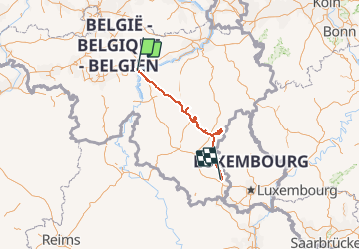
Ruta Motor de 188 km a descubrir en Valonia, Namur, Namur. Esta ruta ha sido propuesta por Malle Poste FTLB.
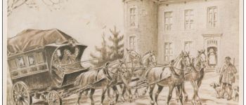
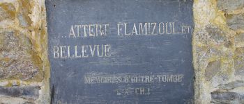
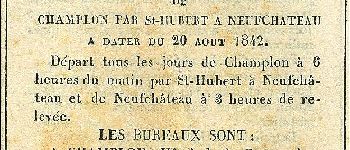
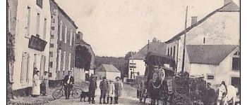
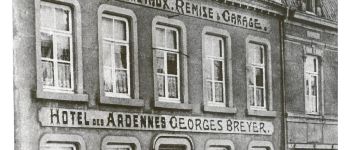
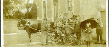
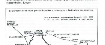
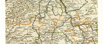
Retrouver les chemins suivis par ces anciennes diligences, c'est évoquer l' histoire mouvementée des premiers voyageurs. C'est retrouver la trace des auberges-relais qui ont accueilli des célébrités ou de simples marchands qui ont parfois croisé le chemin de bandits. Chaque circuit vous invite à découvrir les sites ou tout autre trace de cette passionnante histoire.
 - Photo 1")
 - Photo 2")
 - Photo 3")
 - Photo 4")
 - Photo 5")
 - Photo 6")
 - Photo 7")
 - Photo 8")
 - Photo 9")
 - Photo 10")
 - Photo 11")
 - Photo 12")
 - Photo 13")
 - Photo 14")
 - Photo 15")
 - Photo 16")
 - Photo 17")
 - Photo 18")
 - Photo 19")
 - Photo 20")
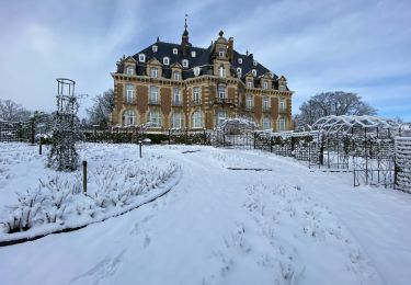
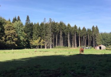
41 fotos en total. Haga clic en una foto para mostrarlas todas en la galería.

Senderismo

Senderismo

Senderismo
Senderismo

Senderismo

Senderismo

Senderismo
Senderismo
Senderismo