![](/images/other/stat-length.png)
![Randonnée Marche Noailhac - 81-Prades-Fialessuch -30/03/2014 - Photo](https://media.geolcdn.com/t/1900/400/ext.pjpeg?maxdim=2&url=https%3A%2F%2Fservices.sitytrail.com%2FGeolivesWS%2FDownloadMedia.ashx%3FTrailID%3D261748%26Media%3Dfix__20140330141454.jpg)
81-Prades-Fialessuch -30/03/2014
Jovila
Utilisateur
![Longueur](/images/other/stat-length.png)
Longueur
11,4 km
![Altitude max](https://static1.geolcdn.com/siteimages/upload/files/1508320355ic_sort_altitude_max_24dp.png)
Altitude max
458 m
![Dénivelé positif](https://static1.geolcdn.com/siteimages/upload/files/1508320355ic_sort_den_pos_24dp.png)
Dénivelé positif
398 m
![Km-Effort](/images/other/stat-length.png)
Km-Effort
16,7 km
![Altitude min](https://static1.geolcdn.com/siteimages/upload/files/1508320355ic_sort_altitude_min_24dp.png)
Altitude min
278 m
![Dénivelé négatif](https://static1.geolcdn.com/siteimages/upload/files/1508320355ic_sort_den_neg_24dp.png)
Dénivelé négatif
397 m
![Boucle](https://static1.geolcdn.com/siteimages/upload/files/16400158638029165_repeat_loop_refresh_sync_direction_icon.png)
Boucle
Oui
Date de création :
2015-10-29 00:00:00.0
Dernière modification :
2015-10-29 00:00:00.0
![Marche](https://static1.geolcdn.com/sitytour/trail-icons/101.png)
3h04
Difficulté : Facile
![Scannez ce code QR pour ouvrir la randonnée dans l'application SityTrail](https://capi.geolives.com/qq0zvz2zws4bq2lad0pu/sitytour/trails/261748/qr.png?size=200)
Application GPS de randonnée GRATUITE
À propos
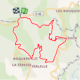
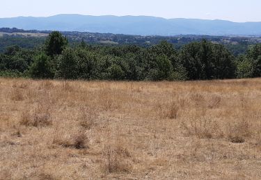
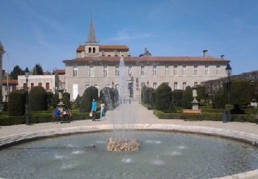
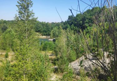
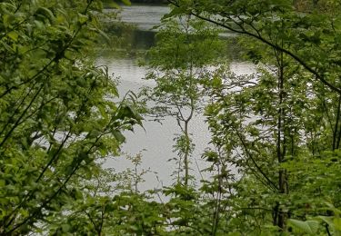
Randonnée Marche de 11,4 km à découvrir à Occitanie, Tarn, Noailhac. Cette randonnée est proposée par Jovila.
Description
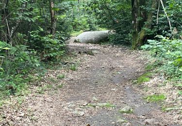
Départ Route de Saint Salvy. Au lieu dit Prades se garer sur la petite route à droite, suivre le balisage jaune.
Attention après une côte caillouteuse prendre la montée à droite avec une croix jaune (oui oui il faut prendre ce chemin) on retrouve le balisage jaune.
Localisation
Pays :
France
Région :
Occitanie
Département/Province :
Tarn
Commune :
Noailhac
Localité :
Unknown
Départ:(Dec)
Départ:(UTM)
447458 ; 4827738 (31T) N.
Commentaires
Randonnées à proximité
![Randonnée Marche Boissezon - 81_Boissezon - Photo](https://media.geolcdn.com/t/375/260/ext.jpg?maxdim=2&url=https%3A%2F%2Fstatic1.geolcdn.com%2Fsiteimages%2Fupload%2Ffiles%2F1553511878bg_sport_marche.png)
![Marche Marche](https://static1.geolcdn.com/sitytour/trail-icons/101.png)
81_Boissezon
Marche
Difficile
(1)
Boissezon,
Occitanie,
Tarn,
France
![](/images/other/stat-length.png)
18,5 km | 26 km-effort
4h 21min
![](https://static1.geolcdn.com/siteimages/upload/files/16400158638029165_repeat_loop_refresh_sync_direction_icon.png)
Oui
![Randonnée A pied Burlats - Chemin des Fontaines - Photo](https://media.geolcdn.com/t/375/260/ext.jpg?maxdim=2&url=https%3A%2F%2Fmedia.geolcdn.com%2Ff%2F0fdbf2bb-361d-42f2-bb88-a8b62041bc5e.jpeg)
![A pied A pied](https://static1.geolcdn.com/sitytour/trail-icons/100.png)
Chemin des Fontaines
A pied
Facile
Burlats,
Occitanie,
Tarn,
France
![](/images/other/stat-length.png)
7,3 km | 8,5 km-effort
1h 55min
![](https://static1.geolcdn.com/siteimages/upload/files/16400158638029165_repeat_loop_refresh_sync_direction_icon.png)
Non
![Randonnée Marche Burlats - Burlats cascade de la truite - Photo](https://media.geolcdn.com/t/375/260/ext.jpg?maxdim=2&url=https%3A%2F%2Fmedia.geolcdn.com%2Ff%2F9661be44-d4ff-4a36-943e-6669881f3e44.jpg)
![Marche Marche](https://static1.geolcdn.com/sitytour/trail-icons/101.png)
Burlats cascade de la truite
Marche
Moyen
Burlats,
Occitanie,
Tarn,
France
![](/images/other/stat-length.png)
19,3 km | 30 km-effort
5h 22min
![](https://static1.geolcdn.com/siteimages/upload/files/16400158638029165_repeat_loop_refresh_sync_direction_icon.png)
Non
![Randonnée Marche Burlats - billets l'Agout 18kms 577m 4h30 - Photo](https://media.geolcdn.com/t/375/260/ext.jpg?maxdim=2&url=https%3A%2F%2Fservices.sitytrail.com%2FGeolivesWS%2FDownloadMedia.ashx%3FTrailID%3D1025519%26Media%3Dfix__20180819134756.jpg)
![Marche Marche](https://static1.geolcdn.com/sitytour/trail-icons/101.png)
billets l'Agout 18kms 577m 4h30
Marche
Facile
Burlats,
Occitanie,
Tarn,
France
![](/images/other/stat-length.png)
18,2 km | 25 km-effort
4h 44min
![](https://static1.geolcdn.com/siteimages/upload/files/16400158638029165_repeat_loop_refresh_sync_direction_icon.png)
Oui
![Randonnée Marche Boissezon - Boissezon - Castres - Photo](https://media.geolcdn.com/t/375/260/ext.jpg?maxdim=2&url=https%3A%2F%2Fservices.sitytrail.com%2FGeolivesWS%2FDownloadMedia.ashx%3FTrailID%3D184716%26Media%3D20130413150526.jpeg)
![Marche Marche](https://static1.geolcdn.com/sitytour/trail-icons/101.png)
Boissezon - Castres
Marche
Moyen
Boissezon,
Occitanie,
Tarn,
France
![](/images/other/stat-length.png)
19,7 km | 25 km-effort
Inconnu
![](https://static1.geolcdn.com/siteimages/upload/files/16400158638029165_repeat_loop_refresh_sync_direction_icon.png)
Non
![Randonnée Marche Lacrouzette - Sidobre - Photo](https://media.geolcdn.com/t/375/260/ext.jpg?maxdim=2&url=https%3A%2F%2Fmedia.geolcdn.com%2Ff%2F89c34aa0-b9ab-4027-9d15-ed34d9b1b44e.jpg)
![Marche Marche](https://static1.geolcdn.com/sitytour/trail-icons/101.png)
![Randonnée Marche Burlats - Sidobre Castres - Photo](https://media.geolcdn.com/t/375/260/ext.jpg?maxdim=2&url=https%3A%2F%2Fstatic1.geolcdn.com%2Fsiteimages%2Fupload%2Ffiles%2F1553511878bg_sport_marche.png)
![Marche Marche](https://static1.geolcdn.com/sitytour/trail-icons/101.png)
![Randonnée Marche Burlats - Chaos de la Rouquette - Photo](https://media.geolcdn.com/t/375/260/ext.jpg?maxdim=2&url=https%3A%2F%2Fmedia.geolcdn.com%2Ff%2Fac313286-f0e8-4524-93a0-8abd2307e7b2.jpg)
![Marche Marche](https://static1.geolcdn.com/sitytour/trail-icons/101.png)
Chaos de la Rouquette
Marche
Moyen
Burlats,
Occitanie,
Tarn,
France
![](/images/other/stat-length.png)
4,3 km | 5,8 km-effort
1h 9min
![](https://static1.geolcdn.com/siteimages/upload/files/16400158638029165_repeat_loop_refresh_sync_direction_icon.png)
Oui
![Randonnée Marche Boissezon - 81-Le Rampaillou Boissezon (Parcours moyen)-18-05-2019 - Photo](https://media.geolcdn.com/t/375/260/ext.jpg?maxdim=2&url=https%3A%2F%2Fmedia.geolcdn.com%2Ff%2Fe6e1b8a2-c2d8-48ac-b403-26f734a61272.jpg)
![Marche Marche](https://static1.geolcdn.com/sitytour/trail-icons/101.png)
81-Le Rampaillou Boissezon (Parcours moyen)-18-05-2019
Marche
Moyen
Boissezon,
Occitanie,
Tarn,
France
![](/images/other/stat-length.png)
18,2 km | 26 km-effort
5h 25min
![](https://static1.geolcdn.com/siteimages/upload/files/16400158638029165_repeat_loop_refresh_sync_direction_icon.png)
Oui