Randonnée Marche Wangenbourg-Engenthal - Le donjon du Wangenbourg - Photo
 VacheKiri67
VacheKiri67

Utilisateur

© OpenStreetMap contributors
Longueur
Longueur
15,9 km
Altitude max
Altitude max
521 m
Dénivelé positif
Dénivelé positif
399 m
Km-Effort
Km-Effort  
21 km
Altitude min
Altitude min
328 m
Dénivelé négatif
Dénivelé négatif
399 m
Boucle
Boucle
Oui
Date de création :
2022-04-15 08:24:00.051
Dernière modification :
2022-04-16 08:30:59.855

(1 Avis)

Marche
Marche
4h32
Difficulté : Moyen

Scannez ce code QR pour ouvrir la randonnée dans l'application SityTrail

Application GPS de randonnée GRATUITE

Logo SityTrail SityTrail

IGN / Instituts géographiques

Télécharger SityTrail sur l'App Store Télécharger SityTrail sur Google Play

Logo SityTrail SityTrail World

Le monde est à vous

Télécharger SityTrail sur l'App Store Télécharger SityTrail sur Google Play Télécharger SityTrail sur Huawei AppGallery

À propos

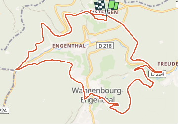
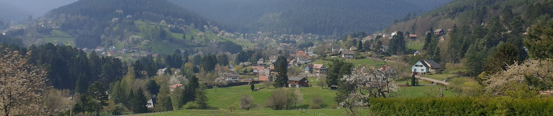
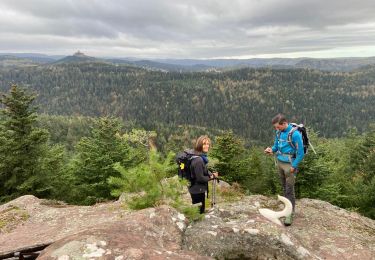
Randonnée Marche de 15,9 km à découvrir à Grand Est, Bas-Rhin, Wangenbourg-Engenthal. Cette randonnée est proposée par VacheKiri67.

Description

Faite le 15/04/2022. Au départ d'Obersteigen.
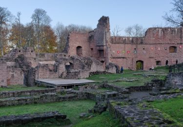
D'après "Passion Vosges : Châteaux forts d'Alsace - 10 : Le donjon du Wangenbourg". Durée indiquée pour le circuit : 4h30.

Profil altimétrique

Photos

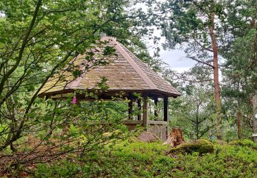
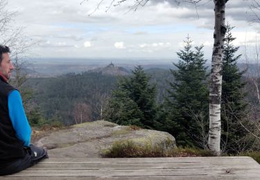
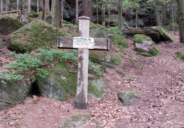
36 photos au total. Cliquez sur une photo pour les afficher toutes dans la galerie.

Localisation

Pays :
France
Région :
Grand Est
Département/Province :
Bas-Rhin
Commune :
Wangenbourg-Engenthal
Localité :
Unknown
Départ:(UTM)
375604 ; 5388930 (32U) N.

Commentaires

Veuillez vous connecter pour laisser un commentaire ou une note


Randonnées à proximité

Randonnée Randonnée équestre Romanswiller - 2021-09-09 Journée cosswiller Wangenbourg - Photo
Randonnée équestre
GUIDE
holtzv

Randonnée équestre

Moyen
Romanswiller, Grand Est, Bas-Rhin, France
21 km | 29 km-effort
4h 12min
Oui
Randonnée Marche Reinhardsmunster - 2021-09-01 Marche Reinhardsmunster Haut Barr - Photo
Marche
GUIDE
holtzv

Marche

Très difficile
Reinhardsmunster, Grand Est, Bas-Rhin, France
21 km | 32 km-effort
6h 39min
Oui
Randonnée Marche Reinhardsmunster - 2020-06-13 Marche Ditschelkopf Schweizerberg - Photo
Marche
GUIDE
holtzv

Marche

Très facile
Reinhardsmunster, Grand Est, Bas-Rhin, France
14,5 km | 22 km-effort
4h 52min
Oui
Randonnée Marche Wangenbourg-Engenthal - 2020-03-14 Marche Engenthal le bas - Photo
Marche
GUIDE
holtzv

Marche

Très facile
Wangenbourg-Engenthal, Grand Est, Bas-Rhin, France
14,3 km | 22 km-effort
4h 27min
Oui
Randonnée Marche Wangenbourg-Engenthal - 2019-11-16 Marche Wangenbourg Castelberg - Photo
Marche
GUIDE
holtzv

Marche

Très facile
Wangenbourg-Engenthal, Grand Est, Bas-Rhin, France
19,8 km | 31 km-effort
4h 51min
Oui
Randonnée Marche Wangenbourg-Engenthal - 2017-02-24 Marche Schneeberg - Photo
Marche
GUIDE
holtzv

Marche

Très facile
(1)
Wangenbourg-Engenthal, Grand Est, Bas-Rhin, France
12,8 km | 19,9 km-effort
Inconnu
Oui
Randonnée Marche Dabo - Windsbourg Dabo - Photo
Marche
oscar1

Marche

Facile
Dabo, Grand Est, Moselle, France
14,3 km | 19,7 km-effort
3h 6min
Oui
Randonnée Marche Wangenbourg-Engenthal - 20230426_rando_Wangenbourg_Chateaux de Freudeneck_Cascade-de-Mencke_Heidenschloss_Rotfels - Photo
Marche
nfranche

Marche

Moyen
Wangenbourg-Engenthal, Grand Est, Bas-Rhin, France
14,1 km | 22 km-effort
4h 56min
Oui
Randonnée Marche Dabo - 2022-11-01 Marche Dabo et ses Rochers - Photo
Marche
GUIDE
holtzv

Marche

Très difficile
Dabo, Grand Est, Moselle, France
26 km | 38 km-effort
7h 8min
Oui


Fermer
Mes abonnements