Randonnée Marche Estaing - Transhumance 2014 - Photo
 dlucas
dlucas

Utilisateur

© OpenStreetMap contributors
Longueur
Longueur
48 km
Altitude max
Altitude max
1408 m
Dénivelé positif
Dénivelé positif
983 m
Km-Effort
Km-Effort  
63 km
Altitude min
Altitude min
419 m
Dénivelé négatif
Dénivelé négatif
1830 m
Boucle
Boucle
Non
Date de création :
2015-06-15 00:00:00.0
Dernière modification :
2015-06-15 00:00:00.0

(0 Avis)

Marche
Marche
13h03
Difficulté : Difficile

Scannez ce code QR pour ouvrir la randonnée dans l'application SityTrail

Application GPS de randonnée GRATUITE

Logo SityTrail SityTrail

IGN / Instituts géographiques

Télécharger SityTrail sur l'App Store Télécharger SityTrail sur Google Play

Logo SityTrail SityTrail World

Le monde est à vous

Télécharger SityTrail sur l'App Store Télécharger SityTrail sur Google Play Télécharger SityTrail sur Huawei AppGallery

À propos

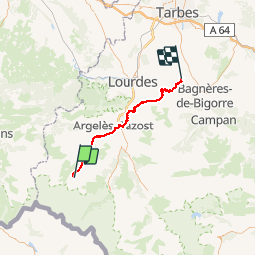
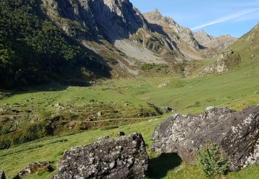
Randonnée Marche de 48 km à découvrir à Occitanie, Hautes-Pyrénées, Estaing. Cette randonnée est proposée par dlucas.

Description

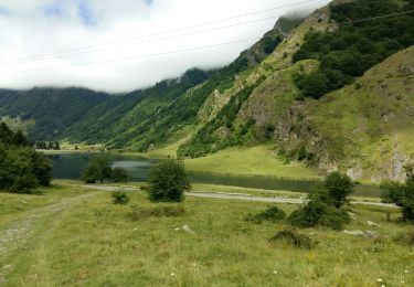
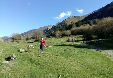
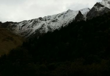
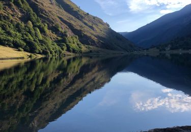
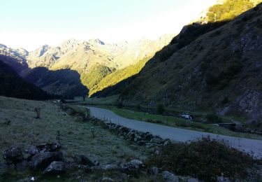
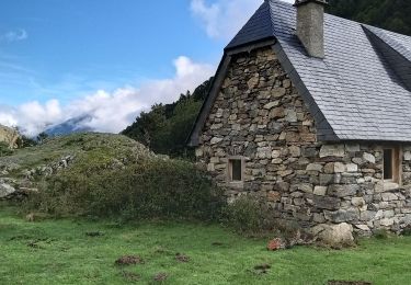
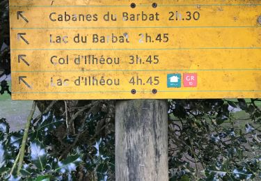
De la cabane d'Arriousec, sur le GR10 au-dessus du lac d'Estaing, à Astugue

Profil altimétrique

Points d'intérêt

Point d'intérêt Berbérust-Lias - Panorama - Photo
dlucas
BERBÉRUST-LIAS 

Localisation

Pays :
France
Région :
Occitanie
Département/Province :
Hautes-Pyrénées
Commune :
Estaing
Localité :
Unknown
Départ:(Dec)
Départ:(UTM)
728187 ; 4753471 (30T) N.

Randonnées à proximité

Randonnée Marche Estaing - Les Viellettes - Estaing - Photo
Marche
tracegps

Marche

Difficile
(1)
Estaing, Occitanie, Hautes-Pyrénées, France
13,1 km | 24 km-effort
4h 0min
Oui
Randonnée Marche Estaing - ESTAING  RS le der de 2022 - Photo
Marche
GUIDE
marmotte65

Marche

Facile
Estaing, Occitanie, Hautes-Pyrénées, France
3,6 km | 5,1 km-effort
1h 5min
Oui
Randonnée Marche Estaing - ESTAING autour du lac - Photo
Marche
GUIDE
marmotte65

Marche

Facile
Estaing, Occitanie, Hautes-Pyrénées, France
3,7 km | 5,3 km-effort
1h 9min
Oui
Randonnée Marche Estaing - ESTAING et la cabane d'Ariousse
Marche
GUIDE
marmotte65

Marche

Difficile
Estaing, Occitanie, Hautes-Pyrénées, France
10,3 km | 14,8 km-effort
2h 49min
Oui
Randonnée Marche Estaing - Ruines et lac de Liantran  - Photo
Marche
jaja64

Marche

Facile
Estaing, Occitanie, Hautes-Pyrénées, France
17,7 km | 28 km-effort
6h 45min
Oui
Randonnée Marche Estaing - ESTAING Cabane d'Ariousec en boucle G3 - Photo
Marche
GUIDE
marmotte65

Marche

Moyen
Estaing, Occitanie, Hautes-Pyrénées, France
9 km | 13,7 km-effort
2h 42min
Oui
Randonnée Marche Estaing - Le lac d'Estaing - Photo
Marche
micheldutilleul

Marche

Facile
Estaing, Occitanie, Hautes-Pyrénées, France
9,1 km | 12,8 km-effort
2h 12min
Oui
Randonnée Marche Estaing - Pyrénées jour 4 - Photo
Marche
dudu85

Marche

Estaing, Occitanie, Hautes-Pyrénées, France
12,6 km | 22 km-effort
4h 6min
Oui
Randonnée Marche Arrens-Marsous - Tech - Ausseila. - Photo
Marche
pffrench

Marche

Moyen
Arrens-Marsous, Occitanie, Hautes-Pyrénées, France
14,3 km | 28 km-effort
8h 39min
Oui


Fermer
Mes abonnements