![](/images/other/stat-length.png)
![Randonnée Marche Aix-la-Chapelle - Aix-la-Chapelle - Photo](https://media.geolcdn.com/t/1900/400/ext.pjpeg?maxdim=2&url=https%3A%2F%2Fmedia.geolcdn.com%2Ff%2F19678e47-68ef-4997-bad3-67eb75fafd82.jpg)
Aix-la-Chapelle
mumu.larandonneuse
Utilisateur GUIDE
![Longueur](/images/other/stat-length.png)
Longueur
11,4 km
![Altitude max](https://static1.geolcdn.com/siteimages/upload/files/1508320355ic_sort_altitude_max_24dp.png)
Altitude max
357 m
![Dénivelé positif](https://static1.geolcdn.com/siteimages/upload/files/1508320355ic_sort_den_pos_24dp.png)
Dénivelé positif
302 m
![Km-Effort](/images/other/stat-length.png)
Km-Effort
15,4 km
![Altitude min](https://static1.geolcdn.com/siteimages/upload/files/1508320355ic_sort_altitude_min_24dp.png)
Altitude min
212 m
![Dénivelé négatif](https://static1.geolcdn.com/siteimages/upload/files/1508320355ic_sort_den_neg_24dp.png)
Dénivelé négatif
301 m
![Boucle](https://static1.geolcdn.com/siteimages/upload/files/16400158638029165_repeat_loop_refresh_sync_direction_icon.png)
Boucle
Oui
Date de création :
2022-11-23 14:07:27.016
Dernière modification :
2023-01-07 18:12:33.512
![Marche](https://static1.geolcdn.com/sitytour/trail-icons/101.png)
3h30
Difficulté : Facile
![Scannez ce code QR pour ouvrir la randonnée dans l'application SityTrail](https://capi.geolives.com/qq0zvz2zws4bq2lad0pu/sitytour/trails/3464322/qr.png?size=200)
Application GPS de randonnée GRATUITE
À propos
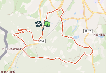
Randonnée Marche de 11,4 km à découvrir à Rhénanie-du-Nord-Westphalie, Région urbaine d'Aix-la-Chapelle, Aix-la-Chapelle. Cette randonnée est proposée par mumu.larandonneuse.
Description
ℹ www.aachen.de/wandern
📌🅿️ Lütticher Strabe 340
➡️ Points-noeuds 16 14 65 64 63 62 61 60 51 48 45 44 55 15 16.
Localisation
Pays :
Allemagne
Région :
Rhénanie-du-Nord-Westphalie
Département/Province :
Région urbaine d'Aix-la-Chapelle
Commune :
Aix-la-Chapelle
Localité :
Aachen-Mitte
Départ:(Dec)
Départ:(UTM)
292728 ; 5625692 (32U) N.
Commentaires
Randonnées à proximité
![Randonnée Marche La Calamine - Le pays calaminaire - Photo](https://media.geolcdn.com/t/375/260/ext.jpg?maxdim=2&url=https%3A%2F%2Fmedia.geolcdn.com%2Ff%2F30655fe2-e81a-47ed-96f4-20092bed94b7.jpg)
![Marche Marche](https://static1.geolcdn.com/sitytour/trail-icons/101.png)
Le pays calaminaire
Marche
Moyen
(1)
La Calamine,
Wallonie,
Liège,
Belgique
![](/images/other/stat-length.png)
9,6 km | 12,1 km-effort
2h 44min
![](https://static1.geolcdn.com/siteimages/upload/files/16400158638029165_repeat_loop_refresh_sync_direction_icon.png)
Oui
![Randonnée Marche Raeren - Aix-la-Chapelle_392 - Photo](https://media.geolcdn.com/t/375/260/ext.jpg?maxdim=2&url=https%3A%2F%2Fmedia.geolcdn.com%2Ff%2F3a31813f-998d-4148-baa8-502439fc02b8.jpg)
![Marche Marche](https://static1.geolcdn.com/sitytour/trail-icons/101.png)
Aix-la-Chapelle_392
Marche
Moyen
(1)
Raeren,
Wallonie,
Liège,
Belgique
![](/images/other/stat-length.png)
13,2 km | 17,3 km-effort
3h 55min
![](https://static1.geolcdn.com/siteimages/upload/files/16400158638029165_repeat_loop_refresh_sync_direction_icon.png)
Oui
![Randonnée Marche La Calamine - La Calamine - Photo](https://media.geolcdn.com/t/375/260/ext.jpg?maxdim=2&url=https%3A%2F%2Fmedia.geolcdn.com%2Ff%2F606e5792-434a-491a-b5eb-2bfc2ef6f1ed.jpg)
![Marche Marche](https://static1.geolcdn.com/sitytour/trail-icons/101.png)
La Calamine
Marche
Facile
(1)
La Calamine,
Wallonie,
Liège,
Belgique
![](/images/other/stat-length.png)
9,1 km | 11,6 km-effort
2h 38min
![](https://static1.geolcdn.com/siteimages/upload/files/16400158638029165_repeat_loop_refresh_sync_direction_icon.png)
Oui
![Randonnée Marche Aix-la-Chapelle - Aix-la-Chapelle - Photo](https://media.geolcdn.com/t/375/260/ext.jpg?maxdim=2&url=https%3A%2F%2Fmedia.geolcdn.com%2Ff%2Fefbe95f3-eeed-42aa-9acc-74aad4d18b78.jpg)
![Marche Marche](https://static1.geolcdn.com/sitytour/trail-icons/101.png)
Aix-la-Chapelle
Marche
Facile
(1)
Aix-la-Chapelle,
Rhénanie-du-Nord-Westphalie,
Région urbaine d'Aix-la-Chapelle,
Allemagne
![](/images/other/stat-length.png)
11,1 km | 13,4 km-effort
3h 2min
![](https://static1.geolcdn.com/siteimages/upload/files/16400158638029165_repeat_loop_refresh_sync_direction_icon.png)
Oui
![Randonnée Marche La Calamine - Kelmis - Photo](https://media.geolcdn.com/t/375/260/ext.jpg?maxdim=2&url=https%3A%2F%2Fmedia.geolcdn.com%2Ff%2F9eea9d75-ea39-4660-b255-7d2a2255555e.jpg)
![Marche Marche](https://static1.geolcdn.com/sitytour/trail-icons/101.png)
Kelmis
Marche
Facile
(1)
La Calamine,
Wallonie,
Liège,
Belgique
![](/images/other/stat-length.png)
14,2 km | 18,4 km-effort
4h 10min
![](https://static1.geolcdn.com/siteimages/upload/files/16400158638029165_repeat_loop_refresh_sync_direction_icon.png)
Oui
![Randonnée Marche Raeren - Lichtenbusch - Photo](https://media.geolcdn.com/t/375/260/ext.jpg?maxdim=2&url=https%3A%2F%2Fmedia.geolcdn.com%2Ff%2F83311396-e126-40d9-b822-9da5f0d28323.jpg)
![Marche Marche](https://static1.geolcdn.com/sitytour/trail-icons/101.png)
Lichtenbusch
Marche
Facile
(2)
Raeren,
Wallonie,
Liège,
Belgique
![](/images/other/stat-length.png)
14,8 km | 17 km-effort
3h 52min
![](https://static1.geolcdn.com/siteimages/upload/files/16400158638029165_repeat_loop_refresh_sync_direction_icon.png)
Oui
![Randonnée Marche Vaals - Vaals_1431 - Photo](https://media.geolcdn.com/t/375/260/ext.jpg?maxdim=2&url=https%3A%2F%2Fmedia.geolcdn.com%2Ff%2Fbe698cb8-a234-4803-8ecd-dfa4be54f61b.jpg)
![Marche Marche](https://static1.geolcdn.com/sitytour/trail-icons/101.png)
Vaals_1431
Marche
Moyen
(1)
Vaals,
Limbourg,
Inconnu,
Pays-Bas
![](/images/other/stat-length.png)
13,1 km | 16,6 km-effort
3h 46min
![](https://static1.geolcdn.com/siteimages/upload/files/16400158638029165_repeat_loop_refresh_sync_direction_icon.png)
Oui
![Randonnée Marche Raeren - Hauset - Photo](https://media.geolcdn.com/t/375/260/ext.jpg?maxdim=2&url=https%3A%2F%2Fmedia.geolcdn.com%2Ff%2F4dbde2fb-33e3-4e75-84b3-1404a45e04cc.jpg)
![Marche Marche](https://static1.geolcdn.com/sitytour/trail-icons/101.png)
![Randonnée Marche La Calamine - 20200730 - Les 3 Bornes 7.3 Km - Photo](https://media.geolcdn.com/t/375/260/ext.jpg?maxdim=2&url=https%3A%2F%2Fmedia.geolcdn.com%2Ff%2Fab7b3f98-4235-4a73-ba70-1bedd5c785f3.jpg)
![Marche Marche](https://static1.geolcdn.com/sitytour/trail-icons/101.png)
20200730 - Les 3 Bornes 7.3 Km
Marche
Difficile
(1)
La Calamine,
Wallonie,
Liège,
Belgique
![](/images/other/stat-length.png)
7,4 km | 10,4 km-effort
1h 50min
![](https://static1.geolcdn.com/siteimages/upload/files/16400158638029165_repeat_loop_refresh_sync_direction_icon.png)
Oui
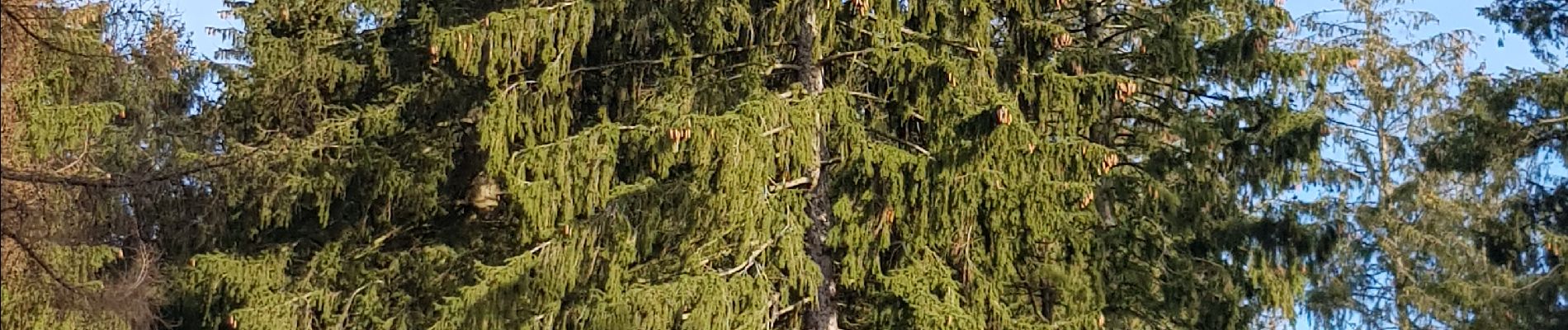
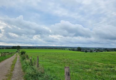
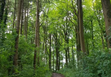
Superbe parcours boisé 🌳🌲.