Randonnée Marche Perpignan - 66 PERPIGNAN, ST GAUDERIQUE AU BAS VERNET  - Photo

66 PERPIGNAN, ST GAUDERIQUE AU BAS VERNET

 jeff66
jeff66

Utilisateur

© OpenStreetMap contributors
Longueur
Longueur
11,3 km
Altitude max
Altitude max
53 m
Dénivelé positif
Dénivelé positif
82 m
Km-Effort
Km-Effort  
12,4 km
Altitude min
Altitude min
21 m
Dénivelé négatif
Dénivelé négatif
80 m
Boucle
Boucle
Oui
Date de création :
2016-03-31 00:00:00.0
Dernière modification :
2016-03-31 00:00:00.0

(0 Avis)

Marche
Marche
2h03
Difficulté : Moyen

Scannez ce code QR pour ouvrir la randonnée dans l'application SityTrail

Application GPS de randonnée GRATUITE

Logo SityTrail SityTrail

IGN / Instituts géographiques

Télécharger SityTrail sur l'App Store Télécharger SityTrail sur Google Play

Logo SityTrail SityTrail World

Le monde est à vous

Télécharger SityTrail sur l'App Store Télécharger SityTrail sur Google Play Télécharger SityTrail sur Huawei AppGallery

À propos

Randonnée Marche de 11,3 km à découvrir à Occitanie, Pyrénées-Orientales, Perpignan. Cette randonnée est proposée par jeff66.

Description

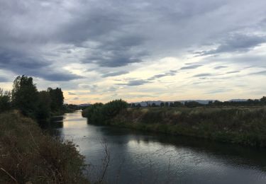
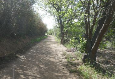
66 PERPIGNAN, ST GAUDERIQUE, parc St Vincens, quartier la Réal, bastion Dominique, cours Palmarole, longer voie sur berges puis traverser la Tet, Vernet et bas Vernet, Theatre de l'archipel, centre ville, place Arago, quartier St Mathieu, palais des rois de Majorque, gendarmerie, lycée Jean Lurcat

Profil altimétrique

Localisation

Pays :
France
Région :
Occitanie
Département/Province :
Pyrénées-Orientales
Commune :
Perpignan
Localité :
Unknown
Départ:(Dec)
Départ:(UTM)
493231 ; 4726132 (31T) N.

Randonnées à proximité

Randonnée Marche Bompas - 66 BOMPAS - promenade en SALANQUE entre Bassas et Agullas - Photo
Marche
jeff66

Marche

Facile
(1)
Bompas, Occitanie, Pyrénées-Orientales, France
11,1 km | 11,6 km-effort
2h 36min
Oui
Randonnée Marche Cabestany - Chemins autour de Cabestany - Photo
Marche
tracegps

Marche

Moyen
(2)
Cabestany, Occitanie, Pyrénées-Orientales, France
11,8 km | 12,7 km-effort
3h 0min
Oui
Randonnée Marche Perpignan - Perpignan 01.10.2017  - Photo
Marche
jeff66

Marche

Facile
(1)
Perpignan, Occitanie, Pyrénées-Orientales, France
6,7 km | 7,5 km-effort
1h 39min
Non
Randonnée Marche Saleilles - 66 SALEILLES - St-NAZAIRE, entre FOSSEILLE et REART - Photo
Marche
jeff66

Marche

Facile
(1)
Saleilles, Occitanie, Pyrénées-Orientales, France
7,3 km | 7,7 km-effort
1h 8min
Oui
Randonnée Marche Cabestany - cabestany - Photo
Marche
66Gribouille83

Marche

Moyen
Cabestany, Occitanie, Pyrénées-Orientales, France
7,5 km | 8,2 km-effort
2h 35min
Oui
Randonnée Marche Perpignan - Perpignan  - Photo
Marche
ombrabella

Marche

Très facile
Perpignan, Occitanie, Pyrénées-Orientales, France
18 km | 19,9 km-effort
2h 23min
Non
Randonnée Marche Perpignan - canal Perpignan  - Photo
Marche
Fildesir

Marche

Très facile
Perpignan, Occitanie, Pyrénées-Orientales, France
25 km | 27 km-effort
7h 29min
Non
Randonnée Marche Perpignan - 66 PERPIGNAN, quartier MAV au Bas Vernet  - Photo
Marche
jeff66

Marche

Facile
Perpignan, Occitanie, Pyrénées-Orientales, France
10,7 km | 11,8 km-effort
1h 45min
Oui
Randonnée Marche Perpignan - 66 Perpignan Panchot centre bas Vernet centre del mon - Photo
Marche
jeff66

Marche

Facile
Perpignan, Occitanie, Pyrénées-Orientales, France
8,6 km | 9,3 km-effort
1h 29min
Oui


Fermer
Mes abonnements